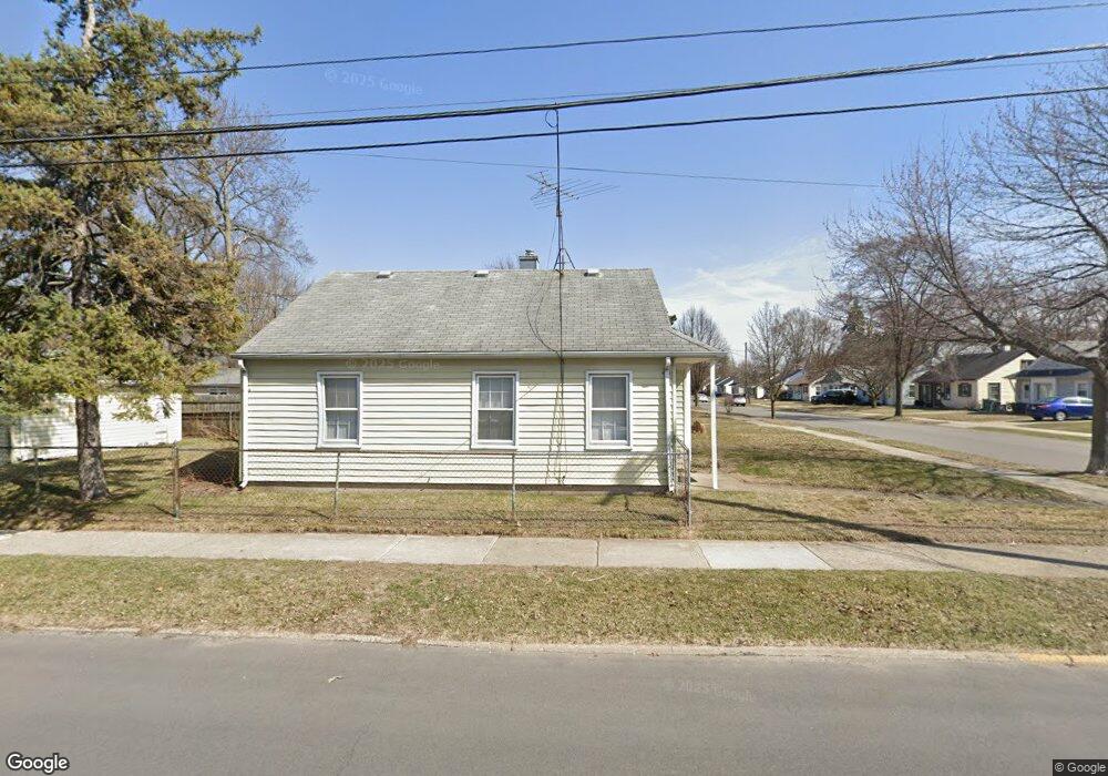
1903 Browning St Ferndale, MI 48220
Estimated Value: $181,251 - $196,000
2
Beds
1
Bath
769
Sq Ft
$246/Sq Ft
Est. Value
About This Home
This home is located at 1903 Browning St, Ferndale, MI 48220 and is currently estimated at $188,813, approximately $245 per square foot. 1903 Browning St is a home located in Oakland County with nearby schools including Hazel Park Junior High School and Hazel Park High School.
Ownership History
Date
Name
Owned For
Owner Type
Purchase Details
Closed on
Mar 28, 2024
Sold by
Champagne Claudia G
Bought by
Champagne Claudia G and Champagne Joshua N
Current Estimated Value
Purchase Details
Closed on
Aug 3, 2022
Sold by
John M Gilbert And Mary D Gilbert Living
Bought by
Champagne Claudia G and Gilbert Virginia Maria
Purchase Details
Closed on
Sep 23, 1998
Sold by
Gilbert John M and Gilbert Mary D
Bought by
John M Gilbert And Mary D Gilbert Living Trus
Purchase Details
Closed on
Jun 9, 1995
Sold by
Basista William E
Bought by
Gilbert John and Gilbert Dolores
Create a Home Valuation Report for This Property
The Home Valuation Report is an in-depth analysis detailing your home's value as well as a comparison with similar homes in the area
Home Values in the Area
Average Home Value in this Area
Purchase History
| Date | Buyer | Sale Price | Title Company |
|---|---|---|---|
| Champagne Claudia G | -- | None Listed On Document | |
| Champagne Claudia G | -- | None Listed On Document | |
| John M Gilbert And Mary D Gilbert Living Trus | -- | None Listed On Document | |
| Gilbert John | $30,000 | -- |
Source: Public Records
Tax History
| Year | Tax Paid | Tax Assessment Tax Assessment Total Assessment is a certain percentage of the fair market value that is determined by local assessors to be the total taxable value of land and additions on the property. | Land | Improvement |
|---|---|---|---|---|
| 2025 | $2,137 | $83,760 | $0 | $0 |
| 2024 | $2,081 | $78,460 | $0 | $0 |
| 2023 | $2,133 | $76,080 | $0 | $0 |
| 2022 | $2,099 | $66,110 | $0 | $0 |
| 2021 | $2,088 | $59,170 | $0 | $0 |
| 2020 | $2,009 | $51,860 | $0 | $0 |
| 2019 | $2,019 | $44,370 | $0 | $0 |
| 2018 | $1,986 | $35,510 | $0 | $0 |
| 2017 | $1,890 | $32,940 | $0 | $0 |
| 2016 | $1,868 | $27,030 | $0 | $0 |
| 2015 | -- | $22,930 | $0 | $0 |
| 2014 | -- | $20,380 | $0 | $0 |
| 2011 | -- | $34,820 | $0 | $0 |
Source: Public Records
Map
Nearby Homes
- 2140 Garfield St
- 1851 Moorhouse St
- 2298 Browning St
- 2260 Brickley St
- 1469 Browning St
- 3191 Harris St
- 3221 Harris St
- 2636 Harris St
- 1489 Woodward Heights
- 3050 Grayson St
- 2217 E 10 Mile Rd
- 2411 Harris St
- 2105 Manatee Ave
- 3311 Goodrich St
- 2157 Symes St
- 2944 Wolcott St
- 2128 Romeo St
- 2028 Barrett Ave
- 2146 Martin Rd
- 164 W Morehouse Ave
- 1919 Browning St
- 1931 Browning St
- 1945 Browning St
- 2006 Garfield St
- 0 Browning St
- 2030 Garfield St
- 2044 Garfield St
- 1959 Browning St Unit Bldg-Unit
- 1959 Browning St
- 1875 Browning St
- 1864 Garfield St
- 2060 Garfield St
- 1902 Browning St
- 1920 Browning St
- 1944 Browning St
- 1930 Browning St
- 1971 Browning St
- 2076 Garfield St
- 1880 Browning St
- 1985 Browning St
Your Personal Tour Guide
Ask me questions while you tour the home.