Estimated Value: $326,000 - $390,000
5
Beds
3
Baths
--
Sq Ft
10,846
Sq Ft Lot
About This Home
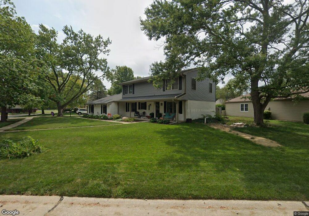
This home is located at 1903 Lyndhurst Dr Unit 1, Savoy, IL 61874 and is currently estimated at $355,883. 1903 Lyndhurst Dr Unit 1 is a home located in Champaign County with nearby schools including Central High School, Montessori School of Champaign-Urbana, and Devonshire KinderCare.
Ownership History
Date
Name
Owned For
Owner Type
Purchase Details
Closed on
Oct 10, 2017
Sold by
Bash Patricia Jo
Bought by
Outlaw Daniel and Outlaw Kelsey
Current Estimated Value
Home Financials for this Owner
Home Financials are based on the most recent Mortgage that was taken out on this home.
Original Mortgage
$227,905
Outstanding Balance
$190,620
Interest Rate
3.87%
Mortgage Type
New Conventional
Estimated Equity
$165,263
Purchase Details
Closed on
Nov 18, 2016
Sold by
Baltierra Daniel B and Baltierra Danielle D
Bought by
Bash Patricia Jo
Purchase Details
Closed on
Jan 10, 2009
Sold by
Block F Donald and Block Gail J
Bought by
Baltierra Daniel B and Baltierra Danielle D
Home Financials for this Owner
Home Financials are based on the most recent Mortgage that was taken out on this home.
Original Mortgage
$100,000
Interest Rate
5.19%
Mortgage Type
Purchase Money Mortgage
Create a Home Valuation Report for This Property
The Home Valuation Report is an in-depth analysis detailing your home's value as well as a comparison with similar homes in the area
Home Values in the Area
Average Home Value in this Area
Purchase History
| Date | Buyer | Sale Price | Title Company |
|---|---|---|---|
| Outlaw Daniel | $240,000 | First Community Title | |
| Bash Patricia Jo | $141,000 | None Available | |
| Baltierra Daniel B | $185,000 | None Available |
Source: Public Records
Mortgage History
| Date | Status | Borrower | Loan Amount |
|---|---|---|---|
| Open | Outlaw Daniel | $227,905 | |
| Previous Owner | Baltierra Daniel B | $100,000 |
Source: Public Records
Tax History
| Year | Tax Paid | Tax Assessment Tax Assessment Total Assessment is a certain percentage of the fair market value that is determined by local assessors to be the total taxable value of land and additions on the property. | Land | Improvement |
|---|---|---|---|---|
| 2024 | $5,737 | $90,080 | $18,110 | $71,970 |
| 2023 | $5,737 | $83,170 | $16,720 | $66,450 |
| 2022 | $5,456 | $72,950 | $15,600 | $57,350 |
| 2021 | $5,318 | $71,660 | $15,320 | $56,340 |
| 2020 | $5,271 | $70,950 | $15,170 | $55,780 |
| 2019 | $4,908 | $67,400 | $14,410 | $52,990 |
| 2018 | $4,775 | $65,840 | $14,410 | $51,430 |
| 2017 | $4,676 | $64,500 | $14,410 | $50,090 |
| 2016 | $4,231 | $64,500 | $14,410 | $50,090 |
| 2015 | $4,238 | $64,500 | $14,410 | $50,090 |
| 2014 | $4,015 | $60,380 | $14,410 | $45,970 |
| 2013 | $3,854 | $59,090 | $14,410 | $44,680 |
Source: Public Records
Map
Nearby Homes
- 409 Park Lane Dr
- 2501 Bedford Dr
- 901 Kent Dr
- 716 Devonshire Dr
- 1409 Yorkshire Dr
- 809 Ayrshire Dr
- 20 Ashley Ln
- 2410 Stillwater Dr
- 2404 Windward Blvd Unit 201
- 2404 Windward Blvd Unit 202
- 2211 Carlisle Dr
- 2317 Brookshire E
- 3 Lake Park Rd
- 612 N Clarendon Ct
- 1205 Broadmoor Dr
- 1506 Sandpiper Ln
- 302 Jay St
- 2144 Harbortown Cir Unit 2144
- 2134 Harbortown Cir
- 506 Van Buren St
- 1903 Lyndhurst Dr
- 2 Magnolia Ct
- 1901 Lyndhurst Dr
- 1819 Old Maple Ln
- 1906 Lyndhurst Dr
- 13 Magnolia Ct
- 3 Magnolia Ct
- 1908 Lyndhurst Dr
- 1817 Old Maple Ln
- 1904 Lyndhurst Dr
- 12 Magnolia Ct
- 1900 Lyndhurst Dr
- 1815 Old Maple Ln
- 4 Magnolia Ct
- 11 Magnolia Ct
- 1816 Old Maple Ln
- 507 Park Lane Dr
- 411 Park Lane Dr
- 1814 Old Maple Ln
- 509 Park Lane Dr
Your Personal Tour Guide
Ask me questions while you tour the home.