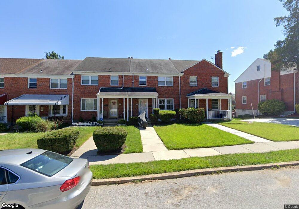
1903 Northbourne Rd Baltimore, MD 21239
Perring Loch NeighborhoodEstimated Value: $217,148 - $245,000
4
Beds
2
Baths
1,782
Sq Ft
$130/Sq Ft
Est. Value
About This Home
This home is located at 1903 Northbourne Rd, Baltimore, MD 21239 and is currently estimated at $231,074, approximately $129 per square foot. 1903 Northbourne Rd is a home located in Baltimore City with nearby schools including Northwood Elementary School, Booker T. Washington Middle School, and Paul Laurence Dunbar High School.
Ownership History
Date
Name
Owned For
Owner Type
Purchase Details
Closed on
Aug 30, 2006
Sold by
1903 Northbourne Road Llc
Bought by
Bennett Alicia
Current Estimated Value
Home Financials for this Owner
Home Financials are based on the most recent Mortgage that was taken out on this home.
Original Mortgage
$137,500
Outstanding Balance
$87,746
Interest Rate
7.85%
Mortgage Type
Purchase Money Mortgage
Estimated Equity
$143,328
Purchase Details
Closed on
Jul 8, 1999
Sold by
James W Busch Wf
Bought by
Williams Marisa C
Create a Home Valuation Report for This Property
The Home Valuation Report is an in-depth analysis detailing your home's value as well as a comparison with similar homes in the area
Home Values in the Area
Average Home Value in this Area
Purchase History
| Date | Buyer | Sale Price | Title Company |
|---|---|---|---|
| Bennett Alicia | $171,900 | -- | |
| Williams Marisa C | $67,900 | -- |
Source: Public Records
Mortgage History
| Date | Status | Borrower | Loan Amount |
|---|---|---|---|
| Open | Bennett Alicia | $137,500 | |
| Closed | Bennett Alicia | $34,350 |
Source: Public Records
Tax History
| Year | Tax Paid | Tax Assessment Tax Assessment Total Assessment is a certain percentage of the fair market value that is determined by local assessors to be the total taxable value of land and additions on the property. | Land | Improvement |
|---|---|---|---|---|
| 2025 | $3,368 | $171,400 | -- | -- |
| 2024 | $3,368 | $156,700 | $36,000 | $120,700 |
| 2023 | $3,269 | $152,867 | $0 | $0 |
| 2022 | $3,183 | $149,033 | $0 | $0 |
| 2021 | $3,427 | $145,200 | $36,000 | $109,200 |
| 2020 | $3,088 | $143,933 | $0 | $0 |
| 2019 | $3,042 | $142,667 | $0 | $0 |
| 2018 | $3,074 | $141,400 | $36,000 | $105,400 |
| 2017 | $3,077 | $140,133 | $0 | $0 |
| 2016 | $2,958 | $138,867 | $0 | $0 |
| 2015 | $2,958 | $137,600 | $0 | $0 |
| 2014 | $2,958 | $137,600 | $0 | $0 |
Source: Public Records
Map
Nearby Homes
- 1814 Winford Rd
- 5413 Hillen Rd
- 1705 Swansea Rd
- 1808 Swansea Rd
- 1613 Winford Rd
- 1708 Hartsdale Rd
- 1903 Ramblewood Rd
- 2014 Crestview Rd
- 4929 Herring Run Dr
- 2318 Ivy Ave
- 1647 Stonewood Rd
- 2326 Ivy Ave
- 1607 Stonewood Rd
- 1645 Sherwood Ave
- 2203 Southern Ave
- 5102 Plymouth Rd
- 5033 Plymouth Rd
- 2107 Echodale Ave
- 5105 Plymouth Rd
- 1662 E Cold Spring Ln
- 1905 Northbourne Rd
- 1901 Northbourne Rd
- 1907 Northbourne Rd
- 1909 Northbourne Rd
- 1817 Northbourne Rd
- 1911 Northbourne Rd
- 1815 Northbourne Rd
- 1913 Northbourne Rd
- 1813 Northbourne Rd
- 1906 Burnwood Rd
- 1908 Burnwood Rd
- 1904 Burnwood Rd
- 1910 Burnwood Rd
- 1902 Burnwood Rd
- 1915 Northbourne Rd
- 1912 Burnwood Rd
- 1811 Northbourne Rd
- 1900 Burnwood Rd
- 1914 Burnwood Rd
- 1814 Burnwood Rd
Your Personal Tour Guide
Ask me questions while you tour the home.