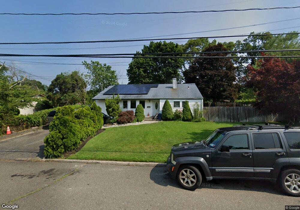
1903 Phillips Dr Medford, NY 11763
Estimated Value: $493,000 - $573,000
3
Beds
1
Bath
1,348
Sq Ft
$394/Sq Ft
Est. Value
About This Home
This home is located at 1903 Phillips Dr, Medford, NY 11763 and is currently estimated at $531,373, approximately $394 per square foot. 1903 Phillips Dr is a home located in Suffolk County with nearby schools including Patchogue-Medford High School and Long Island Baptist Academy.
Ownership History
Date
Name
Owned For
Owner Type
Purchase Details
Closed on
Mar 12, 2007
Current Estimated Value
Purchase Details
Closed on
Feb 3, 2006
Sold by
Augusto Maria H
Bought by
Mejia Sandra
Purchase Details
Closed on
Oct 29, 2003
Sold by
Demaio Anthony P and Demaio Carol A
Bought by
Augusto Maria H
Home Financials for this Owner
Home Financials are based on the most recent Mortgage that was taken out on this home.
Original Mortgage
$227,990
Interest Rate
5.65%
Mortgage Type
Unknown
Purchase Details
Closed on
Jan 24, 2000
Sold by
Pustarfi Robert and Pustarfi Sandra
Bought by
Murphy Matthew E and Murphy Elizabeth A
Create a Home Valuation Report for This Property
The Home Valuation Report is an in-depth analysis detailing your home's value as well as a comparison with similar homes in the area
Home Values in the Area
Average Home Value in this Area
Purchase History
| Date | Buyer | Sale Price | Title Company |
|---|---|---|---|
| -- | -- | -- | |
| Mejia Sandra | $349,170 | Valdas Duoba | |
| Augusto Maria H | $239,990 | -- | |
| Murphy Matthew E | $113,000 | Chicago Title Insurance Co |
Source: Public Records
Mortgage History
| Date | Status | Borrower | Loan Amount |
|---|---|---|---|
| Previous Owner | Augusto Maria H | $227,990 |
Source: Public Records
Tax History Compared to Growth
Tax History
| Year | Tax Paid | Tax Assessment Tax Assessment Total Assessment is a certain percentage of the fair market value that is determined by local assessors to be the total taxable value of land and additions on the property. | Land | Improvement |
|---|---|---|---|---|
| 2024 | $10,716 | $2,450 | $160 | $2,290 |
| 2023 | $10,716 | $2,450 | $160 | $2,290 |
| 2022 | $9,600 | $2,450 | $160 | $2,290 |
| 2021 | $9,600 | $2,450 | $160 | $2,290 |
| 2020 | $9,856 | $2,450 | $160 | $2,290 |
| 2019 | $9,856 | $0 | $0 | $0 |
| 2018 | $9,296 | $2,450 | $160 | $2,290 |
| 2017 | $9,296 | $2,450 | $160 | $2,290 |
| 2016 | $9,112 | $2,450 | $160 | $2,290 |
| 2015 | -- | $2,450 | $160 | $2,290 |
| 2014 | -- | $2,450 | $160 | $2,290 |
Source: Public Records
Map
Nearby Homes
- 1902 Phillips Dr
- 1902 Race Ave
- 2905 Beechnut Ave
- 3004 New London Ave
- 2909 Falcon Ave
- 0 Cedar Ln Unit ONE3556748
- 2812 Sipp Ave
- 0 Sipp Ave Unit KEY830779
- 2816 Acorn Ave
- 1300 Race Ave
- 1301 Race Ave
- 2401 Race Ave
- 3106 Devon Ave
- 3115 Chestnut Ave
- 1600 Fire Ave
- 2617 Kane Ave
- 2697 Heather Ave
- 3110 Kane Ave
- 2405 Fire Ave
- 3115 Heather Ave
- 1905 Phillips Dr
- 1901 Phillips Dr
- 1900 Phillips Dr
- 1907 Phillips Dr
- 2810 Devon Ave
- 2902 Devon Ave
- 2815 Devon Ave
- 2811 New London Ave
- 2903 New London Ave
- 1809 Phillips Dr
- 2818 Watchill Ave
- 2818 Watch Hill Ave
- 2903 Devon Ave
- 1808 Phillips Dr
- 2811 Devon Ave
- 2904 Devon Ave
- 2812 Watchill Ave
- 2812 Watch Hill Ave
- 2905 New London Ave
- 2810 New London Ave