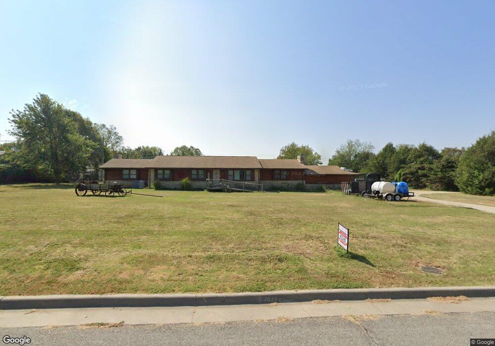
1903 Sharon Ct Winfield, KS 67156
Estimated Value: $64,000 - $353,000
3
Beds
3
Baths
2,287
Sq Ft
$107/Sq Ft
Est. Value
About This Home
This home is located at 1903 Sharon Ct, Winfield, KS 67156 and is currently estimated at $244,553, approximately $106 per square foot. 1903 Sharon Ct is a home located in Cowley County with nearby schools including Winfield High School, Holy Name Catholic School, and Trinity Lutheran School.
Ownership History
Date
Name
Owned For
Owner Type
Purchase Details
Closed on
Jul 11, 2006
Sold by
Bishop Mary
Bought by
Decoudres Mark A and Decoudres Pennie A
Current Estimated Value
Home Financials for this Owner
Home Financials are based on the most recent Mortgage that was taken out on this home.
Original Mortgage
$92,000
Outstanding Balance
$54,528
Interest Rate
6.62%
Mortgage Type
Future Advance Clause Open End Mortgage
Estimated Equity
$190,025
Create a Home Valuation Report for This Property
The Home Valuation Report is an in-depth analysis detailing your home's value as well as a comparison with similar homes in the area
Home Values in the Area
Average Home Value in this Area
Purchase History
| Date | Buyer | Sale Price | Title Company |
|---|---|---|---|
| Decoudres Mark A | -- | -- |
Source: Public Records
Mortgage History
| Date | Status | Borrower | Loan Amount |
|---|---|---|---|
| Open | Decoudres Mark A | $92,000 |
Source: Public Records
Tax History Compared to Growth
Tax History
| Year | Tax Paid | Tax Assessment Tax Assessment Total Assessment is a certain percentage of the fair market value that is determined by local assessors to be the total taxable value of land and additions on the property. | Land | Improvement |
|---|---|---|---|---|
| 2025 | $5,098 | $33,898 | $4,210 | $29,688 |
| 2024 | $5,098 | $33,049 | $4,210 | $28,839 |
| 2023 | $6,671 | $32,866 | $4,210 | $28,656 |
| 2022 | $4,428 | $28,497 | $5,710 | $22,787 |
| 2021 | $4,428 | $24,936 | $3,697 | $21,239 |
| 2020 | $5,555 | $23,835 | $3,612 | $20,223 |
| 2019 | $5,589 | $24,232 | $3,566 | $20,666 |
| 2018 | $5,546 | $24,231 | $3,084 | $21,147 |
| 2017 | $5,316 | $23,055 | $3,640 | $19,415 |
| 2016 | $5,255 | $23,055 | $3,236 | $19,819 |
| 2015 | -- | $20,643 | $1,057 | $19,586 |
| 2014 | -- | $20,643 | $1,984 | $18,659 |
Source: Public Records
Map
Nearby Homes
- 2214 Cottonwood Ct
- 1901 Kitch Rd
- 408 W 13th Ave
- 1315 Menor St
- 219 W 13th Ave
- 18071 65th Rd
- 1 Braid Hill Dr
- 1601 Millington St
- 310 E 11th Ave
- 1711 Loomis St
- 403 E 11th Ave
- 2902 Yaeger Dr
- 1710 Loomis St
- 3114 Long Ct
- 1902 Loomis St
- 508 E 10th Ave
- 1901 Fuller St
- 2016 Loomis St
- 3126 Long Ct
- 3119 Elwell Dr
- 1907 Sharon Ct
- 1007 Grand St
- 1003 Grand St
- 1817 Sharon Ct
- 1104 Grand St
- 1916 Sharon Ct
- 1910 Sharon Ct
- 1906 Sharon Ct
- 1816 Sharon Ct
- 1809 Sharon Ct
- 923 Grand St
- 1808 Sharon Ct
- 1110 Grand St
- 1101 Parkside Ln
- 2012 Crestline Dr
- 2021 W 9th Ave
- 1109 Parkside Ln
- 2009 Holloway Ln
- 1212 Grand St
- 1910 W 9th Ave