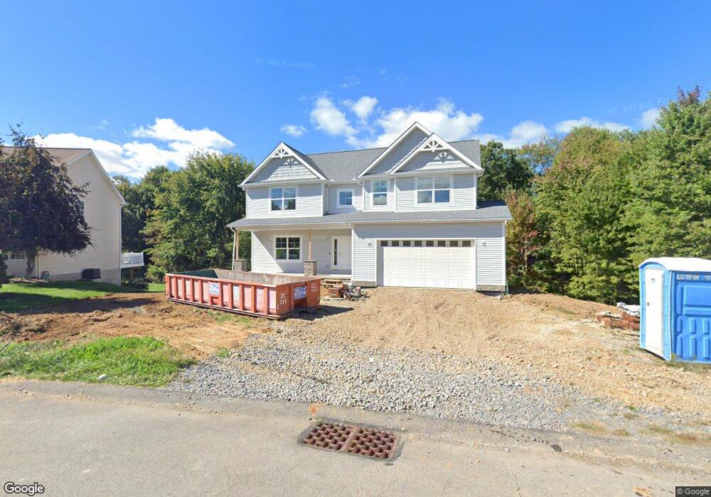
1904 Aspen Ct Conway, PA 15027
Estimated Value: $327,000 - $528,000
4
Beds
3
Baths
--
Sq Ft
0.66
Acres
About This Home
This home is located at 1904 Aspen Ct, Conway, PA 15027 and is currently estimated at $445,865. 1904 Aspen Ct is a home with nearby schools including Freedom Area Elementary School, Freedom Area Middle School, and Freedom Area Senior High School.
Ownership History
Date
Name
Owned For
Owner Type
Purchase Details
Closed on
May 5, 2021
Sold by
Keller Land Dev Company Llc
Bought by
Uhler Joseph Anthony and Uhler Emily A
Current Estimated Value
Home Financials for this Owner
Home Financials are based on the most recent Mortgage that was taken out on this home.
Original Mortgage
$32,600
Outstanding Balance
$19,436
Interest Rate
3.1%
Mortgage Type
New Conventional
Estimated Equity
$426,429
Create a Home Valuation Report for This Property
The Home Valuation Report is an in-depth analysis detailing your home's value as well as a comparison with similar homes in the area
Home Values in the Area
Average Home Value in this Area
Purchase History
| Date | Buyer | Sale Price | Title Company |
|---|---|---|---|
| Uhler Joseph Anthony | $40,750 | Penn Bridge Land Abstract | |
| Uhler Joseph Anthony | $40,750 | Penn Bridge Land Abstract Co |
Source: Public Records
Mortgage History
| Date | Status | Borrower | Loan Amount |
|---|---|---|---|
| Open | Uhler Joseph Anthony | $32,600 | |
| Closed | Uhler Joseph Anthony | $32,600 |
Source: Public Records
Tax History Compared to Growth
Tax History
| Year | Tax Paid | Tax Assessment Tax Assessment Total Assessment is a certain percentage of the fair market value that is determined by local assessors to be the total taxable value of land and additions on the property. | Land | Improvement |
|---|---|---|---|---|
| 2025 | $1,336 | $182,000 | $25,050 | $156,950 |
| 2024 | $6,235 | $182,000 | $25,050 | $156,950 |
| 2023 | $6 | $50 | $50 | $0 |
| 2022 | $6 | $50 | $50 | $0 |
| 2021 | $6 | $50 | $50 | $0 |
| 2020 | $6 | $50 | $50 | $0 |
| 2019 | $6 | $50 | $50 | $0 |
| 2018 | $5 | $50 | $50 | $0 |
| 2017 | $5 | $50 | $50 | $0 |
| 2016 | $5 | $50 | $50 | $0 |
| 2015 | $1 | $50 | $50 | $0 |
| 2014 | $1 | $50 | $50 | $0 |
Source: Public Records
Map
Nearby Homes