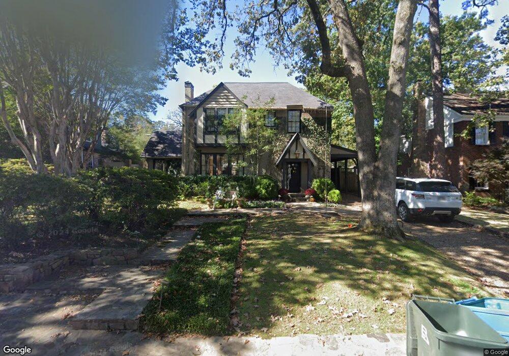
1904 Shadow Ln Little Rock, AR 72207
Heights NeighborhoodEstimated Value: $1,197,000 - $1,434,198
--
Bed
4
Baths
4,214
Sq Ft
$304/Sq Ft
Est. Value
About This Home
This home is located at 1904 Shadow Ln, Little Rock, AR 72207 and is currently estimated at $1,282,066, approximately $304 per square foot. 1904 Shadow Ln is a home located in Pulaski County with nearby schools including Forest Park Elementary School, Pulaski Heights Middle School, and Central High School.
Ownership History
Date
Name
Owned For
Owner Type
Purchase Details
Closed on
Feb 23, 2023
Sold by
Collins Andrew Joseph and Collins Meghan Hauer
Bought by
Collins Andrew Joseph and Collins Meghan Hauer
Current Estimated Value
Home Financials for this Owner
Home Financials are based on the most recent Mortgage that was taken out on this home.
Original Mortgage
$482,128
Interest Rate
6.15%
Mortgage Type
New Conventional
Purchase Details
Closed on
Jun 30, 2020
Sold by
Blair Donald D and Blair Lauren Philips
Bought by
Oak Shadow Lane Llc
Purchase Details
Closed on
Jun 6, 2011
Sold by
Collins Andrew J and Collins Somers
Bought by
Blair Donald D and Blair Lauren Phillips
Home Financials for this Owner
Home Financials are based on the most recent Mortgage that was taken out on this home.
Original Mortgage
$660,000
Interest Rate
4%
Mortgage Type
Adjustable Rate Mortgage/ARM
Create a Home Valuation Report for This Property
The Home Valuation Report is an in-depth analysis detailing your home's value as well as a comparison with similar homes in the area
Home Values in the Area
Average Home Value in this Area
Purchase History
| Date | Buyer | Sale Price | Title Company |
|---|---|---|---|
| Collins Andrew Joseph | -- | None Listed On Document | |
| Collins Andrew Joseph | -- | -- | |
| Oak Shadow Lane Llc | $1,200,000 | Lenders Title Company | |
| Blair Donald D | $825,000 | None Available |
Source: Public Records
Mortgage History
| Date | Status | Borrower | Loan Amount |
|---|---|---|---|
| Previous Owner | Collins Andrew Joseph | $482,128 | |
| Previous Owner | Blair Donald D | $660,000 |
Source: Public Records
Tax History Compared to Growth
Tax History
| Year | Tax Paid | Tax Assessment Tax Assessment Total Assessment is a certain percentage of the fair market value that is determined by local assessors to be the total taxable value of land and additions on the property. | Land | Improvement |
|---|---|---|---|---|
| 2024 | $13,832 | $197,596 | $100,000 | $97,596 |
| 2023 | $13,832 | $197,596 | $100,000 | $97,596 |
| 2022 | $13,021 | $197,596 | $100,000 | $97,596 |
| 2021 | $11,922 | $169,100 | $74,380 | $94,720 |
| 2020 | $11,462 | $169,100 | $74,380 | $94,720 |
| 2019 | $11,462 | $169,100 | $74,380 | $94,720 |
| 2018 | $11,391 | $169,100 | $74,380 | $94,720 |
| 2017 | $10,827 | $169,100 | $74,380 | $94,720 |
| 2016 | $10,926 | $161,090 | $75,000 | $86,090 |
| 2015 | $11,292 | $161,090 | $75,000 | $86,090 |
| 2014 | $11,292 | $161,090 | $75,000 | $86,090 |
Source: Public Records
Map
Nearby Homes
- 1920 Beechwood St
- 1816 N Jackson St
- 5024 Crestwood Dr
- 4817 Kavanaugh Blvd
- 5019 Country Club Blvd
- 5135 Cantrell Rd
- 5205 Kavanaugh Blvd
- 5015 E Crestwood Dr
- 5100 Country Club Blvd
- 1801 N Harrison St
- 5012 Hawthorne Rd
- 5111 Hawthorne Rd
- 5319 Country Club Blvd
- 1109 N Spruce St
- 5410 Stonewall Rd
- 416 N Spruce St
- 1615 N Taylor St
- 5415 L St
- 5520 Hawthorne Rd
- 131 Fairview Rd
- 1914 Shadow Ln
- 1900 Shadow Ln
- 1922 Shadow Ln
- 1901 N Spruce St
- 1917 N Spruce St
- 1911 Shadow Ln
- 1915 Shadow Ln
- 1901 Shadow Ln
- 1825 N Spruce St
- 1921 N Spruce St
- 1822 Shadow Ln
- 1923 Shadow Ln
- 0 Shadow Ln
- 1821 N Spruce St
- 1819 Shadow Ln
- 1817 N Spruce St
- 4708 Club Rd
- 4700 Club Rd
- 1814 Shadow Ln
- 1908 Beechwood St