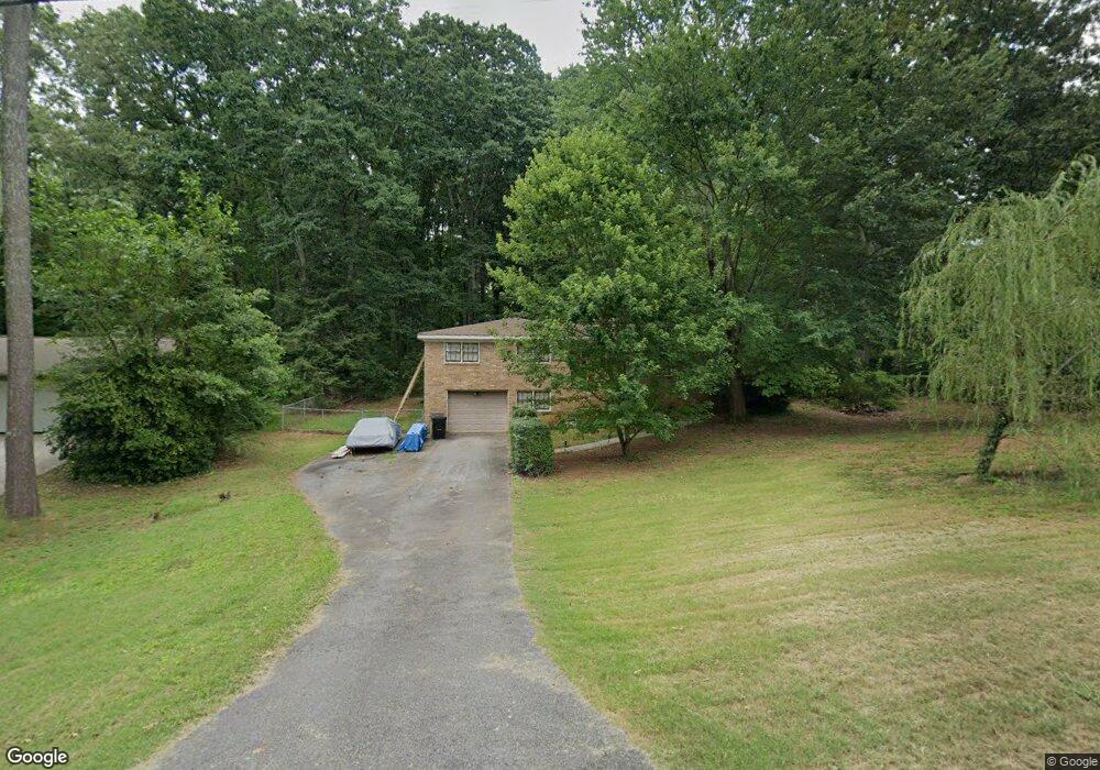
1904 Starlight Dr Marietta, GA 30062
Eastern Marietta NeighborhoodEstimated Value: $347,449 - $444,000
3
Beds
2
Baths
1,471
Sq Ft
$263/Sq Ft
Est. Value
About This Home
This home is located at 1904 Starlight Dr, Marietta, GA 30062 and is currently estimated at $387,362, approximately $263 per square foot. 1904 Starlight Dr is a home located in Cobb County with nearby schools including Kincaid Elementary School, Simpson Middle School, and Sprayberry High School.
Ownership History
Date
Name
Owned For
Owner Type
Purchase Details
Closed on
Oct 11, 2018
Sold by
Boling Jimmy C
Bought by
Boling Jimmy Clark and Boling Cecilia H
Current Estimated Value
Purchase Details
Closed on
Aug 8, 2003
Sold by
Boling Jimmy C
Bought by
Boling Jimmy C and Boling Cecilia
Home Financials for this Owner
Home Financials are based on the most recent Mortgage that was taken out on this home.
Original Mortgage
$95,000
Interest Rate
5.52%
Mortgage Type
Stand Alone Second
Create a Home Valuation Report for This Property
The Home Valuation Report is an in-depth analysis detailing your home's value as well as a comparison with similar homes in the area
Home Values in the Area
Average Home Value in this Area
Purchase History
| Date | Buyer | Sale Price | Title Company |
|---|---|---|---|
| Boling Jimmy Clark | -- | -- | |
| Boling Jimmy C | -- | -- |
Source: Public Records
Mortgage History
| Date | Status | Borrower | Loan Amount |
|---|---|---|---|
| Previous Owner | Boling Jimmy C | $95,000 |
Source: Public Records
Tax History Compared to Growth
Tax History
| Year | Tax Paid | Tax Assessment Tax Assessment Total Assessment is a certain percentage of the fair market value that is determined by local assessors to be the total taxable value of land and additions on the property. | Land | Improvement |
|---|---|---|---|---|
| 2025 | $4,105 | $136,256 | $38,000 | $98,256 |
| 2024 | $4,108 | $136,256 | $38,000 | $98,256 |
| 2023 | $3,811 | $126,408 | $32,000 | $94,408 |
| 2022 | $3,400 | $112,028 | $28,000 | $84,028 |
| 2021 | $2,912 | $95,956 | $26,000 | $69,956 |
| 2020 | $2,912 | $95,956 | $26,000 | $69,956 |
| 2019 | $2,164 | $71,312 | $22,000 | $49,312 |
| 2018 | $2,164 | $71,312 | $22,000 | $49,312 |
| 2017 | $1,825 | $63,472 | $18,000 | $45,472 |
| 2016 | $1,825 | $63,472 | $18,000 | $45,472 |
| 2015 | $1,465 | $49,740 | $18,000 | $31,740 |
| 2014 | $1,478 | $49,740 | $0 | $0 |
Source: Public Records
Map
Nearby Homes
- 1833 Tree Top Ct
- 1991 Kinridge Rd
- 1822 Hasty Rd
- 2020 Starlight Dr
- 1701 Smithwood Dr
- 2289 Glenridge Dr
- 1780 Kinridge Rd
- 1900 Branch View Dr
- 1972 Granite Mill Rd
- 2252 Carefree Cir Unit 3
- 2255 Abbey Cove Ct
- 1854 Butterfly Way
- 1850 Butterfly Way NE
- 1838 Butterfly NE
- Robie Plan at The Village at Sandy Plains
- Harbor Plan at The Village at Sandy Plains
- 1892 Starlight Dr
- 1916 Starlight Dr
- 2038 Kinridge Rd
- 2030 Kinridge Rd
- 1912 Starlight Dr
- 1928 Starlight Dr
- 1880 Starlight Dr
- 2044 Kinridge Rd
- 1917 Poinsetta Dr
- 2022 Kinridge Rd
- 1917 Poinsettia Dr
- 1900 Hasty Rd
- 1940 Starlight Dr
- Lot 51 Starlight Dr
- 1911 Hasty Rd
- 1905 Poinsetta Dr
- 0 Kinridge Rd Unit 8567944
- 0 Kinridge Rd Unit 8531451
- 0 Kinridge Rd Unit 3223836
- 0 Kinridge Rd Unit 9013366