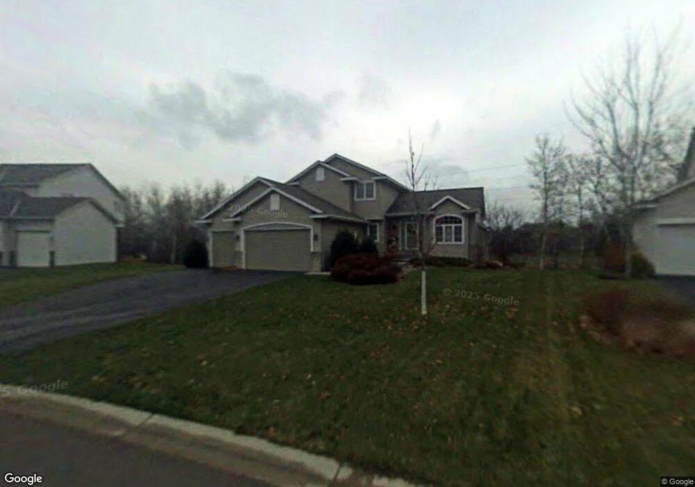
1905 122nd Ln NE Minneapolis, MN 55449
Estimated Value: $471,000 - $527,000
5
Beds
4
Baths
2,730
Sq Ft
$181/Sq Ft
Est. Value
About This Home
This home is located at 1905 122nd Ln NE, Minneapolis, MN 55449 and is currently estimated at $494,903, approximately $181 per square foot. 1905 122nd Ln NE is a home located in Anoka County with nearby schools including Sunrise Elementary School, Northdale Middle School, and Blaine Senior High School.
Ownership History
Date
Name
Owned For
Owner Type
Purchase Details
Closed on
Nov 13, 2015
Sold by
Hottinger Koenigs Rosemary J and Koenigs Joel R
Bought by
Morris John W and Morris Cecelia W
Current Estimated Value
Home Financials for this Owner
Home Financials are based on the most recent Mortgage that was taken out on this home.
Original Mortgage
$322,905
Outstanding Balance
$253,548
Interest Rate
3.74%
Mortgage Type
New Conventional
Estimated Equity
$241,355
Purchase Details
Closed on
Dec 3, 2002
Sold by
Great Northern Land Corp
Bought by
Scott Olmstead Builders Inc
Create a Home Valuation Report for This Property
The Home Valuation Report is an in-depth analysis detailing your home's value as well as a comparison with similar homes in the area
Home Values in the Area
Average Home Value in this Area
Purchase History
| Date | Buyer | Sale Price | Title Company |
|---|---|---|---|
| Morris John W | $339,900 | Burnet Title | |
| Scott Olmstead Builders Inc | $86,900 | -- |
Source: Public Records
Mortgage History
| Date | Status | Borrower | Loan Amount |
|---|---|---|---|
| Open | Morris John W | $322,905 | |
| Previous Owner | Koenigs Joel R | $172,200 |
Source: Public Records
Tax History Compared to Growth
Tax History
| Year | Tax Paid | Tax Assessment Tax Assessment Total Assessment is a certain percentage of the fair market value that is determined by local assessors to be the total taxable value of land and additions on the property. | Land | Improvement |
|---|---|---|---|---|
| 2025 | $4,817 | $453,400 | $112,900 | $340,500 |
| 2024 | $4,817 | $453,600 | $111,100 | $342,500 |
| 2023 | $4,228 | $448,200 | $105,700 | $342,500 |
| 2022 | $3,959 | $440,700 | $92,400 | $348,300 |
| 2021 | $3,899 | $366,100 | $77,000 | $289,100 |
| 2020 | $4,214 | $352,900 | $77,000 | $275,900 |
| 2019 | $3,960 | $365,500 | $72,000 | $293,500 |
| 2018 | $4,161 | $337,500 | $0 | $0 |
| 2017 | $3,611 | $344,800 | $0 | $0 |
| 2016 | $3,638 | $295,800 | $0 | $0 |
| 2015 | $3,760 | $295,800 | $69,700 | $226,100 |
| 2014 | -- | $259,400 | $62,400 | $197,000 |
Source: Public Records
Map
Nearby Homes
- 12101 Hastings St NE
- 1773 124th Ave NE
- 1936 121st Ave NE
- 1653 123rd Ave NE
- 12209 Davenport St NE
- 12051 Owatonna Ct NE
- 12024 Owatonna Ct NE
- 12041 Owatonna Ct NE
- XXXX Radisson Rd NE
- 2429 121st Cir NE Unit F
- 12290 Urbank St NE Unit D
- 12741 Owatonna St NE
- 12175 Vermillion St NE Unit G
- 2204 128th Ln NE
- 2255 119th Cir NE
- 12016 Vermillion St NE Unit D
- 2348 119th Cir NE
- 1876 129th Ave NE
- 2411 119th Ct NE Unit A
- 1635 117th Ave NE
- 1919 122nd Ln NE
- 1891 122nd Ln NE
- 1933 122nd Ln NE
- 12238 Kenyon Ct NE
- 1947 122nd Ln NE
- 12230 Kenyon Ct NE
- 12237 Kenyon Ct NE
- 1961 122nd Ln NE
- 12316 Radisson Rd NE
- 12222 Kenyon Ct NE
- 12229 Kenyon Ct NE
- 12233 Isanti Ct NE
- 12245 Isanti Ct NE
- 1890 122nd Ln NE
- 12248 Radisson Rd NE
- 12253 Isanti Ct NE
- 12214 Kenyon Ct NE
- 12324 Radisson Rd NE
- 1880 122nd Ln NE
- 12221 Kenyon Ct NE