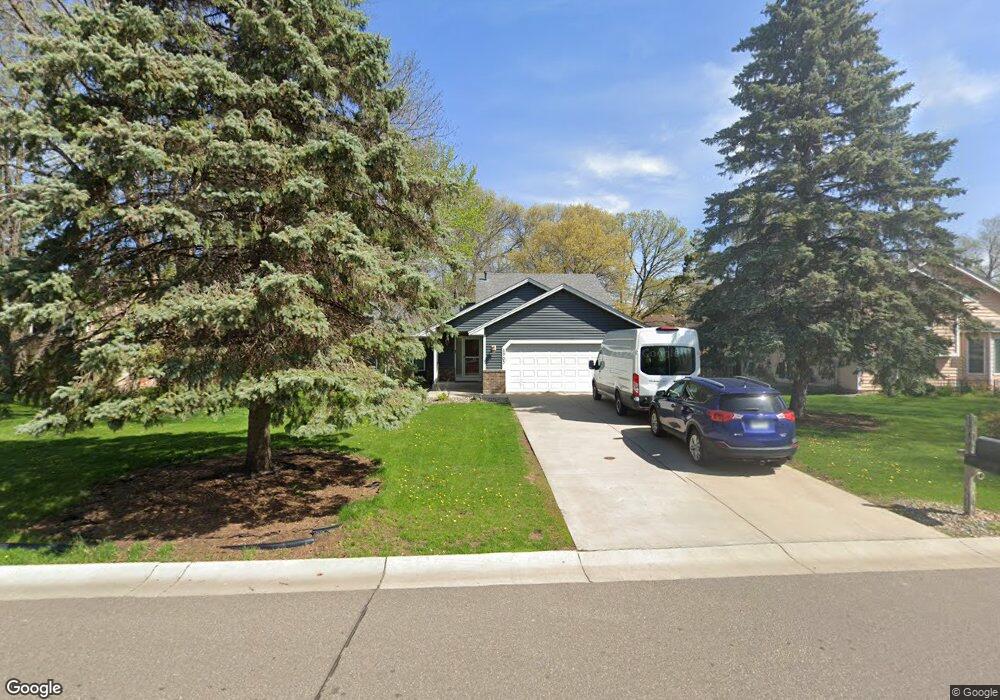
1905 130th Ln NW Coon Rapids, MN 55448
Estimated Value: $390,691 - $408,000
4
Beds
2
Baths
1,203
Sq Ft
$331/Sq Ft
Est. Value
About This Home
This home is located at 1905 130th Ln NW, Coon Rapids, MN 55448 and is currently estimated at $398,173, approximately $330 per square foot. 1905 130th Ln NW is a home located in Anoka County with nearby schools including Lucile Bruner Elementary School, Morris Bye Elementary School, and Laughlin Junior/Senior High School.
Ownership History
Date
Name
Owned For
Owner Type
Purchase Details
Closed on
Jun 18, 2018
Sold by
Hunter Gerald D and Vukonich Mary L
Bought by
Kumi Jones and Eyimah Ethel Joyce
Current Estimated Value
Home Financials for this Owner
Home Financials are based on the most recent Mortgage that was taken out on this home.
Original Mortgage
$279,346
Outstanding Balance
$242,929
Interest Rate
4.75%
Mortgage Type
FHA
Estimated Equity
$155,244
Purchase Details
Closed on
May 14, 2010
Sold by
Kratz Thomas H and Kratz Dianne L
Bought by
Hunter Gerald D and Vukonich Mary L
Create a Home Valuation Report for This Property
The Home Valuation Report is an in-depth analysis detailing your home's value as well as a comparison with similar homes in the area
Home Values in the Area
Average Home Value in this Area
Purchase History
| Date | Buyer | Sale Price | Title Company |
|---|---|---|---|
| Kumi Jones | $284,500 | Trademark Title Services Inc | |
| Hunter Gerald D | $206,000 | -- |
Source: Public Records
Mortgage History
| Date | Status | Borrower | Loan Amount |
|---|---|---|---|
| Open | Kumi Jones | $279,346 |
Source: Public Records
Tax History Compared to Growth
Tax History
| Year | Tax Paid | Tax Assessment Tax Assessment Total Assessment is a certain percentage of the fair market value that is determined by local assessors to be the total taxable value of land and additions on the property. | Land | Improvement |
|---|---|---|---|---|
| 2025 | $3,631 | $351,200 | $90,000 | $261,200 |
| 2024 | $3,631 | $346,800 | $87,000 | $259,800 |
| 2023 | $3,356 | $337,500 | $72,000 | $265,500 |
| 2022 | $2,962 | $342,800 | $72,000 | $270,800 |
| 2021 | $2,914 | $272,500 | $56,000 | $216,500 |
| 2020 | $2,906 | $262,500 | $56,000 | $206,500 |
| 2019 | $2,789 | $251,600 | $56,000 | $195,600 |
| 2018 | $2,621 | $235,700 | $0 | $0 |
| 2017 | $2,419 | $216,500 | $0 | $0 |
| 2016 | $2,477 | $198,600 | $0 | $0 |
| 2015 | $2,414 | $198,600 | $50,000 | $148,600 |
| 2014 | -- | $165,500 | $35,400 | $130,100 |
Source: Public Records
Map
Nearby Homes
- 1687 131st Ln NW
- 1776 133rd Ave NW
- 12759 Ibis St NW
- 1930 127th Cir NW
- 1520 129th Ave NW
- 12760 Raven St NW
- 13416 Swallow St NW
- 12554 Grouse St NW
- 13519 Partridge Cir NW
- 1593 126th Ln NW
- 2147 125th Ln NW
- 1450 126th Ln NW
- 2068 124th Ln NW
- 12365 Jay St NW
- 13182 Zion St NW
- 1625 124th Ave NW
- 1234 128th Cir NW
- 12463 Drake St NW
- 2270 137th Ln NW
- 2675 128th Ave NW
- 1897 130th Ln NW
- 1913 130th Ln NW
- 1910 131st Ave NW
- 1906 131st Ave NW
- 1885 130th Ln NW
- 13049 Martin St NW
- 1900 131st Ave NW
- 1914 131st Ave NW
- 1921 130th Ln NW
- 13050 Linnet St NW
- 1920 131st Ave NW
- 13035 Martin St NW
- 1926 130th Ln NW
- 1854 131st Ave NW
- 1929 130th Ln NW
- 13000 Linnet St NW
- 1871 130th Ln NW
- 1926 131st Ave NW
- 13055 Linnet St NW
- 13021 Martin St NW