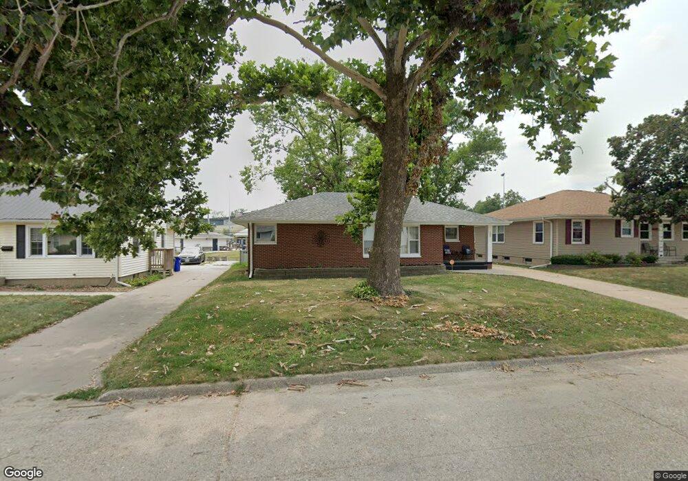
1905 9th Ave SW Cedar Rapids, IA 52404
Cleveland Area NeighborhoodEstimated Value: $209,000 - $229,000
4
Beds
3
Baths
1,224
Sq Ft
$180/Sq Ft
Est. Value
About This Home
This home is located at 1905 9th Ave SW, Cedar Rapids, IA 52404 and is currently estimated at $220,459, approximately $180 per square foot. 1905 9th Ave SW is a home located in Linn County with nearby schools including Junction City Elementary School, Cleveland Elementary School, and Kentucky Tech - Ashland Reg Tech Center.
Ownership History
Date
Name
Owned For
Owner Type
Purchase Details
Closed on
Feb 15, 2024
Sold by
Bennington Alisa Marie and Bennington Brian Thomas
Bought by
Miringu Grace
Current Estimated Value
Home Financials for this Owner
Home Financials are based on the most recent Mortgage that was taken out on this home.
Original Mortgage
$208,550
Outstanding Balance
$204,667
Interest Rate
6.62%
Mortgage Type
New Conventional
Estimated Equity
$15,792
Purchase Details
Closed on
Jun 21, 2021
Sold by
Reynolds Kathleen T and Heineman Jeffery D
Bought by
Beck Alisa M and Bennington Brian T
Home Financials for this Owner
Home Financials are based on the most recent Mortgage that was taken out on this home.
Original Mortgage
$184,500
Interest Rate
2.5%
Mortgage Type
New Conventional
Purchase Details
Closed on
Dec 21, 2020
Sold by
Lkj Llc
Bought by
Reynolds Kathleen T and Heineman Jeffrey D
Home Financials for this Owner
Home Financials are based on the most recent Mortgage that was taken out on this home.
Original Mortgage
$142,000
Interest Rate
2.7%
Mortgage Type
Future Advance Clause Open End Mortgage
Purchase Details
Closed on
Jun 8, 2007
Sold by
Ntanyungu Shartier and Muhimpundu Regina
Bought by
Ask Inc
Purchase Details
Closed on
Jan 11, 2005
Sold by
Cook Thomas L and Cook Sally A
Bought by
Ntanyangu Shartier and Muhimpundu Regina
Purchase Details
Closed on
Jan 31, 2000
Sold by
Morrison Kimberly Kay
Bought by
Morrison Nathan Daniel
Create a Home Valuation Report for This Property
The Home Valuation Report is an in-depth analysis detailing your home's value as well as a comparison with similar homes in the area
Home Values in the Area
Average Home Value in this Area
Purchase History
| Date | Buyer | Sale Price | Title Company |
|---|---|---|---|
| Miringu Grace | $215,000 | None Listed On Document | |
| Miringu Grace | $215,000 | None Listed On Document | |
| Beck Alisa M | $205,000 | None Available | |
| Beck Alisa M | $205,000 | None Available | |
| Reynolds Kathleen T | $112,000 | None Listed On Document | |
| Reynolds Kathleen T | $112,000 | None Listed On Document | |
| Ask Inc | $107,500 | None Available | |
| Ask Inc | $107,500 | None Available | |
| Ntanyangu Shartier | $109,500 | -- | |
| Ntanyangu Shartier | $109,500 | -- | |
| Morrison Nathan Daniel | -- | -- | |
| Morrison Nathan Daniel | -- | -- |
Source: Public Records
Mortgage History
| Date | Status | Borrower | Loan Amount |
|---|---|---|---|
| Open | Miringu Grace | $208,550 | |
| Previous Owner | Beck Alisa M | $184,500 | |
| Previous Owner | Reynolds Kathleen T | $142,000 |
Source: Public Records
Tax History Compared to Growth
Tax History
| Year | Tax Paid | Tax Assessment Tax Assessment Total Assessment is a certain percentage of the fair market value that is determined by local assessors to be the total taxable value of land and additions on the property. | Land | Improvement |
|---|---|---|---|---|
| 2025 | $3,492 | $217,900 | $29,700 | $188,200 |
| 2024 | $3,702 | $216,700 | $27,000 | $189,700 |
| 2023 | $3,702 | $197,300 | $27,000 | $170,300 |
| 2022 | $3,450 | $175,500 | $23,000 | $152,500 |
| 2021 | $3,530 | $166,500 | $23,000 | $143,500 |
| 2020 | $3,530 | $160,000 | $21,600 | $138,400 |
| 2019 | $3,140 | $145,700 | $21,600 | $124,100 |
| 2018 | $3,054 | $145,700 | $21,600 | $124,100 |
| 2017 | $3,048 | $140,000 | $21,600 | $118,400 |
| 2016 | $2,898 | $136,300 | $21,600 | $114,700 |
| 2015 | $2,978 | $139,977 | $21,600 | $118,377 |
| 2014 | $3,067 | $144,961 | $21,600 | $123,361 |
| 2013 | $2,490 | $144,961 | $21,600 | $123,361 |
Source: Public Records
Map
Nearby Homes
- 1807 9th Ave SW
- 1832 8th Ave SW
- 1253 20th St SW
- 1206 18th St SW
- 2178 Chandler St SW
- 2433 8th Ave SW
- 1602 1st Ave NW
- 2437 9th Ave SW
- 1818 Holly Meadow Ave SW
- 1400 7th Ave SW
- 235 Highland Dr NW
- 1824 Holly Meadow Ave SW
- 1812 Holly Meadow Ave SW
- 1806 Holly Meadow Ave SW
- 1913 Holly Meadow Ave SW
- Remington - Cedar Rapids Plan at Whispering Pines
- Copeland Plan at Whispering Pines
- Meadowbrook - Cedar Rapids Plan at Stags Leap Estates
- Caldwell Plan at Stags Leap Estates
- Concord - Cedar Rapids Plan at Stags Leap Estates
- 1905 9th Ave SW
- 1903 9th Ave SW
- 1907 9th Ave SW
- 1909 9th Ave SW
- 1929 Chandler St SW
- 1902 9th Ave SW
- 1823 9th Ave SW
- 1945 9th Ave SW
- 1900 9th Ave SW
- 1919 Chandler St SW
- 1821 9th Ave SW
- 1820 9th Ave SW
- 2011 Chandler St SW
- 1911 Chandler St SW
- 1940 Chandler St SW
- 1818 9th Ave SW
- 1928 Chandler St SW
- 1924 Chandler St SW
- 2000 Chandler St SW
- 1920 Chandler St SW