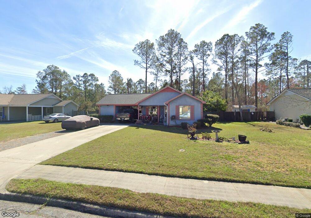
1905 Bancroft Rd Valdosta, GA 31602
Estimated Value: $140,556 - $162,000
--
Bed
2
Baths
1,164
Sq Ft
$130/Sq Ft
Est. Value
About This Home
This home is located at 1905 Bancroft Rd, Valdosta, GA 31602 and is currently estimated at $151,639, approximately $130 per square foot. 1905 Bancroft Rd is a home located in Lowndes County with nearby schools including W.G. Nunn Elementary School, Newbern Middle School, and Valdosta High School.
Ownership History
Date
Name
Owned For
Owner Type
Purchase Details
Closed on
Aug 6, 2003
Sold by
Barden Jeffrey E and Barden Euge
Bought by
Daniels Patricia and Daniels James
Current Estimated Value
Purchase Details
Closed on
Feb 10, 2000
Sold by
Strickland Kimberly
Bought by
Barden Jeffrey E and Barden Euge
Purchase Details
Closed on
Oct 25, 1995
Bought by
Strickland Kimberly
Purchase Details
Closed on
Aug 31, 1993
Bought by
Hoffman Kevin J
Purchase Details
Closed on
Nov 23, 1992
Bought by
D & B Construction Co
Create a Home Valuation Report for This Property
The Home Valuation Report is an in-depth analysis detailing your home's value as well as a comparison with similar homes in the area
Home Values in the Area
Average Home Value in this Area
Purchase History
| Date | Buyer | Sale Price | Title Company |
|---|---|---|---|
| Daniels Patricia | $62,900 | -- | |
| Barden Jeffrey E | $64,000 | -- | |
| Strickland Kimberly | $66,900 | -- | |
| Hoffman Kevin J | $63,000 | -- | |
| D & B Construction Co | $10,000 | -- |
Source: Public Records
Tax History Compared to Growth
Tax History
| Year | Tax Paid | Tax Assessment Tax Assessment Total Assessment is a certain percentage of the fair market value that is determined by local assessors to be the total taxable value of land and additions on the property. | Land | Improvement |
|---|---|---|---|---|
| 2024 | $942 | $39,716 | $4,800 | $34,916 |
| 2023 | $942 | $39,716 | $4,800 | $34,916 |
| 2022 | $798 | $29,600 | $4,800 | $24,800 |
| 2021 | $821 | $29,600 | $4,800 | $24,800 |
| 2020 | $838 | $29,600 | $4,800 | $24,800 |
| 2019 | $838 | $29,600 | $4,800 | $24,800 |
| 2018 | $585 | $22,256 | $4,800 | $17,456 |
| 2017 | $589 | $22,256 | $4,800 | $17,456 |
| 2016 | $588 | $22,256 | $4,800 | $17,456 |
| 2015 | $571 | $23,207 | $4,800 | $18,407 |
| 2014 | $707 | $38,043 | $12,000 | $26,043 |
Source: Public Records
Map
Nearby Homes
- 1703 Largo Cir
- 2570 Marathon Dr
- 1750 Almond Tree Place Unit A & B
- 2570 Forrestwood Dr
- 1724 Eli Place
- 1647 Fresno St
- 2713 Pineview Dr Unit A&B
- 1852 Chestnut Dr
- 1739 Eli Place
- 1761 Hyssop Crossing
- 11 Crestwood Cir
- 1 Pomona Cir
- 1763 Eli Place
- 2400 Lowndes Dr
- 2311 Lowndes Dr
- 2517 Deborah Dr
- 2414 Deborah Dr
- 2320 Barack Obama Blvd
- 7.63 AC Tyndall Dr
- 1703 Leone Ave
- 1907 Bancroft Rd
- 1903 Bancroft Rd
- 1909 Bancroft Rd
- 1906 Bancroft Rd
- 1904 Bancroft Rd
- 1908 Bancroft Rd
- 1902 Bancroft Rd
- * Bancroft Road and Or Wedgewood Rd
- 1911 Bancroft Rd
- 2600 Quincy Cir
- 2602 Wedgewood Dr Unit B
- 6 Pershing Place
- 8 Pershing Place
- 4 Pershing Place
- 2001 Bancroft Rd
- 2604 Wedgewood Dr
- 2602 Quincy Cir
- 2601 Quincy Cir
- 1729 Largo Cir
- 2003 Bancroft Rd