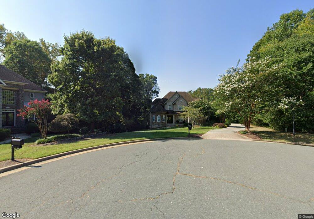
1905 Brant Pointe Ct Whitsett, NC 27377
Estimated Value: $488,000 - $606,000
4
Beds
4
Baths
3,198
Sq Ft
$173/Sq Ft
Est. Value
About This Home
This home is located at 1905 Brant Pointe Ct, Whitsett, NC 27377 and is currently estimated at $554,707, approximately $173 per square foot. 1905 Brant Pointe Ct is a home located in Guilford County with nearby schools including Sedalia Elementary School, Eastern Guilford Middle School, and Eastern Guilford High School.
Ownership History
Date
Name
Owned For
Owner Type
Purchase Details
Closed on
Nov 21, 2003
Sold by
R & K Investment Properties Inc
Bought by
Myles James W and Hinton Myles Simone S
Current Estimated Value
Home Financials for this Owner
Home Financials are based on the most recent Mortgage that was taken out on this home.
Original Mortgage
$312,000
Outstanding Balance
$143,940
Interest Rate
5.93%
Mortgage Type
Credit Line Revolving
Estimated Equity
$410,767
Create a Home Valuation Report for This Property
The Home Valuation Report is an in-depth analysis detailing your home's value as well as a comparison with similar homes in the area
Home Values in the Area
Average Home Value in this Area
Purchase History
| Date | Buyer | Sale Price | Title Company |
|---|---|---|---|
| Myles James W | $390,000 | -- |
Source: Public Records
Mortgage History
| Date | Status | Borrower | Loan Amount |
|---|---|---|---|
| Open | Myles James W | $312,000 | |
| Closed | Myles James W | $78,000 |
Source: Public Records
Tax History Compared to Growth
Tax History
| Year | Tax Paid | Tax Assessment Tax Assessment Total Assessment is a certain percentage of the fair market value that is determined by local assessors to be the total taxable value of land and additions on the property. | Land | Improvement |
|---|---|---|---|---|
| 2025 | $3,294 | $406,400 | $66,000 | $340,400 |
| 2024 | $3,294 | $406,400 | $66,000 | $340,400 |
| 2023 | $3,294 | $406,400 | $66,000 | $340,400 |
| 2022 | $3,294 | $406,400 | $66,000 | $340,400 |
| 2021 | $2,878 | $355,100 | $35,000 | $320,100 |
| 2020 | $2,878 | $355,100 | $35,000 | $320,100 |
| 2019 | $2,878 | $355,100 | $0 | $0 |
| 2018 | $2,864 | $355,100 | $0 | $0 |
| 2017 | $2,878 | $355,100 | $0 | $0 |
| 2016 | $2,719 | $325,600 | $0 | $0 |
| 2015 | $2,735 | $325,600 | $0 | $0 |
| 2014 | $2,768 | $325,600 | $0 | $0 |
Source: Public Records
Map
Nearby Homes
- 1904 Brant Pointe Ct
- 1903 Osterville Ct
- 6710 Breeze Pointe Dr
- 6731 Barton Creek Dr
- 6717 Barton Creek Dr
- 1431 Rock Creek Dairy Rd
- 1911 Whisper Lake Dr Unit A
- 1915 Wake Bridge Dr
- 1942 Whisper Lake Dr
- 1963 Whisper Lake Dr
- 2016 Heron Pointe Dr
- 6506 Donahue Dr
- 6910 Long Meadow Ln
- 1132 Brooksridge Way
- 1130 Brooksridge Way
- 1128 Brooksridge Way
- 1126 Brooksridge Way
- 1112 Brooksridge Way
- 1108 Brooksridge Way
- 1104 Brooksridge Way
- 1903 Brant Pointe Ct
- 1903 Brant Pointe Ct
- 1902 Brant Pointe Ct
- 1901 Brant Pointe Ct
- 1900 Brant Pointe Ct Unit 23
- 1900 Brant Pointe Ct
- 6720 Breeze Pointe Dr
- 6748 Barton Creek Dr Unit 209
- 6744 Barton Creek Dr Unit Lot 207
- 6745 Barton Creek Dr Unit lot 210
- 6714 Breeze Pointe Dr
- 6746 Barton Creek Dr Unit Lot 208
- 6722 Breeze Pointe Dr
- 6743 Barton Creek Dr Unit Lot 211
- 2006 Otter Creek Dr
- 1905 Osterville Ct
- 2004 Otter Creek Dr
- 6712 Breeze Pointe Dr
- 6741 Barton Creek Dr
- 1904 Osterville Ct
