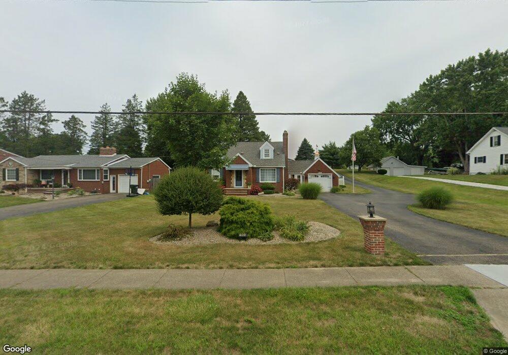
1905 E Main St Louisville, OH 44641
Estimated Value: $180,000 - $244,866
3
Beds
1
Bath
1,386
Sq Ft
$150/Sq Ft
Est. Value
About This Home
This home is located at 1905 E Main St, Louisville, OH 44641 and is currently estimated at $207,717, approximately $149 per square foot. 1905 E Main St is a home located in Stark County with nearby schools including Louisville High School and St. Thomas Aquinas High School & Middle School.
Ownership History
Date
Name
Owned For
Owner Type
Purchase Details
Closed on
Sep 15, 2021
Sold by
Coen Larry E
Bought by
Coen Larry E and Bolin Lynda
Current Estimated Value
Purchase Details
Closed on
Aug 5, 2015
Sold by
Coen Barbara M and Coen Larry E
Bought by
Coen Larry E
Home Financials for this Owner
Home Financials are based on the most recent Mortgage that was taken out on this home.
Original Mortgage
$106,325
Outstanding Balance
$40,523
Interest Rate
3.16%
Mortgage Type
New Conventional
Estimated Equity
$167,194
Purchase Details
Closed on
May 5, 1994
Purchase Details
Closed on
Nov 10, 1988
Create a Home Valuation Report for This Property
The Home Valuation Report is an in-depth analysis detailing your home's value as well as a comparison with similar homes in the area
Home Values in the Area
Average Home Value in this Area
Purchase History
| Date | Buyer | Sale Price | Title Company |
|---|---|---|---|
| Coen Larry E | -- | Nova Title Agency Inc | |
| Coen Larry E | -- | Attorney | |
| -- | $79,900 | -- | |
| -- | $63,900 | -- |
Source: Public Records
Mortgage History
| Date | Status | Borrower | Loan Amount |
|---|---|---|---|
| Open | Coen Larry E | $106,325 |
Source: Public Records
Tax History Compared to Growth
Tax History
| Year | Tax Paid | Tax Assessment Tax Assessment Total Assessment is a certain percentage of the fair market value that is determined by local assessors to be the total taxable value of land and additions on the property. | Land | Improvement |
|---|---|---|---|---|
| 2025 | -- | $68,470 | $21,040 | $47,430 |
| 2024 | -- | $67,700 | $21,040 | $46,660 |
| 2023 | $1,703 | $48,550 | $14,530 | $34,020 |
| 2022 | $1,726 | $48,550 | $14,530 | $34,020 |
| 2021 | $1,731 | $48,550 | $14,530 | $34,020 |
| 2020 | $1,405 | $43,790 | $13,060 | $30,730 |
| 2019 | $1,412 | $38,650 | $12,320 | $26,330 |
| 2018 | $1,202 | $38,650 | $12,320 | $26,330 |
| 2017 | $1,061 | $34,170 | $10,050 | $24,120 |
| 2016 | $1,083 | $34,170 | $10,050 | $24,120 |
| 2015 | $1,086 | $34,170 | $10,050 | $24,120 |
| 2014 | $1,131 | $33,360 | $9,800 | $23,560 |
| 2013 | $569 | $33,360 | $9,800 | $23,560 |
Source: Public Records
Map
Nearby Homes
- 2015 E Main St
- 0 Michigan Blvd
- 1812 E Broad St
- 308 Superior St
- 1170 Winding Ridge Ave
- 641 S Nickelplate St
- 910 Crosswyck Cir
- 520 S Silver St
- 2110 Edmar St
- 728 E Broad St
- 325 Lincoln Ave
- 5495 Meese Rd NE
- 210 E Gorgas St
- 316 E Reno Dr
- 204 E Broad St
- 107 E Broad St
- 428 Honeycrisp Dr NE
- 3047 Mcintosh Dr NE
- 432 Honeycrisp Dr NE
- 2962 Mcintosh Dr NE
- 1915 E Main St
- 1835 E Main St
- 1830 Airpark Dr
- 1925 E Main St
- 1825 E Main St
- 312 Sycamore Dr
- 304 Sycamore Dr
- 2005 E Main St
- 404 Sycamore Dr
- 206 Sycamore Dr
- 56 Cypress Ave
- 1813 E Main St
- 1914 E Main St
- 502 Sycamore Dr
- 57 Cypress Ave
- 51 Cypress St
- 52 Cypress St
- 50 Cypress St
- 53 Cypress St
- 54 Cypress St