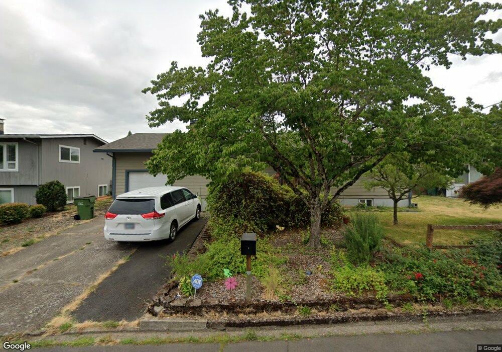
1905 Maple Dr Newberg, OR 97132
Estimated Value: $462,000 - $531,046
4
Beds
2
Baths
2,080
Sq Ft
$243/Sq Ft
Est. Value
About This Home
This home is located at 1905 Maple Dr, Newberg, OR 97132 and is currently estimated at $505,012, approximately $242 per square foot. 1905 Maple Dr is a home located in Yamhill County with nearby schools including Joan Austin Elementary School, Mountain View Middle School, and Newberg Senior High School.
Ownership History
Date
Name
Owned For
Owner Type
Purchase Details
Closed on
Nov 8, 2022
Sold by
Ochse Robert Alexander
Bought by
Ochse Irene
Current Estimated Value
Purchase Details
Closed on
Sep 14, 2007
Sold by
Shoop Brian L and Hageman Tamara L
Bought by
Ochse Robert A and Ochse Irene A
Home Financials for this Owner
Home Financials are based on the most recent Mortgage that was taken out on this home.
Original Mortgage
$209,850
Interest Rate
6.67%
Mortgage Type
Unknown
Purchase Details
Closed on
Oct 21, 2004
Sold by
Smith Robert E
Bought by
Shoop Brian L and Hageman Tamara L
Home Financials for this Owner
Home Financials are based on the most recent Mortgage that was taken out on this home.
Original Mortgage
$149,600
Interest Rate
8.25%
Mortgage Type
Unknown
Create a Home Valuation Report for This Property
The Home Valuation Report is an in-depth analysis detailing your home's value as well as a comparison with similar homes in the area
Purchase History
| Date | Buyer | Sale Price | Title Company |
|---|---|---|---|
| Ochse Irene | -- | -- | |
| Ochse Robert A | $224,900 | First American Title | |
| Shoop Brian L | -- | Ticor Title Insurance Co |
Source: Public Records
Mortgage History
| Date | Status | Borrower | Loan Amount |
|---|---|---|---|
| Previous Owner | Ochse Robert A | $209,850 | |
| Previous Owner | Shoop Brian L | $149,600 |
Source: Public Records
Tax History
| Year | Tax Paid | Tax Assessment Tax Assessment Total Assessment is a certain percentage of the fair market value that is determined by local assessors to be the total taxable value of land and additions on the property. | Land | Improvement |
|---|---|---|---|---|
| 2025 | $3,778 | $234,144 | -- | -- |
| 2024 | $3,634 | $227,324 | -- | -- |
| 2023 | $3,509 | $220,703 | $0 | $0 |
| 2022 | $3,415 | $214,275 | $0 | $0 |
| 2021 | $3,323 | $208,034 | $0 | $0 |
| 2020 | $2,992 | $201,975 | $0 | $0 |
| 2019 | $2,952 | $196,092 | $0 | $0 |
| 2018 | $2,968 | $190,381 | $0 | $0 |
| 2017 | $3,155 | $184,836 | $0 | $0 |
| 2016 | $3,090 | $179,452 | $0 | $0 |
| 2015 | $3,035 | $174,227 | $0 | $0 |
| 2014 | $2,831 | $169,154 | $0 | $0 |
Source: Public Records
Map
Nearby Homes
- 900 N Williams St
- 1903 E Orchard Dr
- 615 N Elliott Rd
- 1826 E Carol Ann Dr
- 710 N Elliott Rd
- 1559 E 2nd St
- 1100 N Meridian St Unit 43
- 300 S Everest Rd
- 300 S Everest St
- 0 E 3rd St Unit 3
- 0 E 3rd St Unit 2
- 492 Donna Dr
- 2901 E 2nd St Unit 109
- 2901 E 2nd St Unit 125
- 461 NE Airpark Way
- 1205 Johnson Ct
- 19885 Mary Lou Ln Unit L-23
- 600 Wynooski St
- 1103 N Springbrook Rd Unit 50
- 1103 N Springbrook Rd Unit 6
Your Personal Tour Guide
Ask me questions while you tour the home.