Estimated Value: $437,614 - $542,000
5
Beds
5
Baths
3,725
Sq Ft
$130/Sq Ft
Est. Value
About This Home
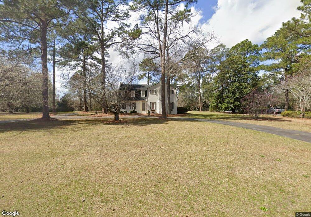
This home is located at 1905 Northside Rd, Perry, GA 31069 and is currently estimated at $484,904, approximately $130 per square foot. 1905 Northside Rd is a home located in Houston County with nearby schools including Morningside Elementary School, Perry Middle School, and Perry High School.
Ownership History
Date
Name
Owned For
Owner Type
Purchase Details
Closed on
Feb 4, 2010
Sold by
Walker Lawrence C
Bought by
Lewis Darrell L and Lewis Kathryn T
Current Estimated Value
Purchase Details
Closed on
Nov 2, 2009
Sold by
Walker Lawrence C
Bought by
Lewis Darrell L and Lewis Kathryn T
Purchase Details
Closed on
Jul 1, 2008
Sold by
Walker Lawrence C
Bought by
Lewis Darrell L and Lewis Kathryn T
Home Financials for this Owner
Home Financials are based on the most recent Mortgage that was taken out on this home.
Original Mortgage
$303,530
Interest Rate
5.96%
Mortgage Type
Purchase Money Mortgage
Purchase Details
Closed on
Aug 9, 1974
Sold by
Culpepper Alice Long Etal
Bought by
Walker Lawrence C
Purchase Details
Closed on
Jan 18, 1974
Sold by
Security Services Inc
Bought by
Walker Lawrence C
Purchase Details
Closed on
Oct 8, 1973
Sold by
Security Services Inc
Bought by
Mullins W G
Purchase Details
Closed on
Feb 22, 1973
Sold by
Culpepper Charles F Etal
Bought by
Security Services Inc
Create a Home Valuation Report for This Property
The Home Valuation Report is an in-depth analysis detailing your home's value as well as a comparison with similar homes in the area
Home Values in the Area
Average Home Value in this Area
Purchase History
| Date | Buyer | Sale Price | Title Company |
|---|---|---|---|
| Lewis Darrell L | -- | None Available | |
| Lewis Darrell L | -- | None Available | |
| Lewis Darrell L | $315,000 | None Available | |
| Walker Lawrence C | -- | -- | |
| Walker Lawrence C | -- | -- | |
| Mullins W G | -- | -- | |
| Security Services Inc | -- | -- | |
| Security Services Inc | -- | -- |
Source: Public Records
Mortgage History
| Date | Status | Borrower | Loan Amount |
|---|---|---|---|
| Previous Owner | Lewis Darrell L | $303,530 |
Source: Public Records
Tax History
| Year | Tax Paid | Tax Assessment Tax Assessment Total Assessment is a certain percentage of the fair market value that is determined by local assessors to be the total taxable value of land and additions on the property. | Land | Improvement |
|---|---|---|---|---|
| 2025 | $5,126 | $155,960 | $18,880 | $137,080 |
| 2024 | $5,559 | $151,280 | $19,160 | $132,120 |
| 2023 | $4,997 | $135,080 | $19,160 | $115,920 |
| 2022 | $2,889 | $125,640 | $19,160 | $106,480 |
| 2021 | $2,690 | $116,360 | $19,160 | $97,200 |
| 2020 | $2,606 | $112,160 | $19,160 | $93,000 |
| 2019 | $2,606 | $112,160 | $19,160 | $93,000 |
| 2018 | $2,606 | $112,160 | $19,160 | $93,000 |
| 2017 | $2,632 | $113,160 | $19,160 | $94,000 |
| 2016 | $2,636 | $113,160 | $19,160 | $94,000 |
| 2015 | $2,641 | $113,160 | $19,160 | $94,000 |
| 2014 | -- | $113,160 | $19,160 | $94,000 |
| 2013 | -- | $113,160 | $19,160 | $94,000 |
Source: Public Records
Map
Nearby Homes
- 102 Ridge Cir N
- 115 Springfield Ct
- 110 Gwendolyn Ave
- 204 Spring Creek Dr
- 1402 Park Ave
- 108 Christine Cir
- 1418 Parkway Dr
- 206 Londie Ln
- 206 Londe Ln
- 411 Stonegate Trail
- 1015 Cherokee Rd
- 103 Kanza Trail
- 109 Kanza Trail
- 111 Tyndall Way
- 118 Farmers Way
- 1729 Milton Way
- 215 Tyndall Way
- 108 Ousley Way
- 102 N Haven Ln
- 106 Raspberry Trail
- 1907 Northside Rd
- 1901 Northside Rd
- 117 Ridge Cir N
- 101 Windermere Cir
- 200 Windermere Dr
- 1909 Northside Rd
- 1908 Northside Rd
- 1906 Northside Rd
- 202 Windermere Dr
- 115 Ridge Cir N
- 1902 Northside Rd
- 204 Windermere Dr
- 103 Windermere Cir
- 1911 Northside Rd
- 1809 Northside Rd
- 1900 Northside Rd
- 206 Windermere Dr
- 113 Ridge Cir N
- 4379 Windamere
- 114 Ridge Cir N
Your Personal Tour Guide
Ask me questions while you tour the home.