Estimated Value: $240,000 - $322,000
3
Beds
4
Baths
1,368
Sq Ft
$210/Sq Ft
Est. Value
About This Home
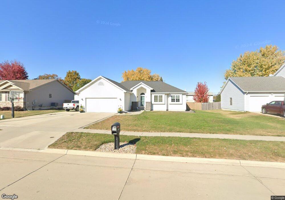
This home is located at 1905 Union St, Boone, IA 50036 and is currently estimated at $287,104, approximately $209 per square foot. 1905 Union St is a home located in Boone County with nearby schools including Boone High School, Sacred Heart School, and Trinity Lutheran School.
Ownership History
Date
Name
Owned For
Owner Type
Purchase Details
Closed on
Jan 21, 2006
Sold by
Wyatt Cathy D and Miller Cathy D
Bought by
Huseman Curtis N and Huseman Julie M
Current Estimated Value
Home Financials for this Owner
Home Financials are based on the most recent Mortgage that was taken out on this home.
Original Mortgage
$160,000
Interest Rate
6.42%
Mortgage Type
New Conventional
Create a Home Valuation Report for This Property
The Home Valuation Report is an in-depth analysis detailing your home's value as well as a comparison with similar homes in the area
Home Values in the Area
Average Home Value in this Area
Purchase History
| Date | Buyer | Sale Price | Title Company |
|---|---|---|---|
| Huseman Curtis N | $183,000 | -- |
Source: Public Records
Mortgage History
| Date | Status | Borrower | Loan Amount |
|---|---|---|---|
| Previous Owner | Huseman Curtis N | $160,000 |
Source: Public Records
Tax History Compared to Growth
Tax History
| Year | Tax Paid | Tax Assessment Tax Assessment Total Assessment is a certain percentage of the fair market value that is determined by local assessors to be the total taxable value of land and additions on the property. | Land | Improvement |
|---|---|---|---|---|
| 2025 | $5,404 | $312,080 | $54,430 | $257,650 |
| 2024 | $5,404 | $303,600 | $38,880 | $264,720 |
| 2023 | $4,950 | $303,600 | $38,880 | $264,720 |
| 2022 | $5,142 | $245,672 | $21,600 | $224,072 |
| 2021 | $5,142 | $245,672 | $21,600 | $224,072 |
| 2020 | $4,574 | $209,263 | $21,600 | $187,663 |
| 2019 | $4,574 | $209,263 | $21,600 | $187,663 |
| 2018 | $4,534 | $201,641 | $0 | $0 |
| 2017 | $4,534 | $181,169 | $21,600 | $159,569 |
| 2016 | $3,960 | $181,169 | $21,600 | $159,569 |
| 2015 | $3,970 | $181,169 | $0 | $0 |
| 2014 | $3,846 | $181,169 | $0 | $0 |
Source: Public Records
Map
Nearby Homes
- 1716 2nd St
- 2021 Garst Cir
- 1632 Mamie Eisenhower Ave
- 1604 Mamie Eisenhower Ave
- 1427 Garst Ave
- 538 Linden Ln
- 1416 Aldrich Ave
- 1311 Union St
- 923 S Jackson St
- 911 S Jackson St
- 1303 Union St
- 1222 2nd St
- 509 Cedar St
- 441 S Linn St
- 1208 Garst Ave
- 204 S Benton St
- 504 Linn St
- 621 Cedar St
- 522 Linn St
- 1322 7th St