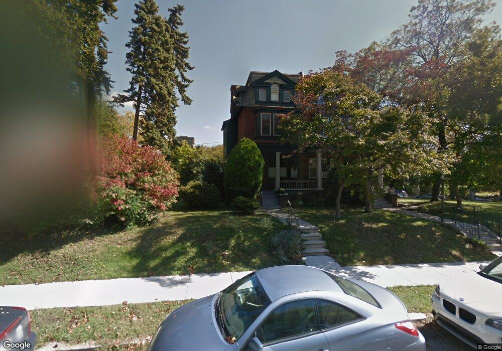
1905 Wynnewood Rd Unit 7 Philadelphia, PA 19151
Overbrook NeighborhoodEstimated Value: $442,000 - $540,000
--
Bed
--
Bath
2,428
Sq Ft
$207/Sq Ft
Est. Value
About This Home
This home is located at 1905 Wynnewood Rd Unit 7, Philadelphia, PA 19151 and is currently estimated at $503,037, approximately $207 per square foot. 1905 Wynnewood Rd Unit 7 is a home located in Philadelphia County with nearby schools including Overbrook Elementary School, Overbrook High School, and Ad Prima Charter School.
Ownership History
Date
Name
Owned For
Owner Type
Purchase Details
Closed on
Sep 8, 2021
Sold by
Freese David W
Bought by
Brown Timothy Shaun and Butiervveck Susan J
Current Estimated Value
Home Financials for this Owner
Home Financials are based on the most recent Mortgage that was taken out on this home.
Original Mortgage
$300,000
Interest Rate
3.09%
Mortgage Type
New Conventional
Purchase Details
Closed on
May 25, 1976
Bought by
Freese David W
Create a Home Valuation Report for This Property
The Home Valuation Report is an in-depth analysis detailing your home's value as well as a comparison with similar homes in the area
Home Values in the Area
Average Home Value in this Area
Purchase History
| Date | Buyer | Sale Price | Title Company |
|---|---|---|---|
| Brown Timothy Shaun | $500,000 | None Listed On Document | |
| Freese David W | $30,000 | -- |
Source: Public Records
Mortgage History
| Date | Status | Borrower | Loan Amount |
|---|---|---|---|
| Previous Owner | Brown Timothy Shaun | $300,000 |
Source: Public Records
Tax History Compared to Growth
Tax History
| Year | Tax Paid | Tax Assessment Tax Assessment Total Assessment is a certain percentage of the fair market value that is determined by local assessors to be the total taxable value of land and additions on the property. | Land | Improvement |
|---|---|---|---|---|
| 2025 | $4,688 | $398,300 | $79,660 | $318,640 |
| 2024 | $4,688 | $398,300 | $79,660 | $318,640 |
| 2023 | $4,688 | $334,900 | $66,980 | $267,920 |
| 2022 | $2,364 | $289,900 | $66,980 | $222,920 |
| 2021 | $2,994 | $0 | $0 | $0 |
| 2020 | $2,994 | $0 | $0 | $0 |
| 2019 | $2,886 | $0 | $0 | $0 |
| 2018 | $3,103 | $0 | $0 | $0 |
| 2017 | $3,103 | $0 | $0 | $0 |
| 2016 | $2,759 | $0 | $0 | $0 |
| 2015 | $2,641 | $0 | $0 | $0 |
| 2014 | -- | $221,700 | $62,350 | $159,350 |
| 2012 | -- | $23,040 | $8,741 | $14,299 |
Source: Public Records
Map
Nearby Homes
- 1122 26 N 63rd St
- 2025 N 62nd St
- 6158 Lebanon Ave
- 1258 N 64th St
- 6127 Lebanon Ave
- 1994 Upland Way
- 6345 Lebanon Ave
- 1200 N 64th St
- 6146 W Columbia Ave
- 1243 N 65th St
- 6451 Woodcrest Ave
- 6136 W Oxford St
- 6021 Clifford Terrace
- 1165 Atwood Rd
- 5933 Woodcrest Ave
- 1210 Atwood Rd
- 5920 Woodbine Ave
- 5919 Upland Way
- 6137 W Jefferson St
- 6133 W Jefferson St
- 1909 Wynnewood Rd Unit 11
- 1911 Wynnewood Rd
- 1913 Wynnewood Rd
- 1919 Wynnewood Rd
- 1871 Wynnewood Rd
- 1172 N 63rd St
- 1908 N 63rd St
- 1921 Wynnewood Rd Unit 23
- 1869 Wynnewood Rd
- 1910 N 63rd St
- 1925 Wynnewood Rd Unit 27
- 1867 Wynnewood Rd
- 1162 N 63rd St Unit 64
- 1914 N 63rd St
- 1865 Wynnewood Rd
- 1916 N 63rd St
- 1929 Wynnewood Rd
- 1863 Wynnewood Rd
- 1158 N 63rd St Unit 60
- 1861 Wynnewood Rd