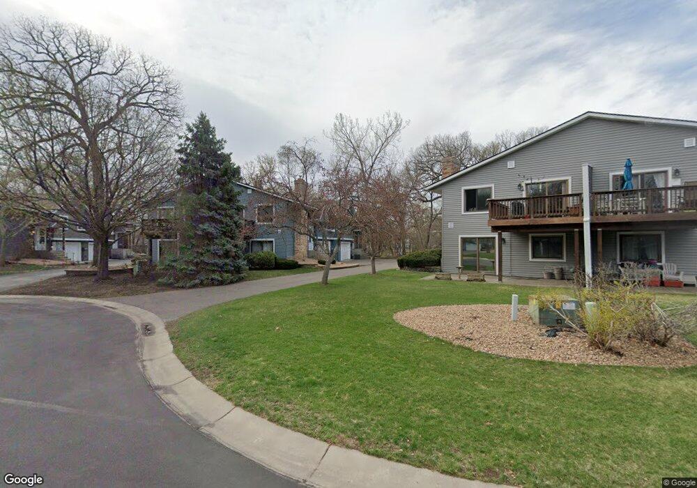
1906 113th Ln NW Coon Rapids, MN 55433
Estimated Value: $244,000 - $265,641
2
Beds
2
Baths
1,078
Sq Ft
$236/Sq Ft
Est. Value
About This Home
This home is located at 1906 113th Ln NW, Coon Rapids, MN 55433 and is currently estimated at $254,160, approximately $235 per square foot. 1906 113th Ln NW is a home located in Anoka County with nearby schools including Lucile Bruner Elementary School, Hamilton Elementary School, and Laughlin Junior/Senior High School.
Ownership History
Date
Name
Owned For
Owner Type
Purchase Details
Closed on
Mar 29, 2018
Sold by
Rengo Lou Ann
Bought by
Larson Jeffrey D and Larson Mary K
Current Estimated Value
Home Financials for this Owner
Home Financials are based on the most recent Mortgage that was taken out on this home.
Original Mortgage
$171,830
Outstanding Balance
$148,819
Interest Rate
4.75%
Mortgage Type
FHA
Estimated Equity
$105,341
Create a Home Valuation Report for This Property
The Home Valuation Report is an in-depth analysis detailing your home's value as well as a comparison with similar homes in the area
Home Values in the Area
Average Home Value in this Area
Purchase History
| Date | Buyer | Sale Price | Title Company |
|---|---|---|---|
| Larson Jeffrey D | $175,000 | Results Title |
Source: Public Records
Mortgage History
| Date | Status | Borrower | Loan Amount |
|---|---|---|---|
| Open | Larson Jeffrey D | $171,830 |
Source: Public Records
Tax History Compared to Growth
Tax History
| Year | Tax Paid | Tax Assessment Tax Assessment Total Assessment is a certain percentage of the fair market value that is determined by local assessors to be the total taxable value of land and additions on the property. | Land | Improvement |
|---|---|---|---|---|
| 2025 | $2,178 | $233,200 | $60,000 | $173,200 |
| 2024 | $2,178 | $221,400 | $47,000 | $174,400 |
| 2023 | $2,099 | $226,200 | $55,000 | $171,200 |
| 2022 | $1,953 | $223,800 | $51,500 | $172,300 |
| 2021 | $2,362 | $188,500 | $30,000 | $158,500 |
| 2020 | $1,936 | $184,200 | $30,000 | $154,200 |
| 2019 | $1,653 | $165,900 | $27,000 | $138,900 |
| 2018 | $1,575 | $150,100 | $0 | $0 |
| 2017 | $1,320 | $140,500 | $0 | $0 |
| 2016 | $1,344 | $120,200 | $0 | $0 |
| 2015 | $1,226 | $120,200 | $17,500 | $102,700 |
| 2014 | -- | $95,000 | $5,200 | $89,800 |
Source: Public Records
Map
Nearby Homes
- 11350 Jay St NW
- 11361 Jay St NW
- 11424 Hanson Blvd NW
- 11444 Hanson Blvd NW
- 11409 Quinn St NW
- 11036 Hanson Blvd NW Unit 20
- 1660 Northdale Blvd NW
- 11267 Robinson Dr NW
- 11000 Swallow St NW
- 2201 108th Ave NW
- 2400 108th Ave NW
- 10658 Hummingbird St NW
- 1449 119th Ln NW
- 12034 Ibis St NW
- 12010 Eagle St NW
- 10634 Hummingbird St NW
- 1830 121st Ln NW Unit 611
- 11852 Yellow Pine St NW
- 1727 121st Ln NW
- 10648 Wren St NW
- 1886 113th Ln NW
- 1902 113th Ln NW
- 1914 113th Ln NW
- 1882 113th Ln NW
- 1910 113th Ln NW
- 1909 113th Ave NW
- 1878 113th Ln NW
- 1889 113th Ave NW
- 11341 Martin St NW
- 1874 113th Ln NW
- 1870 113th Ln NW
- 1881 113th Ave NW
- 1905 113th Ave NW
- 11309 Martin St NW
- 1885 113th Ave NW
- 1913 113th Ave NW
- 1877 113th Ave NW
- 11305 Martin St NW
- 1862 113th Ln NW
- 1873 113th Ave NW