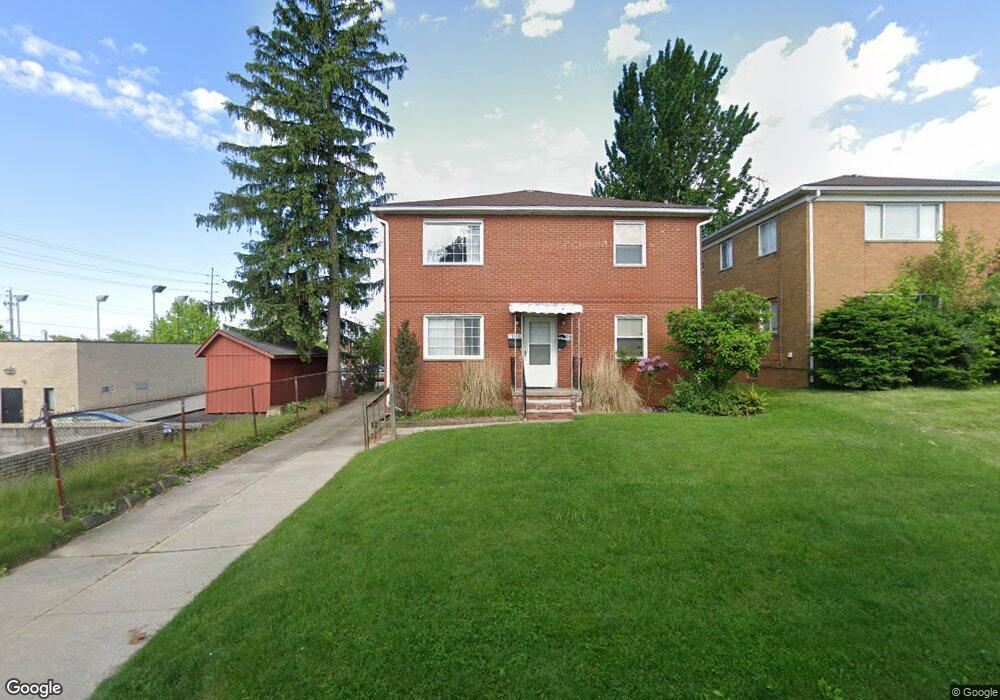
1906 Carter Ave Unit 1908 Akron, OH 44301
Firestone Park NeighborhoodEstimated Value: $184,000 - $195,696
4
Beds
2
Baths
2,160
Sq Ft
$89/Sq Ft
Est. Value
About This Home
This home is located at 1906 Carter Ave Unit 1908, Akron, OH 44301 and is currently estimated at $191,674, approximately $88 per square foot. 1906 Carter Ave Unit 1908 is a home located in Summit County with nearby schools including Kenmore Garfield Community Learning Center, Main Preparatory Academy, and Eagle Elementary.
Ownership History
Date
Name
Owned For
Owner Type
Purchase Details
Closed on
Nov 1, 2001
Sold by
Arnott Scott A
Bought by
Arnott Scott A and The Arnott Family
Current Estimated Value
Purchase Details
Closed on
Aug 29, 2001
Sold by
Arnott Yvonne M
Bought by
Arnott Scott A
Create a Home Valuation Report for This Property
The Home Valuation Report is an in-depth analysis detailing your home's value as well as a comparison with similar homes in the area
Home Values in the Area
Average Home Value in this Area
Purchase History
| Date | Buyer | Sale Price | Title Company |
|---|---|---|---|
| Arnott Scott A | -- | -- | |
| Arnott Scott A | -- | -- |
Source: Public Records
Tax History
| Year | Tax Paid | Tax Assessment Tax Assessment Total Assessment is a certain percentage of the fair market value that is determined by local assessors to be the total taxable value of land and additions on the property. | Land | Improvement |
|---|---|---|---|---|
| 2024 | $3,091 | $57,107 | $8,677 | $48,430 |
| 2023 | $3,091 | $57,107 | $8,677 | $48,430 |
| 2022 | $2,888 | $41,853 | $6,286 | $35,567 |
| 2021 | $2,891 | $41,853 | $6,286 | $35,567 |
| 2020 | $2,848 | $41,860 | $6,290 | $35,570 |
| 2019 | $2,236 | $29,590 | $6,290 | $23,300 |
| 2018 | $2,206 | $29,590 | $6,290 | $23,300 |
| 2017 | $2,332 | $29,590 | $6,290 | $23,300 |
| 2016 | $2,333 | $29,590 | $6,290 | $23,300 |
| 2015 | $2,332 | $29,590 | $6,290 | $23,300 |
| 2014 | $2,314 | $29,590 | $6,290 | $23,300 |
| 2013 | $2,095 | $27,130 | $6,290 | $20,840 |
Source: Public Records
Map
Nearby Homes
- 1810 Carter Ave
- 502 E Woodsdale Ave
- 416 Rockys Run Rd
- 1835 Thornapple Ave
- 1699 Redwood Ave
- 231 E Dresden Ave
- 1726 Coventry St
- 1708 Highview Ave
- 248 E Catawba Ave
- 244 E Catawba Ave
- 1645 Hammel St
- 2069 Penguin Ave
- 361 Mission Dr
- 1612 Oakwood Ave
- 2162 Canterbury Cir
- 1646 Highview Ave
- 457 S Firestone Blvd
- 1595 Redwood Ave
- 0 Woodview Dr
- 1620 Highview Ave
- 1900 Carter Ave Unit 1902
- 1896 Carter Ave Unit 1898
- 1892 Carter Ave Unit 1894
- 755 S Firestone Blvd Unit 757
- 1905 1907 Carter Ave
- 755 757 S Firestone Blvd
- 763 S Firestone Blvd Unit 765
- 1905 Carter Ave Unit 1907
- 757 S Firestone Blvd
- 1899 Carter Ave Unit 1901
- 1888 Carter Ave Unit 1890
- 1895 Carter Ave Unit 1897
- 751 S Firestone Blvd Unit 753
- 751 S Firestone Blvd Unit 753
- 751 S Firestone Blvd Unit 753
- 751 S Firestone Blvd
- 751 753 S Firestone Blvd
- 1893 Carter Ave
- 1891 Carter Ave Unit 1893
- 1882 Carter Ave Unit 1884