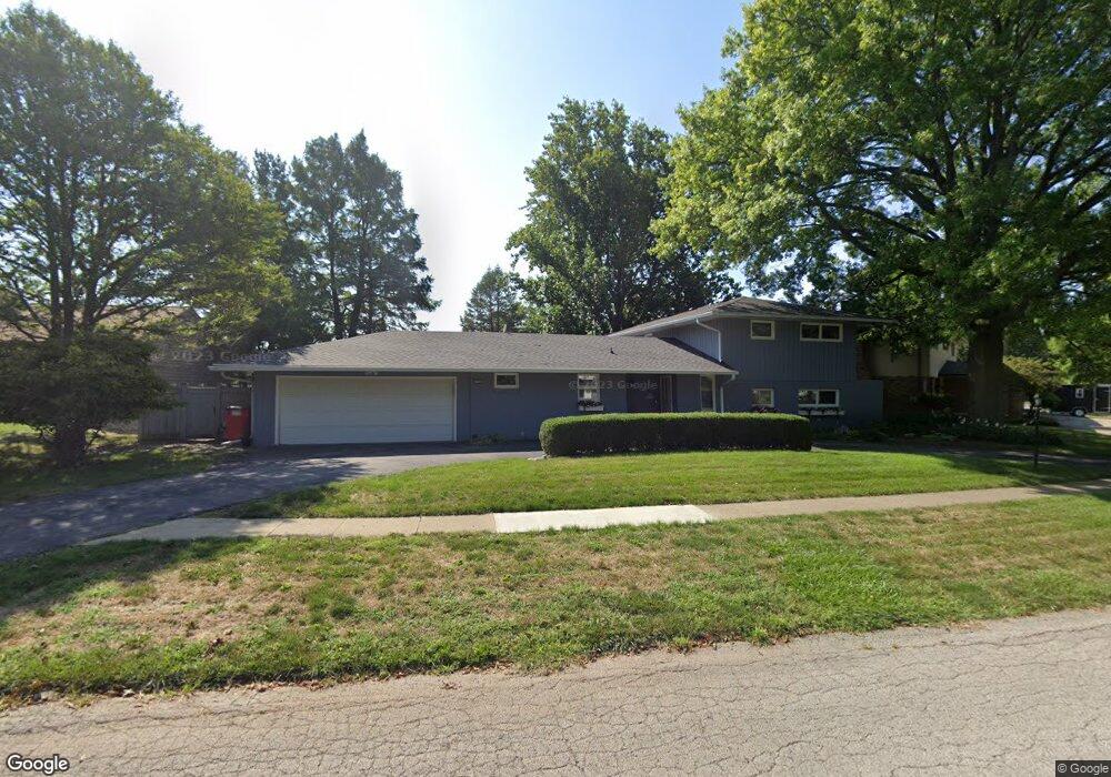
1906 Maynard Dr Champaign, IL 61822
Estimated Value: $453,930 - $606,000
Studio
--
Bath
--
Sq Ft
13,809
Sq Ft Lot
About This Home
This home is located at 1906 Maynard Dr, Champaign, IL 61822 and is currently estimated at $540,483. 1906 Maynard Dr is a home located in Champaign County with nearby schools including Centennial High School, Countryside School, and Swann Special Care Center-Elem/Secondary School.
Ownership History
Date
Name
Owned For
Owner Type
Purchase Details
Closed on
May 3, 2004
Sold by
Bailey Andrew D and Bailey Irene S
Bought by
Bloom Richard Lee and Bloom Carla June
Current Estimated Value
Home Financials for this Owner
Home Financials are based on the most recent Mortgage that was taken out on this home.
Original Mortgage
$268,000
Outstanding Balance
$126,802
Interest Rate
5.63%
Mortgage Type
Purchase Money Mortgage
Estimated Equity
$413,681
Create a Home Valuation Report for This Property
The Home Valuation Report is an in-depth analysis detailing your home's value as well as a comparison with similar homes in the area
Purchase History
| Date | Buyer | Sale Price | Title Company |
|---|---|---|---|
| Bloom Richard Lee | $335,000 | -- |
Source: Public Records
Mortgage History
| Date | Status | Borrower | Loan Amount |
|---|---|---|---|
| Open | Bloom Richard Lee | $268,000 |
Source: Public Records
Tax History
| Year | Tax Paid | Tax Assessment Tax Assessment Total Assessment is a certain percentage of the fair market value that is determined by local assessors to be the total taxable value of land and additions on the property. | Land | Improvement |
|---|---|---|---|---|
| 2024 | $9,088 | $145,970 | $44,440 | $101,530 |
| 2023 | $9,088 | $134,780 | $41,030 | $93,750 |
| 2022 | $8,649 | $125,720 | $38,270 | $87,450 |
| 2021 | $8,306 | $123,490 | $37,590 | $85,900 |
| 2020 | $8,234 | $122,270 | $37,220 | $85,050 |
| 2019 | $8,307 | $124,990 | $36,600 | $88,390 |
| 2018 | $8,660 | $124,990 | $36,600 | $88,390 |
| 2017 | $9,146 | $131,460 | $36,600 | $94,860 |
| 2016 | $7,952 | $127,870 | $36,600 | $91,270 |
| 2015 | $7,566 | $127,870 | $36,600 | $91,270 |
| 2014 | $7,514 | $118,770 | $36,600 | $82,170 |
| 2013 | $7,388 | $118,770 | $36,600 | $82,170 |
Source: Public Records
Map
Nearby Homes
- 1850 Maynard Dr
- 1914 Woodfield Rd
- 3120 Moraine Dr
- 1914 Trout Valley Dr
- 3510 S Duncan Rd
- 4002 Lakepoint Rd
- 7 Briar Hill Cir Unit G
- 1610 Stratford Dr
- 4010 Clubhouse Dr
- 2205 Edgewater Place
- 2605 Trafalgar Square
- 2410 Wendover Place
- 2704 W Kirby Ave
- 4203 Curtis Meadow Dr
- 1309 Maplepark Dr
- 2612 W Kirby Ave
- 2703 Lawndale Dr
- 2504 Hathaway Dr
- 2705 Willowpark Dr
- 2104 Morningview Place
- 1902 Maynard Dr
- 1910 Maynard Dr
- 1914 Maynard Dr
- 1905 Maynard Dr
- 1901 Maynard Dr
- 1909 Maynard Dr
- 1908 Oak Park Dr
- 1918 Maynard Dr
- 1906 Oak Park Dr
- 1841 Maynard Dr
- 1821 Coventry Dr
- 1846 Maynard Dr
- 1913 Maynard Dr
- 1904 Oak Park Dr
- 1922 Maynard Dr
- 1910 Oak Park Dr
- 1917 Maynard Dr
- 1820 Coventry Dr
- 1819 Coventry Dr
- 1842 Maynard Dr
Your Personal Tour Guide
Ask me questions while you tour the home.