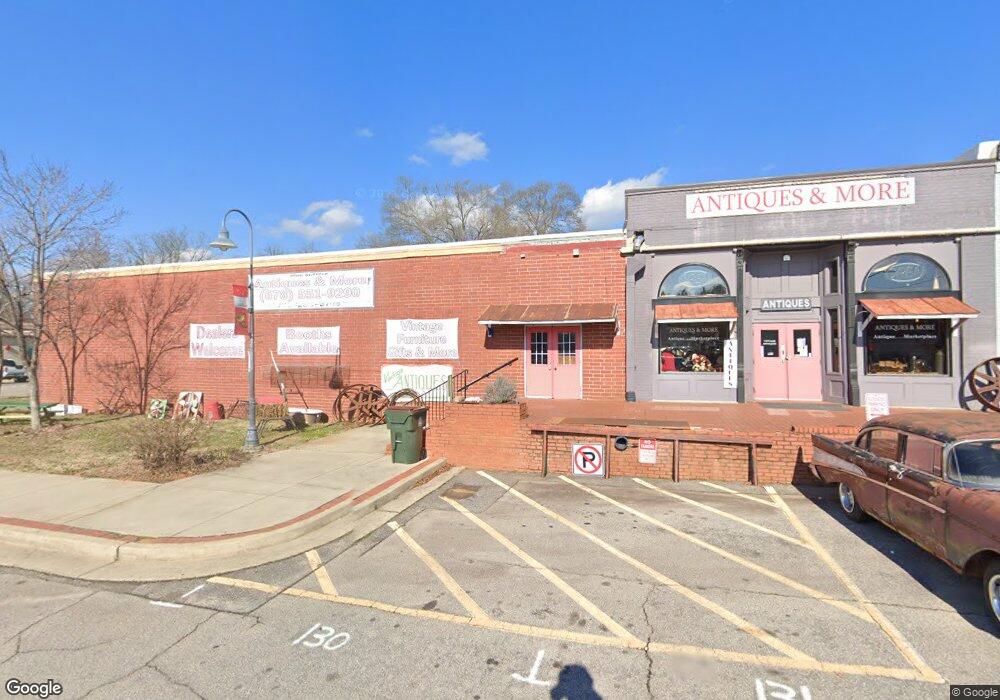
1906 Railroad St Statham, GA 30666
--
Bed
--
Bath
2,200
Sq Ft
0.47
Acres
About This Home
This home is located at 1906 Railroad St, Statham, GA 30666. 1906 Railroad St is a home located in Barrow County with nearby schools including Statham Elementary School, Bear Creek Middle School, and Winder-Barrow High School.
Ownership History
Date
Name
Owned For
Owner Type
Purchase Details
Closed on
Feb 17, 2016
Sold by
E & B Properties Llc
Bought by
Casto Brothers Llc
Home Financials for this Owner
Home Financials are based on the most recent Mortgage that was taken out on this home.
Original Mortgage
$647,647
Interest Rate
3.81%
Mortgage Type
Commercial
Purchase Details
Closed on
May 29, 2003
Sold by
Barrow Manufacturing Co
Bought by
E/B Prop Llc
Home Financials for this Owner
Home Financials are based on the most recent Mortgage that was taken out on this home.
Original Mortgage
$179,705
Interest Rate
5.79%
Mortgage Type
Commercial
Create a Home Valuation Report for This Property
The Home Valuation Report is an in-depth analysis detailing your home's value as well as a comparison with similar homes in the area
Home Values in the Area
Average Home Value in this Area
Purchase History
| Date | Buyer | Sale Price | Title Company |
|---|---|---|---|
| Casto Brothers Llc | -- | -- | |
| Casto Brothers Llc | $642,952 | -- | |
| E/B Prop Llc | $217,000 | -- |
Source: Public Records
Mortgage History
| Date | Status | Borrower | Loan Amount |
|---|---|---|---|
| Closed | Casto Brothers Llc | $647,647 | |
| Previous Owner | E/B Prop Llc | $179,705 |
Source: Public Records
Tax History Compared to Growth
Tax History
| Year | Tax Paid | Tax Assessment Tax Assessment Total Assessment is a certain percentage of the fair market value that is determined by local assessors to be the total taxable value of land and additions on the property. | Land | Improvement |
|---|---|---|---|---|
| 2024 | $8,283 | $278,195 | $18,800 | $259,395 |
| 2023 | $7,145 | $278,195 | $18,800 | $259,395 |
| 2022 | $8,226 | $278,195 | $18,800 | $259,395 |
| 2021 | $5,273 | $166,468 | $24,000 | $142,468 |
| 2020 | $5,305 | $166,468 | $24,000 | $142,468 |
| 2019 | $5,127 | $158,475 | $23,740 | $134,735 |
| 2018 | $5,114 | $158,475 | $23,740 | $134,735 |
| 2017 | $5,530 | $158,474 | $24,000 | $134,474 |
| 2016 | $3,081 | $95,330 | $24,000 | $71,330 |
| 2015 | $3,164 | $97,781 | $24,000 | $73,781 |
| 2014 | $2,735 | $87,221 | $13,440 | $73,781 |
| 2013 | -- | $82,284 | $11,760 | $70,524 |
Source: Public Records
Map
Nearby Homes
- 1906 Railroad St Unit Ste. C
- 1910 Railroad St
- 324 Second St
- 1912 Lucille St
- 1916 Railroad St
- 325 Second St
- 1909 Broad St
- 1918 Railroad St
- 1911 Broad St
- 2346 Atlanta Hwy SE
- 1723 Atlanta Hwy SE
- 1915 Broad St
- 1898 Railroad St
- 1899 Broad St
- 333 Jefferson St Unit 333
- 333 Jefferson St
- 335 Jefferson St
- 337 Jefferson St
- 1907 Atlanta Hwy SE
- 1917 Broad St