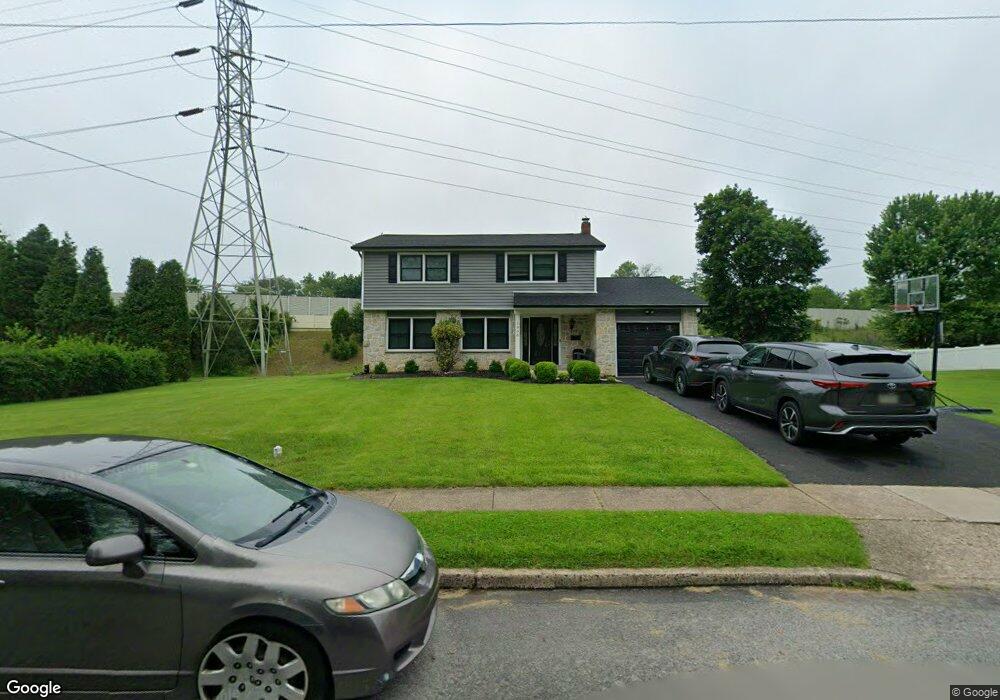
1906 Scott Rd Oreland, PA 19075
Estimated Value: $539,734 - $567,000
4
Beds
3
Baths
1,961
Sq Ft
$280/Sq Ft
Est. Value
About This Home
This home is located at 1906 Scott Rd, Oreland, PA 19075 and is currently estimated at $549,684, approximately $280 per square foot. 1906 Scott Rd is a home located in Montgomery County with nearby schools including Erdenheim Elementary School, Enfield Elementary School, and Springfield Township Middle School.
Ownership History
Date
Name
Owned For
Owner Type
Purchase Details
Closed on
Dec 10, 2004
Sold by
Not Provided
Bought by
Goodwin Montik F and Goodwin Robin E
Current Estimated Value
Purchase Details
Closed on
Nov 22, 2004
Sold by
Not Provided
Bought by
Goodwin Montik F and Goodwin Robin E
Purchase Details
Closed on
Dec 9, 2002
Sold by
Morrissey Edw Patricia A
Bought by
Morrissey Patricia A
Create a Home Valuation Report for This Property
The Home Valuation Report is an in-depth analysis detailing your home's value as well as a comparison with similar homes in the area
Home Values in the Area
Average Home Value in this Area
Purchase History
| Date | Buyer | Sale Price | Title Company |
|---|---|---|---|
| Goodwin Montik F | $290,000 | -- | |
| Goodwin Montik F | $290,000 | -- | |
| Morrissey Patricia A | -- | -- | |
| Morrissey James | -- | -- | |
| Morrissey James | -- | -- |
Source: Public Records
Mortgage History
| Date | Status | Borrower | Loan Amount |
|---|---|---|---|
| Closed | Goodwin Montik F | $0 |
Source: Public Records
Tax History
| Year | Tax Paid | Tax Assessment Tax Assessment Total Assessment is a certain percentage of the fair market value that is determined by local assessors to be the total taxable value of land and additions on the property. | Land | Improvement |
|---|---|---|---|---|
| 2025 | $7,277 | $154,470 | $48,910 | $105,560 |
| 2024 | $7,277 | $154,470 | $48,910 | $105,560 |
| 2023 | $7,022 | $154,470 | $48,910 | $105,560 |
| 2022 | $6,821 | $154,470 | $48,910 | $105,560 |
| 2021 | $6,643 | $154,470 | $48,910 | $105,560 |
| 2020 | $6,488 | $154,470 | $48,910 | $105,560 |
| 2019 | $6,388 | $154,470 | $48,910 | $105,560 |
Source: Public Records
Map
Nearby Homes
- 502 E Mill Rd
- 2106 Carolton Way
- 238 Plymouth Ave
- 442 Oreland Mill Rd
- 5 Highland Ave Unit 30
- 215 Allison Rd
- 300 Preston Rd
- 421 Pennybrook Ct Unit 5 REDFORD END
- 423 Pennybrook Ct Unit 6 REDFORD INTERIOR
- 407 Pennybrook Ct Unit 4 REDFORD END
- 405 Pennybrook Ct Unit 3 REDFORD INTERIOR
- 001 Pennybrook Ct Unit REDFORD INTERIOR
- 401 Pennybrook Ct Unit 1 REDFORD END
- 403 Pennybrook Ct Unit 2 REDFORD INTERIOR
- 406 Pennybrook Ct Unit 14 REDFORD INTERIOR
- 404 Pennybrook Ct Unit 15 REDFORD INTERIOR
- 404 Enfield Rd
- 402 Pennybrook Ct
- 4 Comly Ct
- 9 Comly Ct