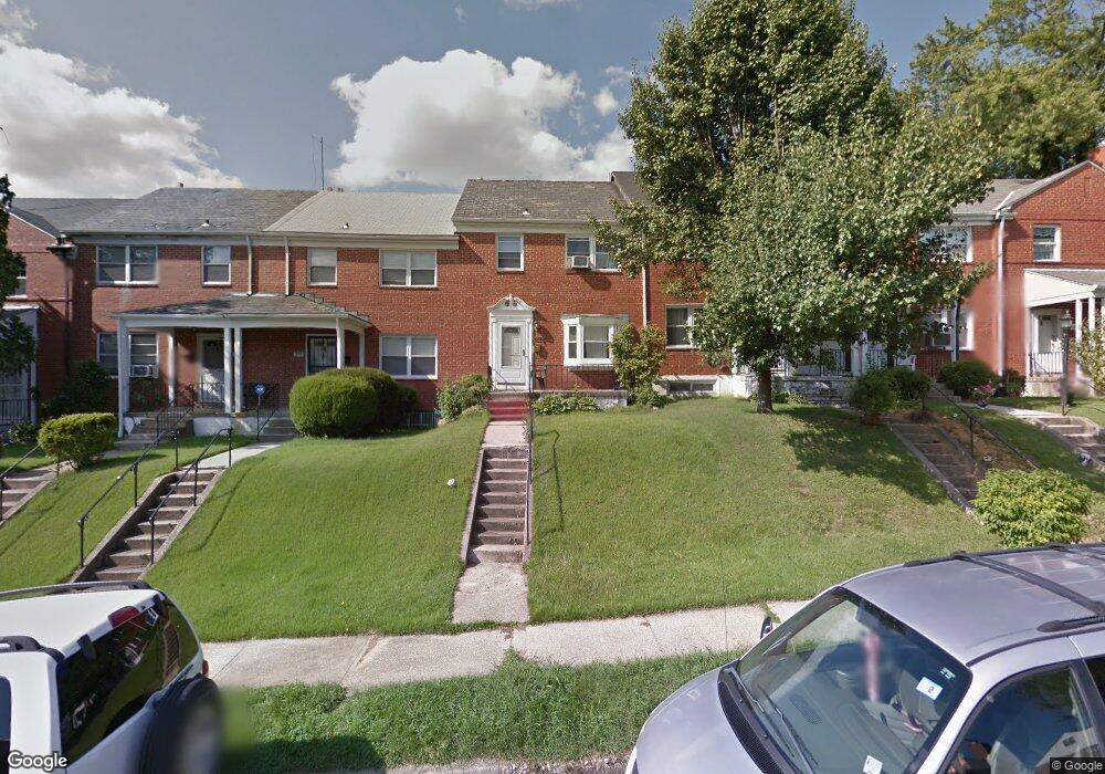
1907 Heathfield Rd Baltimore, MD 21239
Perring Loch NeighborhoodEstimated Value: $210,981 - $228,000
Studio
2
Baths
1,280
Sq Ft
$171/Sq Ft
Est. Value
About This Home
This home is located at 1907 Heathfield Rd, Baltimore, MD 21239 and is currently estimated at $219,491, approximately $171 per square foot. 1907 Heathfield Rd is a home located in Baltimore City with nearby schools including Northwood Elementary School, Booker T. Washington Middle School, and Paul Laurence Dunbar High School.
Ownership History
Date
Name
Owned For
Owner Type
Purchase Details
Closed on
Jan 4, 2006
Sold by
Williams Antoinette C
Bought by
Powell Tara
Current Estimated Value
Home Financials for this Owner
Home Financials are based on the most recent Mortgage that was taken out on this home.
Original Mortgage
$137,413
Outstanding Balance
$76,756
Interest Rate
6.36%
Mortgage Type
FHA
Estimated Equity
$142,735
Purchase Details
Closed on
Aug 23, 1996
Sold by
Fox Maurice O
Bought by
Williams Antoinette C
Create a Home Valuation Report for This Property
The Home Valuation Report is an in-depth analysis detailing your home's value as well as a comparison with similar homes in the area
Home Values in the Area
Average Home Value in this Area
Purchase History
| Date | Buyer | Sale Price | Title Company |
|---|---|---|---|
| Powell Tara | $138,500 | -- | |
| Williams Antoinette C | $72,900 | -- |
Source: Public Records
Mortgage History
| Date | Status | Borrower | Loan Amount |
|---|---|---|---|
| Open | Powell Tara | $137,413 | |
| Closed | Powell Tara | $5,000 |
Source: Public Records
Tax History
| Year | Tax Paid | Tax Assessment Tax Assessment Total Assessment is a certain percentage of the fair market value that is determined by local assessors to be the total taxable value of land and additions on the property. | Land | Improvement |
|---|---|---|---|---|
| 2025 | $2,852 | $143,567 | -- | -- |
| 2024 | $2,852 | $132,000 | $36,000 | $96,000 |
| 2023 | $2,775 | $129,033 | $0 | $0 |
| 2022 | $2,709 | $126,067 | $0 | $0 |
| 2021 | $2,905 | $123,100 | $36,000 | $87,100 |
| 2020 | $2,650 | $122,733 | $0 | $0 |
| 2019 | $2,556 | $122,367 | $0 | $0 |
| 2018 | $2,497 | $122,000 | $36,000 | $86,000 |
| 2017 | $2,425 | $121,067 | $0 | $0 |
| 2016 | $2,094 | $120,133 | $0 | $0 |
| 2015 | $2,094 | $119,200 | $0 | $0 |
| 2014 | $2,094 | $119,200 | $0 | $0 |
Source: Public Records
Map
Nearby Homes
- 1708 Hartsdale Rd
- 1814 Winford Rd
- 1647 Stonewood Rd
- 2318 Ivy Ave
- 2326 Ivy Ave
- 1607 Stonewood Rd
- 2203 Southern Ave
- 5413 Hillen Rd
- 4929 Herring Run Dr
- 1662 E Cold Spring Ln
- 1705 Swansea Rd
- 1644 E Cold Spring Ln
- 1808 Swansea Rd
- 4308 Mainfield Ave
- 2014 Crestview Rd
- 1516 E Cold Spring Ln
- 1903 Ramblewood Rd
- 1603 Northgate Rd
- 5033 Plymouth Rd
- 5102 Plymouth Rd
- 1905 Heathfield Rd
- 1903 Heathfield Rd
- 1911 Heathfield Rd
- 1901 Heathfield Rd
- 1913 Heathfield Rd
- 1815 Heathfield Rd
- 1915 Heathfield Rd
- 1732 Ingram Rd
- 1800 Ingram Rd
- 1813 Heathfield Rd
- 1730 Ingram Rd
- 1802 Ingram Rd
- 1728 Ingram Rd
- 1917 Heathfield Rd
- 1804 Ingram Rd
- 1811 Heathfield Rd
- 1726 Ingram Rd
- 1806 Ingram Rd
- 1919 Heathfield Rd
- 1916 Heathfield Rd
Your Personal Tour Guide
Ask me questions while you tour the home.