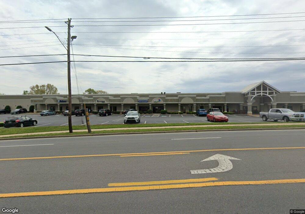
1907 W Morris Blvd Morristown, TN 37813
--
Bed
18
Baths
2,740
Sq Ft
6.21
Acres
About This Home
This home is located at 1907 W Morris Blvd, Morristown, TN 37813. 1907 W Morris Blvd is a home located in Hamblen County with nearby schools including Lincoln Heights Elementary School, Lincoln Heights Middle School, and Morristown West High School.
Ownership History
Date
Name
Owned For
Owner Type
Purchase Details
Closed on
Dec 3, 2002
Bought by
Mcguffin Partners
Purchase Details
Closed on
Jul 10, 2002
Sold by
Mcguffin George B
Bought by
Mcguffin Partners
Home Financials for this Owner
Home Financials are based on the most recent Mortgage that was taken out on this home.
Original Mortgage
$300,000
Interest Rate
6.67%
Mortgage Type
Commercial
Purchase Details
Closed on
Jun 1, 1990
Bought by
Mcguffin George B and Mcguffin Julia G
Purchase Details
Closed on
Sep 20, 1974
Bought by
Mcguffin George B
Create a Home Valuation Report for This Property
The Home Valuation Report is an in-depth analysis detailing your home's value as well as a comparison with similar homes in the area
Home Values in the Area
Average Home Value in this Area
Purchase History
| Date | Buyer | Sale Price | Title Company |
|---|---|---|---|
| Mcguffin Partners | $17,800 | -- | |
| Mcguffin Partners | -- | -- | |
| Mcguffin George B | -- | -- | |
| Mcguffin George B | $75,000 | -- |
Source: Public Records
Mortgage History
| Date | Status | Borrower | Loan Amount |
|---|---|---|---|
| Previous Owner | Mcguffin George B | $300,000 |
Source: Public Records
Tax History Compared to Growth
Tax History
| Year | Tax Paid | Tax Assessment Tax Assessment Total Assessment is a certain percentage of the fair market value that is determined by local assessors to be the total taxable value of land and additions on the property. | Land | Improvement |
|---|---|---|---|---|
| 2024 | $23,210 | $1,318,760 | $271,760 | $1,047,000 |
| 2023 | $23,210 | $1,318,760 | $0 | $0 |
| 2022 | $41,673 | $1,318,760 | $271,760 | $1,047,000 |
| 2021 | $41,673 | $1,318,760 | $271,760 | $1,047,000 |
| 2020 | $41,617 | $1,318,760 | $271,760 | $1,047,000 |
| 2019 | $52,639 | $1,548,200 | $271,760 | $1,276,440 |
| 2018 | $48,769 | $1,548,200 | $271,760 | $1,276,440 |
| 2017 | $47,994 | $1,548,200 | $271,760 | $1,276,440 |
| 2016 | $45,826 | $1,548,200 | $271,760 | $1,276,440 |
| 2015 | $42,637 | $1,548,200 | $271,760 | $1,276,440 |
| 2014 | -- | $1,548,200 | $271,760 | $1,276,440 |
| 2013 | -- | $1,694,000 | $0 | $0 |
Source: Public Records
Map
Nearby Homes
- 1530 Rayburn Dr
- 2310 Sandstone Dr
- 2444 Sandstone Dr
- 2454 Sandstone Dr
- 2430 Sandstone Dr
- 707 Walters Dr
- 1476 Darbee Dr
- 2045 N Economy Rd Unit A3
- 440 S Fairmont Ave
- 941 Heykoop Dr
- 1442 Darbee Dr
- 1211 W 6th St N
- 1033 Walters Dr
- 1002 Watercrest St
- 1613 Cardinal Dr
- Darwin Plan at Southwood
- Penwell Plan at Southwood
- Elston Plan at Southwood
- Robie Plan at Southwood
- Cali Plan at Southwood
- 1907 W Morris Blvd Unit Suite F
- 1907 W Morris Blvd Unit Suite E
- 1907 W Morris Blvd Unit Suite A
- 1907 W Morris Blvd Unit Suite D
- 1907 W Morris Blvd Unit Suite A-300
- 0 Western Ave
- 2101 Maden Dr
- 1838 W Morris Blvd
- 206 Western Ave
- 1950 W Morris Blvd
- 1839 W Morris Blvd
- 1840 W Morris Blvd
- 1937 S Economy Rd
- 1946 W Morris Blvd Unit Suite 1942
- 1946 W Morris Blvd Unit Suite 1940
- 1946 W Morris Blvd
- 1950 S Economy Rd
- 222 Western Ave
- 222 Western Ave Unit D-15
- 1826 W Morris Blvd