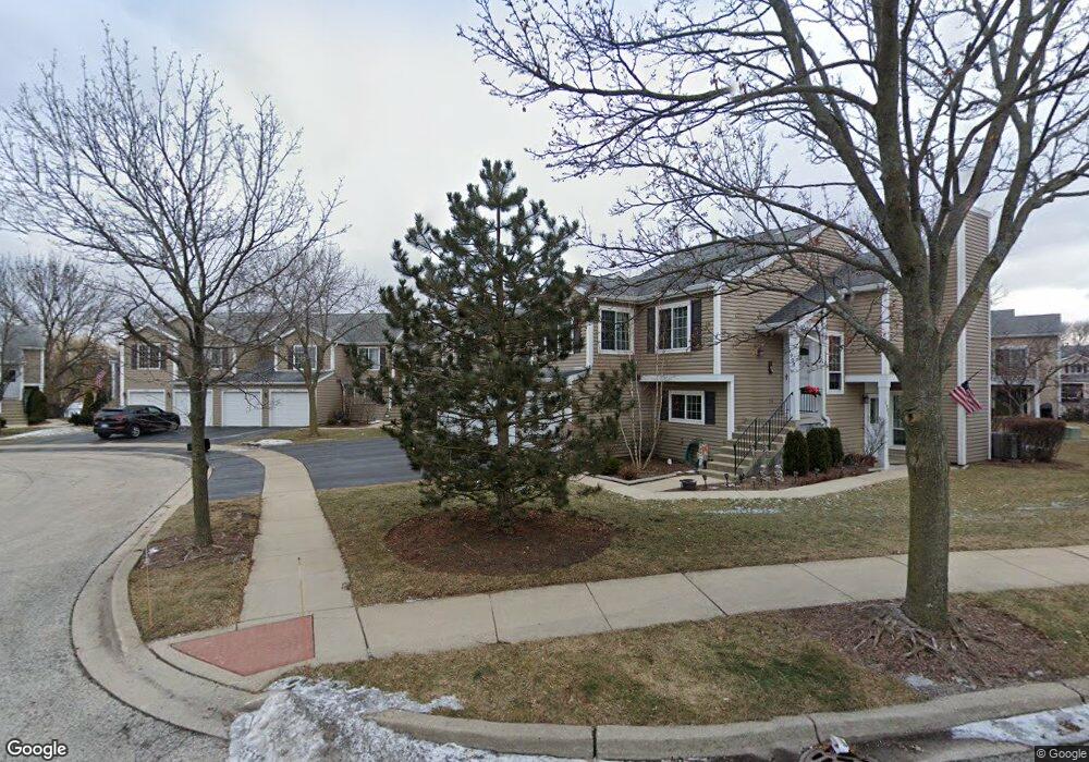
1907 Windsong Dr Unit 271E1 Schaumburg, IL 60194
West Schaumburg NeighborhoodEstimated Value: $249,082 - $287,000
2
Beds
2
Baths
1,000
Sq Ft
$264/Sq Ft
Est. Value
About This Home
This home is located at 1907 Windsong Dr Unit 271E1, Schaumburg, IL 60194 and is currently estimated at $264,271, approximately $264 per square foot. 1907 Windsong Dr Unit 271E1 is a home located in Cook County with nearby schools including Elizabeth Blackwell Elementary School, Dwight D Eisenhower Junior High School, and Hoffman Estates High School.
Ownership History
Date
Name
Owned For
Owner Type
Purchase Details
Closed on
Jul 28, 2006
Sold by
Chicago Title Land Trust Co
Bought by
Khan Niloufer
Current Estimated Value
Home Financials for this Owner
Home Financials are based on the most recent Mortgage that was taken out on this home.
Original Mortgage
$146,800
Outstanding Balance
$88,471
Interest Rate
6.83%
Mortgage Type
Unknown
Estimated Equity
$175,800
Create a Home Valuation Report for This Property
The Home Valuation Report is an in-depth analysis detailing your home's value as well as a comparison with similar homes in the area
Home Values in the Area
Average Home Value in this Area
Purchase History
| Date | Buyer | Sale Price | Title Company |
|---|---|---|---|
| Khan Niloufer | $183,500 | Git |
Source: Public Records
Mortgage History
| Date | Status | Borrower | Loan Amount |
|---|---|---|---|
| Open | Khan Niloufer | $146,800 |
Source: Public Records
Tax History Compared to Growth
Tax History
| Year | Tax Paid | Tax Assessment Tax Assessment Total Assessment is a certain percentage of the fair market value that is determined by local assessors to be the total taxable value of land and additions on the property. | Land | Improvement |
|---|---|---|---|---|
| 2024 | $4,259 | $18,569 | $3,038 | $15,531 |
| 2023 | $4,093 | $18,569 | $3,038 | $15,531 |
| 2022 | $4,093 | $18,569 | $3,038 | $15,531 |
| 2021 | $3,118 | $13,641 | $4,785 | $8,856 |
| 2020 | $3,136 | $13,641 | $4,785 | $8,856 |
| 2019 | $3,158 | $15,233 | $4,785 | $10,448 |
| 2018 | $2,743 | $12,587 | $2,962 | $9,625 |
| 2017 | $2,717 | $12,587 | $2,962 | $9,625 |
| 2016 | $2,781 | $12,587 | $2,962 | $9,625 |
| 2015 | $2,568 | $11,229 | $2,582 | $8,647 |
| 2014 | $2,555 | $11,229 | $2,582 | $8,647 |
| 2013 | $1,932 | $11,229 | $2,582 | $8,647 |
Source: Public Records
Map
Nearby Homes
- 1020 Denham Place Unit 1
- 1912 Finchley Ct Unit 3
- 2216 Andover Ct
- 808 Bishop Ct Unit 2
- 2342 Hamilton Place
- 2312 Hyde Ct
- 1103 Southbridge Ln
- 1121 Southbridge Ln
- 1901 Kingsley Dr
- 2201 Brittany Ct Unit 20
- 1375 Rebecca Dr Unit 318
- 1475 Rebecca Dr Unit 217
- 775 Harmon Blvd
- 1698 Pebble Beach Dr
- 1672 Cornell Dr
- 1685 Cornell Dr
- 290 Green Knoll Ln Unit 1920
- 8 Warwick Ct
- 508 N Walnut Ln
- 10 Warwick Ct
- 1905 Windsong Dr Unit 273E1
- 1901 Windsong Dr Unit 272E1
- 1901 Windsong Dr Unit 27-2
- 1903 Windsong Dr Unit 274E1
- 1913 Windsong Dr Unit 284E1
- 1913 Windsong Dr Unit 28-4
- 1911 Windsong Dr Unit 282E1
- 1911 Windsong Dr Unit 28-2
- 1915 Windsong Dr Unit 283E1
- 1917 Windsong Dr Unit 281E1
- 2012 Windemere Cir Unit 25-4
- 2012 Windemere Cir Unit 254E1
- 2012 Windemere Cir Unit 2012
- 2014 Windemere Cir Unit 253E1
- 2010 Windemere Cir Unit 252E1
- 2016 Windemere Cir Unit 251E1
- 2004 Windemere Cir Unit 243E1
- 2046 Windemere Cir Unit 261E1
- 2044 Windemere Cir Unit 263E1
- 2006 Windemere Cir Unit 241E1