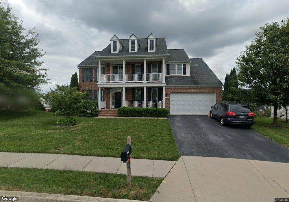
1908 Castle Green Cir Mount Airy, MD 21771
Estimated Value: $869,997 - $971,000
Studio
4
Baths
4,036
Sq Ft
$230/Sq Ft
Est. Value
About This Home
This home is located at 1908 Castle Green Cir, Mount Airy, MD 21771 and is currently estimated at $927,999, approximately $229 per square foot. 1908 Castle Green Cir is a home located in Carroll County with nearby schools including Parr's Ridge Elementary School, Mount Airy Elementary School, and Mount Airy Middle School.
Ownership History
Date
Name
Owned For
Owner Type
Purchase Details
Closed on
Mar 17, 2008
Sold by
Woodl&S Development Corporation
Bought by
Ferguson Alvah B and Ferguson Lea Ann
Current Estimated Value
Home Financials for this Owner
Home Financials are based on the most recent Mortgage that was taken out on this home.
Original Mortgage
$417,000
Interest Rate
6.17%
Mortgage Type
Purchase Money Mortgage
Purchase Details
Closed on
Jan 14, 2008
Sold by
Woodl&S Development Corporation
Bought by
Ferguson Alvah B and Ferguson Lea Ann
Home Financials for this Owner
Home Financials are based on the most recent Mortgage that was taken out on this home.
Original Mortgage
$417,000
Interest Rate
6.17%
Mortgage Type
Purchase Money Mortgage
Create a Home Valuation Report for This Property
The Home Valuation Report is an in-depth analysis detailing your home's value as well as a comparison with similar homes in the area
Home Values in the Area
Average Home Value in this Area
Purchase History
| Date | Buyer | Sale Price | Title Company |
|---|---|---|---|
| Ferguson Alvah B | $876,645 | -- | |
| Ferguson Alvah B | $876,645 | -- |
Source: Public Records
Mortgage History
| Date | Status | Borrower | Loan Amount |
|---|---|---|---|
| Closed | Ferguson Alvah B | $417,000 | |
| Previous Owner | Ferguson Alvah B | $417,000 |
Source: Public Records
Tax History
| Year | Tax Paid | Tax Assessment Tax Assessment Total Assessment is a certain percentage of the fair market value that is determined by local assessors to be the total taxable value of land and additions on the property. | Land | Improvement |
|---|---|---|---|---|
| 2025 | $10,309 | $803,500 | $0 | $0 |
| 2024 | $9,827 | $747,000 | $196,300 | $550,700 |
| 2023 | $9,366 | $733,400 | $0 | $0 |
| 2022 | $9,180 | $719,800 | $0 | $0 |
| 2021 | $18,178 | $706,200 | $176,300 | $529,900 |
| 2020 | $8,948 | $701,967 | $0 | $0 |
| 2019 | $9,044 | $697,733 | $0 | $0 |
| 2018 | $8,853 | $693,500 | $176,300 | $517,200 |
| 2017 | $8,790 | $687,933 | $0 | $0 |
| 2016 | -- | $682,367 | $0 | $0 |
| 2015 | -- | $676,800 | $0 | $0 |
| 2014 | -- | $673,633 | $0 | $0 |
Source: Public Records
Map
Nearby Homes
- 2305 Connor Cir
- 6 Jimmys St
- 806 Kingsbridge Terrace
- 1303 Quarterstaff Trail
- 0 Watersville Rd Unit MDCR2019316
- 720 W Watersville Rd
- 415 Twin Arch Rd
- 17794 Old Frederick Rd
- 7401 Watersville Rd
- 7001 Watersville Rd
- 413 Beck Dr
- 415 Beck Dr
- 7714 Walnut Ln
- .58+- ACRES Center St
- 1110 Jousting Way
- 307 Bellview Ave
- 212 Hoff Ct
- 1402 Woodenbridge Ln
- 0 Dogwood Dr
- 3683 Falling Green Way
- 1906 Castle Green Cir
- 1910 Castle Green Cir
- 2108 Scarlet Way
- 2106 Scarlet Way
- 2110 Scarlet Way
- 1904 Castle Green Cir
- 2104 Scarlet Way
- 2009 Kings Forest Trail
- 2103 Huntington Terrace
- 2112 Scarlet Way
- 1902 Castle Green Cir
- 2102 Huntington Terrace
- 2102 Scarlet Way
- 2007 Kings Forest Trail
- 2107 Scarlet Way
- 2005 Kings Forest Trail
- 1903 Gallant Knight Ln
- 2105 Huntington Terrace
- 2105 Scarlet Way
- 2114 Scarlet Way