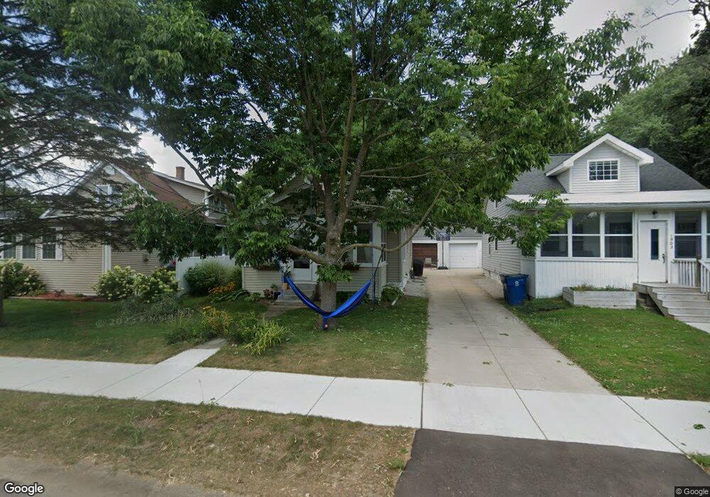
1908 Commonwealth Ave Kalamazoo, MI 49006
Westwood NeighborhoodEstimated Value: $173,660 - $246,000
4
Beds
1
Bath
1,187
Sq Ft
$176/Sq Ft
Est. Value
About This Home
This home is located at 1908 Commonwealth Ave, Kalamazoo, MI 49006 and is currently estimated at $209,415, approximately $176 per square foot. 1908 Commonwealth Ave is a home located in Kalamazoo County with nearby schools including Northglade Montessori School, Hillside Middle School, and Kalamazoo Central High School.
Ownership History
Date
Name
Owned For
Owner Type
Purchase Details
Closed on
Jan 24, 2020
Sold by
Loncharte Francis H
Bought by
Loncharte Julie and Loncharte Francis H
Current Estimated Value
Home Financials for this Owner
Home Financials are based on the most recent Mortgage that was taken out on this home.
Original Mortgage
$133,000
Outstanding Balance
$63,698
Interest Rate
3.7%
Mortgage Type
New Conventional
Estimated Equity
$145,717
Purchase Details
Closed on
Jan 2, 2003
Sold by
Campbell Jay A and Hosley Mary J
Bought by
Loncharte Francis H
Home Financials for this Owner
Home Financials are based on the most recent Mortgage that was taken out on this home.
Original Mortgage
$79,900
Interest Rate
6.01%
Mortgage Type
Purchase Money Mortgage
Create a Home Valuation Report for This Property
The Home Valuation Report is an in-depth analysis detailing your home's value as well as a comparison with similar homes in the area
Home Values in the Area
Average Home Value in this Area
Purchase History
| Date | Buyer | Sale Price | Title Company |
|---|---|---|---|
| Loncharte Julie | -- | Chicago Title Of Mi Inc | |
| Loncharte Francis H | $79,900 | Chicago Title |
Source: Public Records
Mortgage History
| Date | Status | Borrower | Loan Amount |
|---|---|---|---|
| Open | Loncharte Julie | $133,000 | |
| Closed | Loncharte Francis H | $79,900 |
Source: Public Records
Tax History
| Year | Tax Paid | Tax Assessment Tax Assessment Total Assessment is a certain percentage of the fair market value that is determined by local assessors to be the total taxable value of land and additions on the property. | Land | Improvement |
|---|---|---|---|---|
| 2025 | $463 | $79,800 | $0 | $0 |
| 2024 | $449 | $73,700 | $0 | $0 |
| 2023 | $428 | $64,100 | $0 | $0 |
| 2022 | $2,129 | $57,400 | $0 | $0 |
| 2021 | $1,998 | $51,300 | $0 | $0 |
| 2020 | $1,966 | $46,400 | $0 | $0 |
| 2019 | $1,878 | $41,800 | $0 | $0 |
| 2018 | $1,831 | $37,500 | $0 | $0 |
| 2017 | $0 | $37,500 | $0 | $0 |
| 2016 | -- | $36,100 | $0 | $0 |
| 2015 | -- | $35,900 | $0 | $0 |
| 2014 | -- | $33,600 | $0 | $0 |
Source: Public Records
Map
Nearby Homes
- 545 N Berkley St
- 1904 W North St
- 421 Hilbert St
- 130 S Clarendon St
- 518 Fletcher Ave
- 238 Falkirk Ct
- 160 Carberry Hill Ct Unit 40
- 156 Carberry Hill Ct Unit 42
- 209 Paisley Ct
- 2720 W Main St
- 204 Monroe St
- 221 Paisley Ct Unit 117
- 141 Selkirk Ct Unit 103
- 1209 Jefferson Ave
- 125 Balmoral Ct
- 1302 Ogden Ave
- 605 Coolidge Ave
- 902 Coolidge Ave
- 1120 Jefferson Ave
- 2904 Grace Rd
- 1902 Commonwealth Ave
- 1912 Commonwealth Ave
- 0 N Clarendon St
- 425427 N Clarendon St
- 445 N Clarendon St
- 427 N Clarendon St
- 1828 Commonwealth Ave
- 425 N Clarendon St
- 425 N Clarendon St Unit 425427
- 1922 Commonwealth Ave
- 1911 Commonwealth Ave
- 501 N Clarendon St
- 1917 Commonwealth Ave
- 1822 Commonwealth Ave
- 1827 Commonwealth Ave
- 1930 Commonwealth Ave
- 506 N Dartmouth St
- 1925 Commonwealth Ave
- 1816 Commonwealth Ave
- 1819 Commonwealth Ave
Your Personal Tour Guide
Ask me questions while you tour the home.