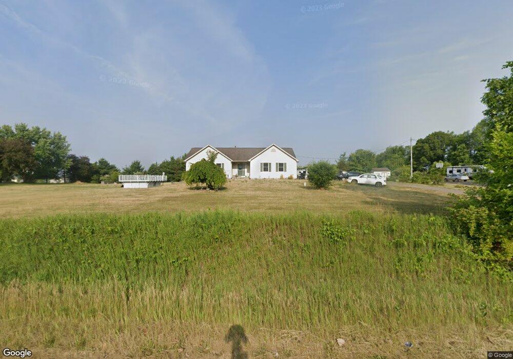
1908 S Canal Rd Eaton Rapids, MI 48827
Estimated Value: $281,000 - $320,000
3
Beds
2
Baths
1,442
Sq Ft
$207/Sq Ft
Est. Value
About This Home
This home is located at 1908 S Canal Rd, Eaton Rapids, MI 48827 and is currently estimated at $299,163, approximately $207 per square foot. 1908 S Canal Rd is a home located in Eaton County with nearby schools including Lockwood Elementary School, Greyhound Intermediate School, and Eaton Rapids Middle School.
Ownership History
Date
Name
Owned For
Owner Type
Purchase Details
Closed on
Feb 28, 2005
Sold by
Gibson Tammie L
Bought by
Gibson Tammie L and Tammie L Gibson Revocable Trust
Current Estimated Value
Purchase Details
Closed on
Jul 30, 2003
Sold by
Ross & Associates Realtors Llc
Bought by
Gibson Tammie
Home Financials for this Owner
Home Financials are based on the most recent Mortgage that was taken out on this home.
Original Mortgage
$147,900
Outstanding Balance
$63,610
Interest Rate
5.3%
Mortgage Type
Unknown
Estimated Equity
$235,553
Create a Home Valuation Report for This Property
The Home Valuation Report is an in-depth analysis detailing your home's value as well as a comparison with similar homes in the area
Home Values in the Area
Average Home Value in this Area
Purchase History
| Date | Buyer | Sale Price | Title Company |
|---|---|---|---|
| Gibson Tammie L | -- | -- | |
| Gibson Tammie | $25,000 | Midstate Title Co |
Source: Public Records
Mortgage History
| Date | Status | Borrower | Loan Amount |
|---|---|---|---|
| Open | Gibson Tammie | $147,900 |
Source: Public Records
Tax History Compared to Growth
Tax History
| Year | Tax Paid | Tax Assessment Tax Assessment Total Assessment is a certain percentage of the fair market value that is determined by local assessors to be the total taxable value of land and additions on the property. | Land | Improvement |
|---|---|---|---|---|
| 2025 | $3,179 | $144,800 | $0 | $0 |
| 2024 | $1,111 | $140,500 | $0 | $0 |
| 2023 | $1,058 | $126,200 | $0 | $0 |
| 2022 | $2,762 | $115,200 | $0 | $0 |
| 2021 | $2,491 | $109,000 | $0 | $0 |
| 2020 | $2,460 | $103,300 | $0 | $0 |
| 2019 | $2,426 | $92,100 | $0 | $0 |
| 2018 | $2,370 | $82,800 | $10,300 | $72,500 |
| 2017 | $2,240 | $82,800 | $10,300 | $72,500 |
| 2016 | -- | $82,800 | $10,300 | $72,500 |
| 2015 | -- | $82,800 | $10,300 | $72,500 |
| 2014 | -- | $77,610 | $0 | $0 |
| 2013 | -- | $77,400 | $0 | $0 |
Source: Public Records
Map
Nearby Homes
- Parcel B Dawn Marie Ln
- Parcel H Dawn Marie Ln
- 518 Clark St
- 108 Division St
- 220 Dexter Rd
- 210 Diana St
- 329 W Knight St
- 215 E Knight St
- 101 S East St
- V / L S Canfield Rd
- 100 S Center St
- 3630 Whittum Rd
- 220 S River St
- 500 King St
- 502 S Main St
- 208 Dutton St
- 201 W Broad St
- 502 S East St
- 5895 Plains Rd
- 933 Tyler Dr
- 1960 S Canal Rd
- 1900 S Canal Rd
- 1921 S Canal Rd
- 1921 S Canal St
- 8905 Petrieville Hwy
- 1961 S Canal Rd
- 9041 Petrieville Hwy
- 8855 Petrieville Hwy
- 1914 Anita Ln
- 8842 Petrieville Hwy
- 1954 Anita Ln
- 1771 S Canal Rd
- 1864 Anita Ln
- 8810 Petrieville Hwy
- 1787 S Canal Rd
- 1917 Anita Ln
- 1955 Anita Ln
- 1835 Anita Ln