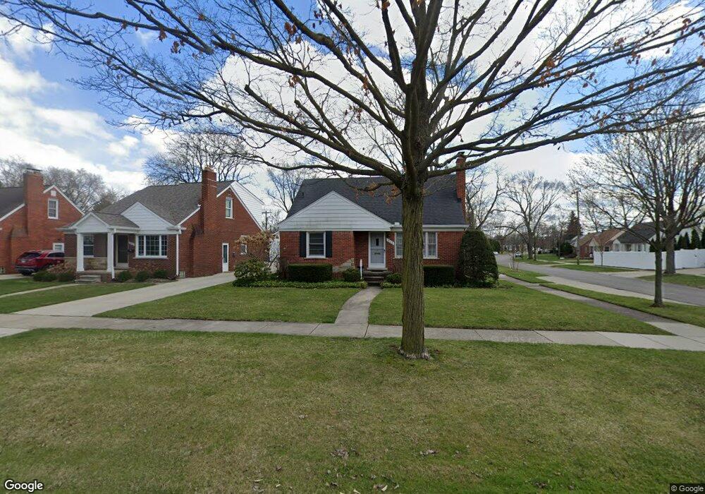
1908 Sheffield Rd Birmingham, MI 48009
Estimated Value: $417,932 - $449,000
3
Beds
3
Baths
1,103
Sq Ft
$394/Sq Ft
Est. Value
About This Home
This home is located at 1908 Sheffield Rd, Birmingham, MI 48009 and is currently estimated at $434,983, approximately $394 per square foot. 1908 Sheffield Rd is a home located in Oakland County with nearby schools including Pembroke Elementary School, Derby Middle School, and Ernest W. Seaholm High School.
Ownership History
Date
Name
Owned For
Owner Type
Purchase Details
Closed on
Aug 24, 2021
Sold by
Sinelli Shirley J
Bought by
Sinelli Shirley J and Shirley J Sinelli Revocable Living Trust
Current Estimated Value
Purchase Details
Closed on
Mar 26, 2019
Sold by
Sinelli Shirley Jean and Sinelli Donald D
Bought by
Sinelli Shirley J and Sinelli Michael J
Purchase Details
Closed on
Jul 12, 2013
Sold by
Sinelli Shirley Jean and Sinelli Donald D
Bought by
Sinelli Shirley J and Sinelli Michael J
Create a Home Valuation Report for This Property
The Home Valuation Report is an in-depth analysis detailing your home's value as well as a comparison with similar homes in the area
Home Values in the Area
Average Home Value in this Area
Purchase History
| Date | Buyer | Sale Price | Title Company |
|---|---|---|---|
| Sinelli Shirley J | -- | None Listed On Document | |
| Sinelli Shirley J | -- | None Available | |
| Sinelli Shirley J | -- | None Available | |
| Sinelli Shirley J | -- | None Available |
Source: Public Records
Tax History
| Year | Tax Paid | Tax Assessment Tax Assessment Total Assessment is a certain percentage of the fair market value that is determined by local assessors to be the total taxable value of land and additions on the property. | Land | Improvement |
|---|---|---|---|---|
| 2025 | $3,820 | $187,740 | $0 | $0 |
| 2024 | $3,372 | $174,460 | $0 | $0 |
| 2023 | $3,232 | $156,200 | $0 | $0 |
| 2022 | $3,465 | $148,100 | $0 | $0 |
| 2021 | $3,496 | $142,320 | $0 | $0 |
| 2020 | $3,115 | $133,620 | $0 | $0 |
| 2019 | $3,525 | $126,110 | $0 | $0 |
| 2018 | $3,498 | $122,510 | $0 | $0 |
| 2017 | $3,492 | $119,350 | $0 | $0 |
| 2016 | $3,499 | $115,870 | $0 | $0 |
| 2015 | -- | $109,510 | $0 | $0 |
| 2014 | -- | $92,770 | $0 | $0 |
| 2011 | -- | $78,990 | $0 | $0 |
Source: Public Records
Map
Nearby Homes
- 1723 E 14 Mile Rd Unit B
- 1717 E 14 Mile Rd Unit C
- 1845 Humphrey Ave
- 1544 Sheffield Rd
- 4725 Elmwood Ave
- 1257 S Eton St
- 1588 Bennaville Ave
- 1909 W Melton Rd
- 1982 E Lincoln St
- 1476 Humphrey Ave
- 1368 Bennaville Ave
- 1389 Bird Ave
- 1815 E Lincoln St
- 1571 Ruffner Ave
- 1331 Davis Ave
- 4707 Olivia Ave
- 1323 Bennaville Ave
- 1963 Cole St
- 1798 Webster St
- 1205 E 14 Mile Rd
- 1926 Sheffield Rd
- 1944 Sheffield Rd
- 1617 Penistone St
- 1888 Sheffield Rd
- 1962 Sheffield Rd Unit Bldg-Unit
- 1641 Penistone St
- 1872 Sheffield Rd
- 1978 Sheffield Rd
- 1628 Penistone St
- 1622 S Eton St
- 1608 S Eton St
- 1903 Sheffield Rd
- 1935 Sheffield Rd
- 1646 S Eton St
- 1680 Penistone St
- 1681 Penistone St
- 1986 Sheffield Rd
- 1955 Sheffield Rd
- 1856 Sheffield Rd
- 1668 S Eton St
Your Personal Tour Guide
Ask me questions while you tour the home.