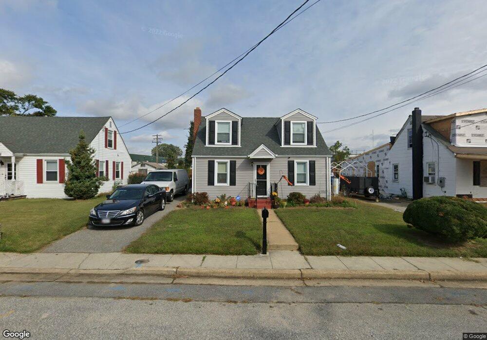
1908 Vincent St Annapolis, MD 21401
Forest Villa NeighborhoodEstimated Value: $341,816 - $477,000
Studio
1
Bath
1,566
Sq Ft
$259/Sq Ft
Est. Value
About This Home
This home is located at 1908 Vincent St, Annapolis, MD 21401 and is currently estimated at $405,454, approximately $258 per square foot. 1908 Vincent St is a home located in Anne Arundel County with nearby schools including Walter S. Mills-Parole Elementary School, Annapolis Middle School, and Annapolis High School.
Ownership History
Date
Name
Owned For
Owner Type
Purchase Details
Closed on
Aug 7, 2023
Sold by
Collison Enid R
Bought by
Collison Lee Enid and Cobbs Lee Herbert
Current Estimated Value
Purchase Details
Closed on
Jun 30, 1981
Bought by
Collison Enid R
Home Financials for this Owner
Home Financials are based on the most recent Mortgage that was taken out on this home.
Original Mortgage
$26,500
Interest Rate
16.62%
Create a Home Valuation Report for This Property
The Home Valuation Report is an in-depth analysis detailing your home's value as well as a comparison with similar homes in the area
Home Values in the Area
Average Home Value in this Area
Purchase History
| Date | Buyer | Sale Price | Title Company |
|---|---|---|---|
| Collison Lee Enid | -- | None Listed On Document | |
| Lee Enid Collison | -- | None Listed On Document | |
| Collison Enid R | $41,500 | -- |
Source: Public Records
Mortgage History
| Date | Status | Borrower | Loan Amount |
|---|---|---|---|
| Previous Owner | Collison Enid R | $26,500 |
Source: Public Records
Tax History
| Year | Tax Paid | Tax Assessment Tax Assessment Total Assessment is a certain percentage of the fair market value that is determined by local assessors to be the total taxable value of land and additions on the property. | Land | Improvement |
|---|---|---|---|---|
| 2025 | $3,282 | $293,633 | -- | -- |
| 2024 | $3,282 | $271,267 | $0 | $0 |
Source: Public Records
Map
Nearby Homes
- 8 Dorsey Ave
- 14 A Dorsey Ave
- 206 Admiral Dr
- 612 Severn Island Ct
- 1808 Lincoln Dr
- 706 Agnes Dorsey Place
- 606 James Walker Place
- 1403 Corey Ln
- 1703 Nimitz Dr
- 1402 S Virginia St
- 1915 Towne Centre Blvd Unit 1001
- 1915 Towne Centre Blvd Unit 301
- 1915 Towne Centre Blvd Unit 606
- 1915 Towne Centre Blvd Unit 807
- 1915 Towne Centre Blvd Unit 309
- 1915 Towne Centre Blvd Unit 406
- 1915 Towne Centre Blvd Unit 707
- 1915 Towne Centre Blvd Unit 503
- 1915 Towne Centre Blvd Unit 402
- 1915 Towne Centre Blvd Unit 1210
- 1904 Vincent St
- 1912 Vincent St
- 1900 Vincent St
- 1914 Vincent St
- 1915 Vincent St
- 1911 Vincent St
- 1917 Vincent St
- 1916 Vincent St
- 1919 Vincent St
- 1918 Vincent St
- 1918 Vincent St Unit 201
- 1920 Vincent St
- 1938 Drew St
- 1940 Drew St
- 1944 Drew St
- 35 Parole St
- 1946 Drew St
- 37 Parole St
- 1922 Vincent St
- 20 Lee St
Your Personal Tour Guide
Ask me questions while you tour the home.