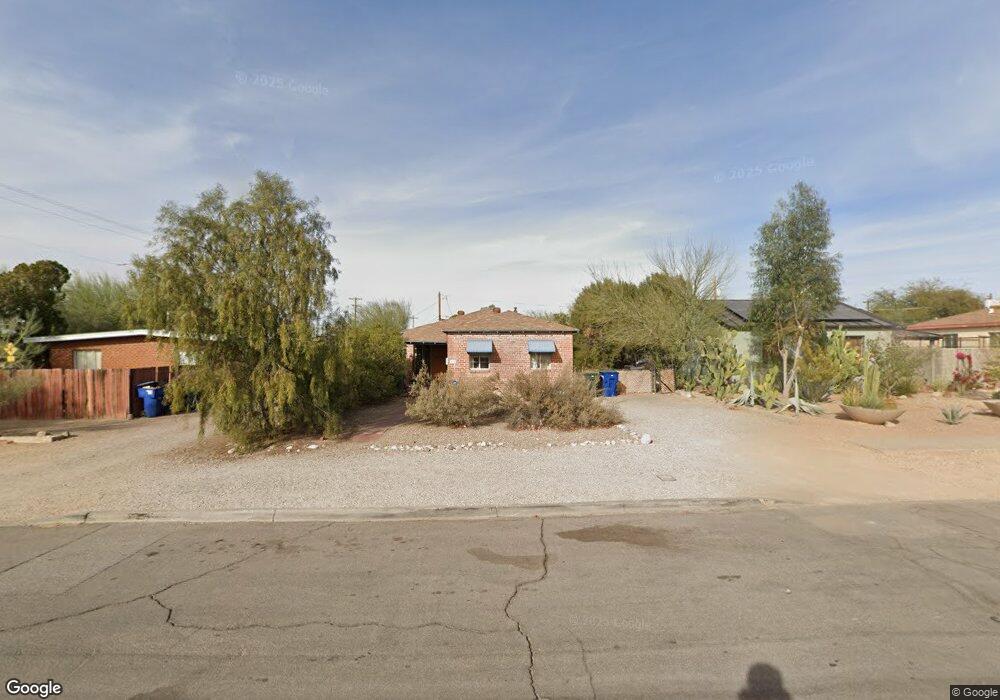
1909 E 10th St Tucson, AZ 85719
Sam Hughes NeighborhoodEstimated Value: $317,000 - $383,000
2
Beds
1
Bath
819
Sq Ft
$423/Sq Ft
Est. Value
About This Home
This home is located at 1909 E 10th St, Tucson, AZ 85719 and is currently estimated at $346,816, approximately $423 per square foot. 1909 E 10th St is a home located in Pima County with nearby schools including Sam Hughes Elementary, Mansfeld Middle School, and Tucson High Magnet School.
Ownership History
Date
Name
Owned For
Owner Type
Purchase Details
Closed on
Jan 20, 2005
Sold by
Harris Thomas D and Harris Melanie C
Bought by
Curtis David Judd and Curtis Helen L
Current Estimated Value
Home Financials for this Owner
Home Financials are based on the most recent Mortgage that was taken out on this home.
Original Mortgage
$135,000
Outstanding Balance
$66,480
Interest Rate
5.79%
Mortgage Type
New Conventional
Estimated Equity
$280,336
Purchase Details
Closed on
May 3, 1996
Sold by
Fels Anna
Bought by
Fels Anna and Sterngast Mysons Moses Herman
Purchase Details
Closed on
Jan 9, 1995
Sold by
Fels Anna
Bought by
Harris Thomas D and Harris Melanie C
Home Financials for this Owner
Home Financials are based on the most recent Mortgage that was taken out on this home.
Original Mortgage
$47,100
Interest Rate
9.16%
Mortgage Type
Seller Take Back
Create a Home Valuation Report for This Property
The Home Valuation Report is an in-depth analysis detailing your home's value as well as a comparison with similar homes in the area
Home Values in the Area
Average Home Value in this Area
Purchase History
| Date | Buyer | Sale Price | Title Company |
|---|---|---|---|
| Curtis David Judd | $170,000 | -- | |
| Curtis David Judd | $170,000 | -- | |
| Fels Anna | -- | -- | |
| Harris Thomas D | -- | -- | |
| Harris Thomas D | $67,100 | -- |
Source: Public Records
Mortgage History
| Date | Status | Borrower | Loan Amount |
|---|---|---|---|
| Open | Curtis David Judd | $135,000 | |
| Closed | Curtis David Judd | $135,000 | |
| Previous Owner | Harris Thomas D | $47,100 |
Source: Public Records
Tax History
| Year | Tax Paid | Tax Assessment Tax Assessment Total Assessment is a certain percentage of the fair market value that is determined by local assessors to be the total taxable value of land and additions on the property. | Land | Improvement |
|---|---|---|---|---|
| 2026 | $2,857 | $22,680 | -- | -- |
| 2025 | $2,857 | $21,600 | -- | -- |
| 2024 | $2,586 | $20,571 | -- | -- |
| 2023 | $2,586 | $19,592 | $0 | $0 |
| 2022 | $2,599 | $18,659 | $0 | $0 |
| 2021 | $2,860 | $19,241 | $0 | $0 |
| 2020 | $2,848 | $19,241 | $0 | $0 |
| 2019 | $2,811 | $19,878 | $0 | $0 |
| 2018 | $2,749 | $16,960 | $0 | $0 |
| 2017 | $2,789 | $16,960 | $0 | $0 |
| 2016 | $2,788 | $16,723 | $0 | $0 |
| 2015 | $2,702 | $15,927 | $0 | $0 |
Source: Public Records
Map
Nearby Homes
- 1927 E 9th St
- 116 N Martin Ave
- 0 No Address Unit 22515641
- 0 No Address Unit 22515640
- 1909 E 8th St
- 323 N Norris Ave
- 230 N Warren Ave
- 55 N Cherry Ave Unit 105
- 55 N Cherry Ave Unit 206
- 55 N Cherry Ave Unit 205
- 55 N Cherry Ave Unit 211
- 446 N Campbell Ave Unit 1304
- 446 N Campbell Ave Unit 2204
- 446 N Campbell Ave Unit 1212
- 2245 E 8th St
- 1515 E 12th St
- 2210 E 6th St
- 2316 E 7th St
- 1511 E Miles St
- 1448 E 7th St
- 1915 E 10th St
- 106 N Campbell Ave
- 1921 E 10th St
- 120 N Campbell Ave
- 118 N Campbell Ave
- 1927 E 10th St
- 128 N Campbell Ave
- 1933 E 10th St
- 1902 E 10th St
- 1910 E 10th St
- 121 N Norris Ave
- 1916 E 10th St
- 1920 E 10th St
- 127 N Norris Ave
- 1945 E 10th St
- 1932 E 10th St
- 1910 E 9th St
- 1902 E 9th St
- 1916 E 9th St
- 1922 E 9th St
Your Personal Tour Guide
Ask me questions while you tour the home.