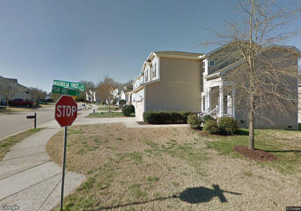
1909 Pear Tree Ln Durham, NC 27703
Estimated Value: $453,126 - $463,000
4
Beds
3
Baths
2,391
Sq Ft
$191/Sq Ft
Est. Value
About This Home
This home is located at 1909 Pear Tree Ln, Durham, NC 27703 and is currently estimated at $456,532, approximately $190 per square foot. 1909 Pear Tree Ln is a home located in Durham County with nearby schools including R.N. Harris Elementary School, James E. Shepard Middle School, and Hillside High School.
Ownership History
Date
Name
Owned For
Owner Type
Purchase Details
Closed on
Mar 2, 2016
Sold by
Royster Mark R
Bought by
Dawson Rishaun Young and Dawson Alshadera
Current Estimated Value
Home Financials for this Owner
Home Financials are based on the most recent Mortgage that was taken out on this home.
Original Mortgage
$226,000
Outstanding Balance
$182,362
Interest Rate
4.25%
Estimated Equity
$274,170
Purchase Details
Closed on
May 18, 2007
Sold by
Beazer Homes Corp
Bought by
Royster Mark R and Royster Christina L
Home Financials for this Owner
Home Financials are based on the most recent Mortgage that was taken out on this home.
Original Mortgage
$231,250
Interest Rate
6.25%
Create a Home Valuation Report for This Property
The Home Valuation Report is an in-depth analysis detailing your home's value as well as a comparison with similar homes in the area
Purchase History
| Date | Buyer | Sale Price | Title Company |
|---|---|---|---|
| Dawson Rishaun Young | $224,000 | -- | |
| Royster Mark R | $231,500 | None Available |
Source: Public Records
Mortgage History
| Date | Status | Borrower | Loan Amount |
|---|---|---|---|
| Open | Dawson Rishaun Young | $226,000 | |
| Previous Owner | Royster Mark R | $231,250 |
Source: Public Records
Tax History Compared to Growth
Tax History
| Year | Tax Paid | Tax Assessment Tax Assessment Total Assessment is a certain percentage of the fair market value that is determined by local assessors to be the total taxable value of land and additions on the property. | Land | Improvement |
|---|---|---|---|---|
| 2025 | $4,545 | $458,469 | $84,750 | $373,719 |
| 2024 | $3,460 | $248,077 | $48,025 | $200,052 |
| 2023 | $3,250 | $0 | $0 | $0 |
| 2022 | $3,175 | $248,033 | $47,982 | $200,051 |
| 2021 | $3,160 | $248,033 | $47,982 | $200,051 |
| 2020 | $3,085 | $248,033 | $47,982 | $200,051 |
| 2019 | $3,085 | $248,033 | $47,982 | $200,051 |
| 2018 | $3,134 | $231,009 | $39,515 | $191,494 |
| 2017 | $3,111 | $231,009 | $39,515 | $191,494 |
| 2016 | $3,006 | $231,009 | $39,515 | $191,494 |
| 2015 | $3,300 | $238,383 | $42,026 | $196,357 |
| 2014 | $3,300 | $238,383 | $42,026 | $196,357 |
Source: Public Records
Map
Nearby Homes
- 2105 Pear Tree Ln
- 2705 Enfield Dr
- 2638 S Alston Ave
- 2605 Magnolia Tree Ln
- 1912 So-Hi Dr
- 104 Brennan Ct
- 229 Zante Currant Rd
- 2458 S Alston Ave
- 112 Churment Ct
- 1222 Helms St
- 1218 Helms St
- 1226 Helms St
- 1642 Holly Grove Way
- 1674 Snowmass Way
- 1135 Longitude Dr
- 3309 Delmar Dr
- 2810 Wyntercrest Ln
- Cadence Plan at Courtney Creek
- Ballad Plan at Courtney Creek
- Aria Plan at Courtney Creek
- 1912 Pear Tree Ln
- 1905 Pear Tree Ln
- 2802 Magnolia Tree Ln
- 1903 Pear Tree Ln
- 1004 Oak Park Dr
- 1910 Pear Tree Ln
- 1906 Pear Tree Ln
- 1914 Pear Tree Ln
- 2712 Magnolia Tree Ln
- 2805 Magnolia Tree Ln
- 1006 Oak Park Dr
- 2803 Magnolia Tree Ln
- 1902 Pear Tree Ln
- 2801 Magnolia Tree Ln
- 2002 Pear Tree Ln
- 1008 Oak Park Dr
- 2710 Magnolia Tree Ln
- 1824 Pear Tree Ln
- 2713 Magnolia Tree Ln
- 2005 Pear Tree Ln
