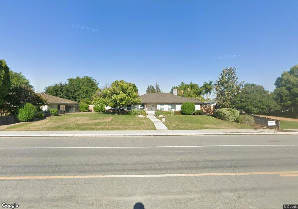
1909 Renfro Rd Bakersfield, CA 93314
Estimated Value: $636,033 - $856,000
4
Beds
3
Baths
2,565
Sq Ft
$271/Sq Ft
Est. Value
About This Home
This home is located at 1909 Renfro Rd, Bakersfield, CA 93314 and is currently estimated at $696,258, approximately $271 per square foot. 1909 Renfro Rd is a home located in Kern County with nearby schools including Centennial Elementary School, Rosedale Middle School, and Liberty High School.
Ownership History
Date
Name
Owned For
Owner Type
Purchase Details
Closed on
Sep 22, 2023
Sold by
Taylor Keeling Wright
Bought by
Taylor Kasey James
Current Estimated Value
Purchase Details
Closed on
Sep 18, 2023
Sold by
James L Taylor Trust
Bought by
Taylor Kasey James and Taylor Keeling Wright
Purchase Details
Closed on
Sep 16, 2023
Sold by
Taylor Kirin Jenean
Bought by
Talor Kasey James
Purchase Details
Closed on
Mar 16, 2021
Sold by
Taylor James L
Bought by
Taylor James L and James L Taylor Trust
Create a Home Valuation Report for This Property
The Home Valuation Report is an in-depth analysis detailing your home's value as well as a comparison with similar homes in the area
Home Values in the Area
Average Home Value in this Area
Purchase History
| Date | Buyer | Sale Price | Title Company |
|---|---|---|---|
| Taylor Kasey James | -- | None Listed On Document | |
| Taylor Kasey James | -- | None Listed On Document | |
| Talor Kasey James | -- | None Listed On Document | |
| Taylor James L | -- | None Available |
Source: Public Records
Tax History
| Year | Tax Paid | Tax Assessment Tax Assessment Total Assessment is a certain percentage of the fair market value that is determined by local assessors to be the total taxable value of land and additions on the property. | Land | Improvement |
|---|---|---|---|---|
| 2025 | $5,258 | $420,459 | $135,741 | $284,718 |
| 2024 | $4,288 | $412,216 | $133,080 | $279,136 |
| 2023 | $4,288 | $334,211 | $70,715 | $263,496 |
| 2022 | $4,187 | $327,659 | $69,329 | $258,330 |
| 2021 | $4,060 | $321,235 | $67,970 | $253,265 |
| 2020 | $3,981 | $317,943 | $67,274 | $250,669 |
| 2019 | $3,906 | $317,943 | $67,274 | $250,669 |
| 2018 | $3,799 | $305,598 | $64,662 | $240,936 |
| 2017 | $3,730 | $299,607 | $63,395 | $236,212 |
| 2016 | $3,497 | $293,733 | $62,152 | $231,581 |
| 2015 | $3,446 | $289,322 | $61,219 | $228,103 |
| 2014 | $3,368 | $283,655 | $60,020 | $223,635 |
Source: Public Records
Map
Nearby Homes
- 14508 Harvest Crest Ave
- 14306 Westdale Dr
- 1507 Pollen Crest Ct
- 14918 Thunder Valley Rd
- 15014 Thunder Valley Rd
- 14912 Henderson Ave
- 14614 Tribute Way
- 14035 Rosedale Hwy Unit 72
- 14035 Rosedale Hwy Unit 93
- 14035 Rosedale Hwy Unit 134
- 14035 Rosedale Hwy Unit 108
- 14035 Rosedale Hwy Unit 87
- 14035 Rosedale Hwy Unit 162
- 14854 Tribute Way
- 13804 Taradale Ct
- 2065 Jenkins Rd
- 13904 Fremantle Ct
- 1509 Renoir Ave
- 15553 Joseph Phelps Ave
- 15417 Lila Rose Ct
- 1901 Renfro Rd
- 1917 Renfro Rd
- 2001 Renfro Rd
- 1908 Klemer St
- 1916 Klemer St
- 1900 Klemer St
- 1910 Renfro Rd
- 14509 Palm Ave
- 14501 Palm Ave
- 2009 Renfro Rd
- 14517 Palm Ave
- 2000 Klemer St
- 14601 Palm Ave
- 2008 Klemer St
- 2017 Renfro Rd
- 14500 Harvest Crest Ave
- 14516 Harvest Crest Ave
- 14609 Palm Ave
- 14600 Harvest Crest Ave
- 2016 Klemer St
Your Personal Tour Guide
Ask me questions while you tour the home.