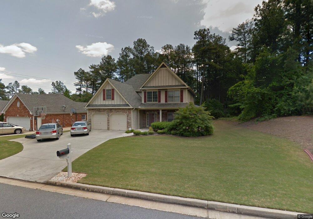
1909 Scout Ridge SW Marietta, GA 30064
West Cobb NeighborhoodEstimated Value: $506,000 - $565,000
5
Beds
4
Baths
2,922
Sq Ft
$182/Sq Ft
Est. Value
About This Home
This home is located at 1909 Scout Ridge SW, Marietta, GA 30064 and is currently estimated at $531,820, approximately $182 per square foot. 1909 Scout Ridge SW is a home located in Cobb County with nearby schools including Cheatham Hill Elementary School, Lovinggood Middle School, and Hillgrove High School.
Ownership History
Date
Name
Owned For
Owner Type
Purchase Details
Closed on
Mar 23, 2001
Sold by
J W Boone Homes Inc
Bought by
Oaks Marcus D and Oaks Karen D
Current Estimated Value
Home Financials for this Owner
Home Financials are based on the most recent Mortgage that was taken out on this home.
Original Mortgage
$199,818
Outstanding Balance
$72,705
Interest Rate
7.01%
Mortgage Type
VA
Estimated Equity
$459,115
Create a Home Valuation Report for This Property
The Home Valuation Report is an in-depth analysis detailing your home's value as well as a comparison with similar homes in the area
Home Values in the Area
Average Home Value in this Area
Purchase History
| Date | Buyer | Sale Price | Title Company |
|---|---|---|---|
| Oaks Marcus D | $195,900 | -- |
Source: Public Records
Mortgage History
| Date | Status | Borrower | Loan Amount |
|---|---|---|---|
| Open | Oaks Marcus D | $199,818 |
Source: Public Records
Tax History Compared to Growth
Tax History
| Year | Tax Paid | Tax Assessment Tax Assessment Total Assessment is a certain percentage of the fair market value that is determined by local assessors to be the total taxable value of land and additions on the property. | Land | Improvement |
|---|---|---|---|---|
| 2025 | $4,627 | $192,124 | $54,000 | $138,124 |
| 2024 | $4,631 | $192,124 | $54,000 | $138,124 |
| 2023 | $4,088 | $192,124 | $54,000 | $138,124 |
| 2022 | $3,375 | $133,080 | $24,000 | $109,080 |
| 2021 | $3,375 | $133,080 | $24,000 | $109,080 |
| 2020 | $3,004 | $116,136 | $24,000 | $92,136 |
| 2019 | $3,004 | $116,136 | $24,000 | $92,136 |
| 2018 | $2,753 | $104,640 | $24,000 | $80,640 |
| 2017 | $2,632 | $104,640 | $24,000 | $80,640 |
| 2016 | $2,359 | $92,152 | $24,000 | $68,152 |
| 2015 | $2,417 | $92,152 | $24,000 | $68,152 |
| 2014 | $2,437 | $92,152 | $0 | $0 |
Source: Public Records
Map
Nearby Homes
- 1830 MacLand Rd SW
- 1946 MacLand Rd SW
- 1646 Desford Ct SW
- 2002 MacLand Square Dr Unit 1
- 1830 Kolb Farm Cir SW Unit 7
- 2040 Hardwood Cir SW Unit 3
- 1533 Fallen Leaf Dr SW
- 2028 MacLand Square Dr Unit 4
- 1952 Freestone Way
- 2093 Breconridge Dr SW
- 1927 Kolb Farm Cir SW Unit 90
- Monteluce Plan at Freestone Station
- Hillside Plan at Freestone Station
- Oakshire Plan at Freestone Station
- Hendricks Plan at Freestone Station
- Hedgerow Plan at Freestone Station
- Antioch Plan at Freestone Station
- 1906 Kolb Farm Cir SW Unit 51
- 1985 Freestone Way
- 1505 Old John Ward Rd SW
- 1907 Scout Ridge SW
- 1910 Scout Ridge SW
- 1785 Benningfield Dr SW
- 1787 Benningfield Dr SW
- 1736 Rifle Ridge SW
- 1805 Scout Ct SW
- 1804 Scout Ct SW
- 1688 Rifle Way SW
- 1789 Benningfield Dr SW Unit 5
- 1738 Rifle Ridge SW
- 1783 Benningfield Dr SW
- 1791 Benningfield Dr SW Unit 5
- 1730 Rifle Ridge SW
- 1803 Scout Ct SW
- 1684 Rifle Way SW
- 1802 Scout Ct SW
- 1793 Benningfield Dr SW
- 1801 Scout Ct SW
- 1781 Benningfield Dr SW
- 1733 Rifle Ridge SW