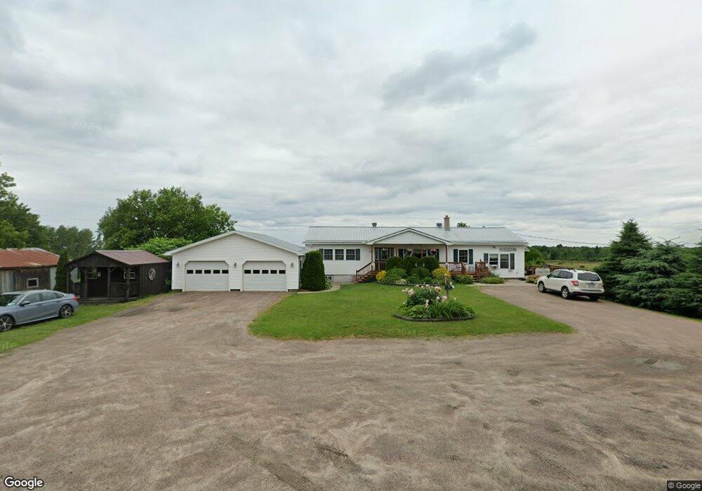
1909 State Route 11b North Bangor, NY 12966
Estimated Value: $132,000 - $254,000
5
Beds
2
Baths
1,736
Sq Ft
$115/Sq Ft
Est. Value
About This Home
This home is located at 1909 State Route 11b, North Bangor, NY 12966 and is currently estimated at $200,126, approximately $115 per square foot. 1909 State Route 11b is a home located in Franklin County with nearby schools including Brushton-Moira Elementary School and Brushton-Moira High School.
Ownership History
Date
Name
Owned For
Owner Type
Purchase Details
Closed on
Apr 21, 2009
Sold by
Preve Thayne
Bought by
Preve Thayne
Current Estimated Value
Purchase Details
Closed on
Jul 11, 2008
Sold by
Collins Tiffany
Bought by
Preve Thayne
Purchase Details
Closed on
Jun 20, 2008
Sold by
Shantie Carl
Bought by
Collins Tiffany
Create a Home Valuation Report for This Property
The Home Valuation Report is an in-depth analysis detailing your home's value as well as a comparison with similar homes in the area
Home Values in the Area
Average Home Value in this Area
Purchase History
| Date | Buyer | Sale Price | Title Company |
|---|---|---|---|
| Preve Thayne | -- | James Martineau | |
| Preve Thayne | -- | Jonathan Miller | |
| Collins Tiffany | -- | Jonathan Miller |
Source: Public Records
Mortgage History
| Date | Status | Borrower | Loan Amount |
|---|---|---|---|
| Closed | Preve Thayne E | $136,000 | |
| Closed | Preve Tiffany A | $15,000 | |
| Closed | Preve Thayne E | $123,125 | |
| Closed | Lavalley Janet M | $10,000 |
Source: Public Records
Tax History Compared to Growth
Tax History
| Year | Tax Paid | Tax Assessment Tax Assessment Total Assessment is a certain percentage of the fair market value that is determined by local assessors to be the total taxable value of land and additions on the property. | Land | Improvement |
|---|---|---|---|---|
| 2024 | $3,312 | $110,400 | $17,000 | $93,400 |
| 2023 | $3,746 | $110,400 | $17,000 | $93,400 |
| 2022 | $3,796 | $110,400 | $17,000 | $93,400 |
| 2021 | $3,770 | $110,400 | $17,000 | $93,400 |
| 2020 | $3,172 | $110,400 | $17,000 | $93,400 |
| 2019 | $2,956 | $110,400 | $17,000 | $93,400 |
| 2018 | $2,791 | $110,400 | $17,000 | $93,400 |
| 2017 | $2,711 | $110,400 | $17,000 | $93,400 |
| 2016 | $2,655 | $110,400 | $17,000 | $93,400 |
| 2015 | -- | $110,400 | $17,000 | $93,400 |
| 2014 | -- | $110,400 | $17,000 | $93,400 |
Source: Public Records
Map
Nearby Homes
- 0 Cox Rd Unit 204813
- 40 Mccarthy Rd
- 1822 State Route 11
- 1336 State Route 11b
- 20 Mill St
- 390 Co Rt 12
- 725 S Woods Rd
- 752 S Woods Rd
- 0 Wagner Rd Unit 203197
- 706 County Route 7
- 32 Grove St
- 2422 U S 11
- 1107 County Rt 53
- 202 County Route 8
- 87 Van Dusen Dr
- 192 Wiley Rd
- 916 County Route 8
- 75 Cr Rt 3
- 30 New York 95
- 34 New York 95
- 1914 State Route 11b
- 1899 State Route 11b
- 1917 State Route 11b
- 1883 State Route 11b
- 1966 State Route 11b
- 1967 State Route 11b
- 1908 State Route 11b
- 522 County Route 15
- 516 County Route 15
- 1979 State Route 11b
- 1991 New York 11b
- 1991 State Route 11b
- 1908 New York 11b
- 1816 State Route 11b
- 1805 State Route 11b
- 2014 State Route 11b
- 478 County Route 15
- 116 County Route 16
- 455 County Route 15
- 1766 State Route 11b