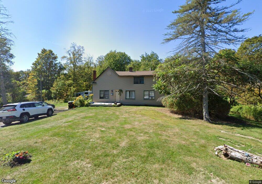
191 Daniels Rd North Adams, MA 01247
Estimated Value: $283,214 - $334,000
4
Beds
2
Baths
1,520
Sq Ft
$201/Sq Ft
Est. Value
About This Home
This home is located at 191 Daniels Rd, North Adams, MA 01247 and is currently estimated at $306,071, approximately $201 per square foot. 191 Daniels Rd is a home located in Berkshire County with nearby schools including Colegrove Park Elementary School and Drury High School.
Ownership History
Date
Name
Owned For
Owner Type
Purchase Details
Closed on
Nov 23, 1998
Sold by
Reynolds Nathan D and Reynolds Kimberly J
Bought by
Eichorn Mark S and Eichorn Laurie J
Current Estimated Value
Purchase Details
Closed on
Apr 13, 1994
Sold by
Bopp Stephen R and Bopp Pennie M
Bought by
Reynolds Nathan D and Reynolds Kimberly J
Purchase Details
Closed on
Mar 24, 1992
Sold by
Candiloro Francis and Candiloro Cynthia M
Bought by
Stonybrook Prop Inc
Purchase Details
Closed on
Aug 14, 1991
Sold by
Arnold Wayne G
Bought by
Bopp Stephen R and Bopp Pennie M
Purchase Details
Closed on
Mar 18, 1988
Sold by
Gagne Edward F
Bought by
Arnold Wayne G
Create a Home Valuation Report for This Property
The Home Valuation Report is an in-depth analysis detailing your home's value as well as a comparison with similar homes in the area
Home Values in the Area
Average Home Value in this Area
Purchase History
| Date | Buyer | Sale Price | Title Company |
|---|---|---|---|
| Eichorn Mark S | $117,000 | -- | |
| Reynolds Nathan D | $92,000 | -- | |
| Stonybrook Prop Inc | $20,000 | -- | |
| Bopp Stephen R | $45,000 | -- | |
| Arnold Wayne G | $70,000 | -- |
Source: Public Records
Mortgage History
| Date | Status | Borrower | Loan Amount |
|---|---|---|---|
| Open | Arnold Wayne G | $152,735 | |
| Closed | Arnold Wayne G | $32,629 |
Source: Public Records
Tax History Compared to Growth
Tax History
| Year | Tax Paid | Tax Assessment Tax Assessment Total Assessment is a certain percentage of the fair market value that is determined by local assessors to be the total taxable value of land and additions on the property. | Land | Improvement |
|---|---|---|---|---|
| 2025 | $3,715 | $222,300 | $55,700 | $166,600 |
| 2024 | $3,491 | $203,700 | $51,000 | $152,700 |
| 2023 | $3,419 | $193,500 | $51,000 | $142,500 |
| 2022 | $3,145 | $169,700 | $51,000 | $118,700 |
| 2021 | $2,925 | $157,200 | $47,200 | $110,000 |
| 2020 | $2,800 | $150,400 | $47,000 | $103,400 |
| 2019 | $2,639 | $138,100 | $43,400 | $94,700 |
| 2018 | $2,505 | $138,600 | $45,600 | $93,000 |
| 2017 | $2,426 | $137,300 | $45,200 | $92,100 |
| 2016 | $2,356 | $135,500 | $45,200 | $90,300 |
| 2015 | $2,265 | $135,700 | $45,200 | $90,500 |
Source: Public Records
Map
Nearby Homes
- 0 Oak Hill Unit 237953
- 350 Mohawk Trail
- 921 Mohawk Trail
- 360 Mohawk Trail
- 2438 Mohawk Trail
- 100 Autumn Dr
- 667 & 669 E Main St
- 54 Pine Hill Terrace
- 83 Walker St
- 0 Mohawk Trail
- 0 Beaver St
- 0 Daniels Rd
- 23-27 Gallup St
- 50 Gallup St
- 00 Mohawk Trail
- 306 Union St
- 26 Bradford St
- 0 Strykers Rd
- 67 Cherry St
- 30 Dover St