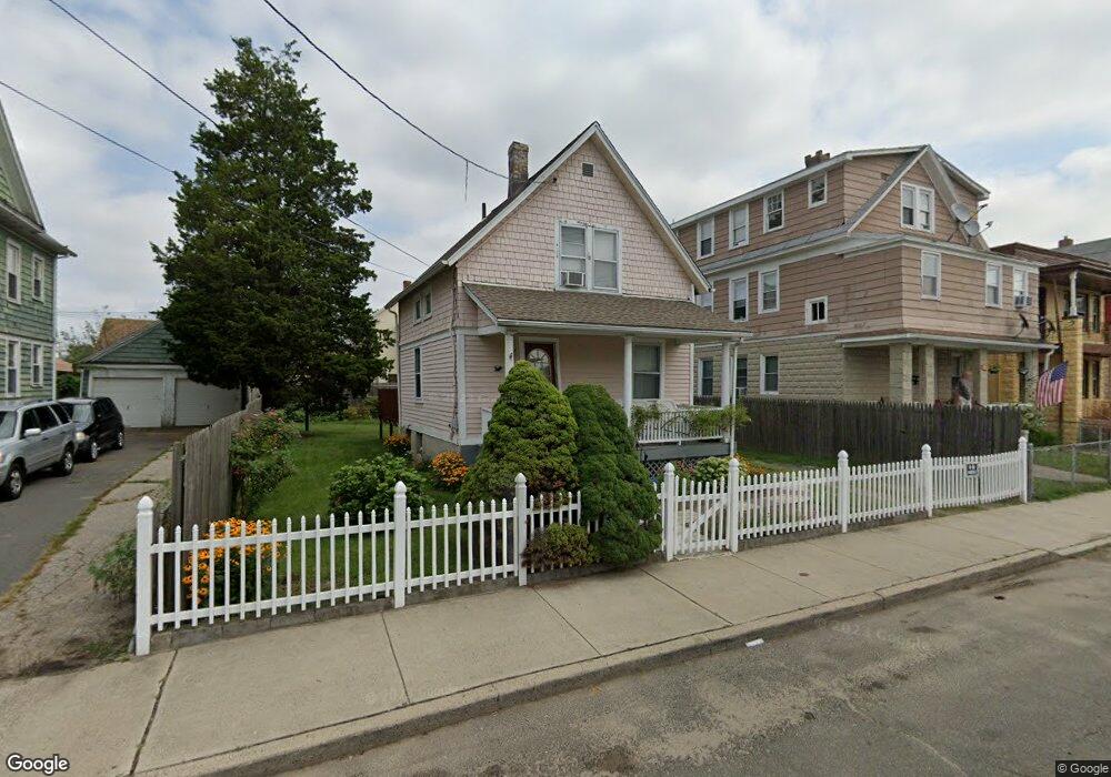
191 Deforest Ave Bridgeport, CT 06607
East End NeighborhoodEstimated Value: $209,000 - $297,000
2
Beds
1
Bath
735
Sq Ft
$337/Sq Ft
Est. Value
About This Home
This home is located at 191 Deforest Ave, Bridgeport, CT 06607 and is currently estimated at $248,014, approximately $337 per square foot. 191 Deforest Ave is a home located in Fairfield County with nearby schools including Dunbar School, Harding High School, and The Bridge Academy.
Ownership History
Date
Name
Owned For
Owner Type
Purchase Details
Closed on
Sep 5, 2006
Sold by
Hernandez Salil
Bought by
Garcia Miguel and Garcia Evette
Current Estimated Value
Home Financials for this Owner
Home Financials are based on the most recent Mortgage that was taken out on this home.
Original Mortgage
$164,900
Interest Rate
6.83%
Purchase Details
Closed on
Apr 14, 1987
Sold by
Vazquez Pauline
Bought by
Hernandez Saul
Create a Home Valuation Report for This Property
The Home Valuation Report is an in-depth analysis detailing your home's value as well as a comparison with similar homes in the area
Home Values in the Area
Average Home Value in this Area
Purchase History
| Date | Buyer | Sale Price | Title Company |
|---|---|---|---|
| Garcia Miguel | $164,900 | -- | |
| Garcia Miguel | $164,900 | -- | |
| Hernandez Saul | $12,000 | -- |
Source: Public Records
Mortgage History
| Date | Status | Borrower | Loan Amount |
|---|---|---|---|
| Open | Hernandez Saul | $156,376 | |
| Closed | Hernandez Saul | $164,900 | |
| Previous Owner | Hernandez Saul | $71,500 |
Source: Public Records
Tax History Compared to Growth
Tax History
| Year | Tax Paid | Tax Assessment Tax Assessment Total Assessment is a certain percentage of the fair market value that is determined by local assessors to be the total taxable value of land and additions on the property. | Land | Improvement |
|---|---|---|---|---|
| 2025 | $3,307 | $76,100 | $33,530 | $42,570 |
| 2024 | $3,307 | $76,100 | $33,530 | $42,570 |
| 2023 | $3,307 | $76,100 | $33,530 | $42,570 |
| 2022 | $3,307 | $76,100 | $33,530 | $42,570 |
| 2021 | $3,307 | $76,100 | $33,530 | $42,570 |
| 2020 | $2,954 | $54,710 | $18,750 | $35,960 |
| 2019 | $2,954 | $54,710 | $18,750 | $35,960 |
| 2018 | $2,975 | $54,710 | $18,750 | $35,960 |
| 2017 | $2,975 | $54,710 | $18,750 | $35,960 |
| 2016 | $2,975 | $54,710 | $18,750 | $35,960 |
| 2015 | $3,468 | $82,180 | $32,150 | $50,030 |
| 2014 | $3,468 | $82,180 | $32,150 | $50,030 |
Source: Public Records
Map
Nearby Homes
- 194 Adams St
- 325 Jefferson St
- 376 Seaview Ave
- 55 Deforest Ave
- 205 Smith St
- 800 Seaview Ave Unit 790-3
- 520 Seaview Ave
- 93 Clifford St
- 320 Union Ave
- 643 Newfield Ave Unit 645
- 40 5th St
- 306 Carroll Ave
- 408 Union Ave
- 363 Carroll Ave Unit 365
- 54 6th St
- 49 Bunnell St Unit 51
- 1440 Stratford Ave
- 221 Bunnell St
- 247 6th St
- 566 Wilmot Ave Unit 4
- 199 Deforest Ave
- 181 Deforest Ave Unit 183
- 215 Deforest Ave
- 207 Deforest Ave Unit 213
- 180 Adams St
- 198-200 Adams St
- 217 Deforest Ave
- 182 Deforest Ave
- 170 Adams St
- 196 Deforest Ave
- 188 Deforest Ave
- 206 Adams St
- 221 Deforest Ave
- 210 Deforest Ave
- 176 Deforest Ave
- 164 Adams St
- 225 Deforest Ave
- 161 Deforest Ave
- 216 Deforest Ave Unit 218
- 149 Deforest Ave