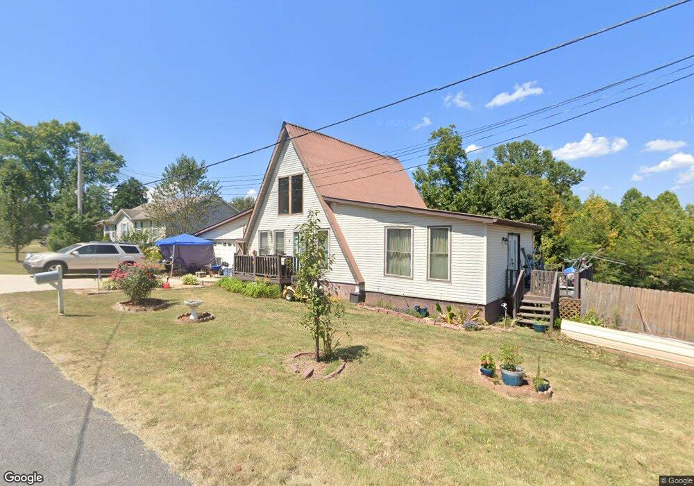
191 Forest Cir Sparta, TN 38583
Estimated Value: $206,000 - $282,000
--
Bed
2
Baths
1,666
Sq Ft
$149/Sq Ft
Est. Value
About This Home
This home is located at 191 Forest Cir, Sparta, TN 38583 and is currently estimated at $247,553, approximately $148 per square foot. 191 Forest Cir is a home located in White County with nearby schools including Doyle Elementary School, White County Middle School, and White County High School.
Ownership History
Date
Name
Owned For
Owner Type
Purchase Details
Closed on
Nov 16, 2021
Sold by
Carter Carolyn S and The Carter Trust
Bought by
Johnson Ashley and Johnson Holly
Current Estimated Value
Purchase Details
Closed on
May 16, 2012
Bought by
Carter Trust
Purchase Details
Closed on
Mar 28, 2007
Bought by
Carter Family Trust
Purchase Details
Closed on
Aug 17, 2004
Sold by
James Clouse
Bought by
Carter Carolyn S
Home Financials for this Owner
Home Financials are based on the most recent Mortgage that was taken out on this home.
Original Mortgage
$40,000
Interest Rate
5.91%
Purchase Details
Closed on
Jan 13, 2003
Sold by
Equicredit
Bought by
Clouse and Wilma
Purchase Details
Closed on
Mar 25, 2002
Sold by
Lack and Gary
Bought by
Equicredit
Purchase Details
Closed on
Jul 27, 2000
Bought by
Lack Gary and Lack Karen
Purchase Details
Closed on
May 3, 1994
Bought by
Sims Carl
Create a Home Valuation Report for This Property
The Home Valuation Report is an in-depth analysis detailing your home's value as well as a comparison with similar homes in the area
Home Values in the Area
Average Home Value in this Area
Purchase History
| Date | Buyer | Sale Price | Title Company |
|---|---|---|---|
| Johnson Ashley | -- | None Available | |
| Carter Trust | -- | -- | |
| Carter Family Trust | -- | -- | |
| Carter Carolyn S | $40,000 | -- | |
| Clouse | $32,000 | -- | |
| Equicredit | $44,373 | -- | |
| Lack Gary | $48,000 | -- | |
| Sims Carl | $2,000 | -- |
Source: Public Records
Mortgage History
| Date | Status | Borrower | Loan Amount |
|---|---|---|---|
| Previous Owner | Sims Carl | $40,000 |
Source: Public Records
Tax History Compared to Growth
Tax History
| Year | Tax Paid | Tax Assessment Tax Assessment Total Assessment is a certain percentage of the fair market value that is determined by local assessors to be the total taxable value of land and additions on the property. | Land | Improvement |
|---|---|---|---|---|
| 2025 | $673 | $56,525 | $0 | $0 |
| 2024 | $673 | $32,850 | $3,800 | $29,050 |
| 2023 | $673 | $32,850 | $3,800 | $29,050 |
| 2022 | $673 | $32,850 | $3,800 | $29,050 |
| 2021 | $673 | $32,850 | $3,800 | $29,050 |
| 2020 | $673 | $32,850 | $3,800 | $29,050 |
| 2019 | $560 | $27,300 | $3,750 | $23,550 |
| 2018 | $560 | $27,300 | $3,750 | $23,550 |
| 2017 | $560 | $27,300 | $3,750 | $23,550 |
| 2016 | $560 | $27,300 | $3,750 | $23,550 |
| 2015 | $505 | $27,300 | $3,750 | $23,550 |
| 2014 | -- | $27,300 | $3,750 | $23,550 |
| 2013 | -- | $27,650 | $3,750 | $23,900 |
Source: Public Records
Map
Nearby Homes
- 0 Forest Cir
- 351 Forest Cir
- 570 Forest Cir
- 375 Golden Herren Rd
- 285 Middle Dr
- 2190 Sullivan Knowles Rd
- 1062 Pleasant Hill Rd
- 00 Loyalty Ln
- 0 Loyalty Ln
- 845 McMinnville Hwy
- 149 Central Cir
- 476 Sunset Dr
- 128 N Turner Dr
- 899 Messenger Rd
- 1462 Franks Ferry Rd
- 00 Hickory Valley Rd
- 1165 Sullivan Knowles Rd
- 116 Haley Ave
- 516 Heather Dr
- 00 Wallace St
- 219 Forest Cir
- 196 Forest Cir
- 157 Forest Cir
- 218 Forest Cir
- 249 Forest Cir
- 2333 McMinnville Hwy
- 2315 McMinnville Hwy
- 279 Forest Cir
- 117 Forest Cir
- 276 Forest Cir
- 2295 McMinnville Hwy
- 2275 McMinnville Hwy
- 116 Forest Cir
- 321 Forest Cir
- 926 Forest Cir
- 2380 McMinnville Hwy
- 155 Crawford Cir
- 2219 McMinnville Hwy
- 00 Forest Cir
- 2392 McMinnville Hwy