Estimated Value: $702,000 - $762,000
3
Beds
3
Baths
1,932
Sq Ft
$373/Sq Ft
Est. Value
About This Home
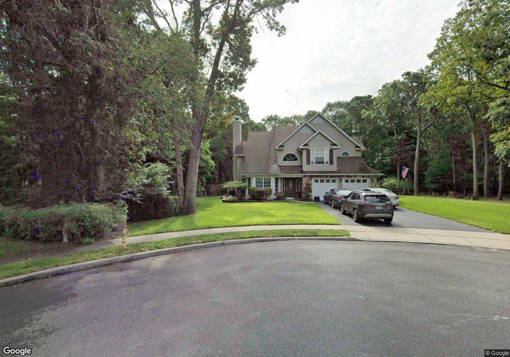
This home is located at 191 Glen Ridge Ct, Brick, NJ 08724 and is currently estimated at $721,294, approximately $373 per square foot. 191 Glen Ridge Ct is a home located in Ocean County with nearby schools including Midstreams Elementary School, Veterans Memorial Middle School, and Brick Township Memorial High School.
Ownership History
Date
Name
Owned For
Owner Type
Purchase Details
Closed on
Nov 15, 2022
Sold by
Forca Laura
Bought by
Forca Gregory L
Current Estimated Value
Home Financials for this Owner
Home Financials are based on the most recent Mortgage that was taken out on this home.
Original Mortgage
$464,000
Outstanding Balance
$446,561
Interest Rate
5.88%
Mortgage Type
New Conventional
Estimated Equity
$274,733
Purchase Details
Closed on
Jul 14, 2015
Sold by
Forca Gregory and Forca Laura
Bought by
Forca Laura
Purchase Details
Closed on
Apr 29, 1998
Sold by
Forca Gregory
Bought by
Forca Gregory and Forca Laura
Purchase Details
Closed on
Jul 22, 1997
Sold by
Ball William S
Bought by
Forka Gregory
Home Financials for this Owner
Home Financials are based on the most recent Mortgage that was taken out on this home.
Original Mortgage
$160,000
Interest Rate
7.7%
Create a Home Valuation Report for This Property
The Home Valuation Report is an in-depth analysis detailing your home's value as well as a comparison with similar homes in the area
Home Values in the Area
Average Home Value in this Area
Purchase History
| Date | Buyer | Sale Price | Title Company |
|---|---|---|---|
| Forca Gregory L | $580,000 | Chicago Title | |
| Forca Laura | -- | Coastal Title Agency Inc | |
| Forca Gregory | -- | -- | |
| Forka Gregory | $180,000 | -- |
Source: Public Records
Mortgage History
| Date | Status | Borrower | Loan Amount |
|---|---|---|---|
| Open | Forca Gregory L | $464,000 | |
| Previous Owner | Forka Gregory | $160,000 |
Source: Public Records
Tax History Compared to Growth
Tax History
| Year | Tax Paid | Tax Assessment Tax Assessment Total Assessment is a certain percentage of the fair market value that is determined by local assessors to be the total taxable value of land and additions on the property. | Land | Improvement |
|---|---|---|---|---|
| 2025 | $8,905 | $341,200 | $153,800 | $187,400 |
| 2024 | $8,452 | $341,200 | $153,800 | $187,400 |
| 2023 | $8,329 | $341,200 | $153,800 | $187,400 |
| 2022 | $8,329 | $341,200 | $153,800 | $187,400 |
| 2021 | $7,552 | $341,200 | $153,800 | $187,400 |
| 2020 | $8,049 | $341,200 | $153,800 | $187,400 |
| 2019 | $7,906 | $341,200 | $153,800 | $187,400 |
| 2018 | $7,725 | $341,200 | $153,800 | $187,400 |
| 2017 | $7,517 | $341,200 | $153,800 | $187,400 |
| 2016 | $7,476 | $341,200 | $153,800 | $187,400 |
| 2015 | $7,281 | $341,200 | $153,800 | $187,400 |
| 2014 | $7,220 | $341,200 | $153,800 | $187,400 |
Source: Public Records
Map
Nearby Homes
- 16 Mallard Dr
- 17 Mallard Dr
- 113 Elizabeth Ave
- 2 Brant Dr Unit Lot 5.01
- 17 Brant Dr
- 103 Sleepy Hollow Dr
- 16 Wayside Dr
- 5 Fieldcrest Ln
- 100 Sleepy Hollow Dr
- 90 Sleepy Hollow Dr
- 74 Fairview Ave
- 24 Mayapple Dr
- 288 Princeton Ave
- 141 Taylor Blvd
- 313 Shawnee Dr
- 91 Princeton Ave
- 49 N Cherokee Ln
- 24 Laurelhurst Dr
- 29 Robbins St
- 5 Island Dr