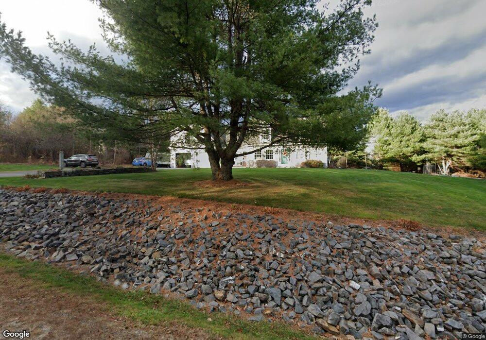
191 Harding Bridge Rd Gorham, ME 04038
Estimated Value: $722,000 - $847,000
3
Beds
3
Baths
3,273
Sq Ft
$237/Sq Ft
Est. Value
About This Home
This home is located at 191 Harding Bridge Rd, Gorham, ME 04038 and is currently estimated at $774,296, approximately $236 per square foot. 191 Harding Bridge Rd is a home located in Cumberland County with nearby schools including Great Falls Elementary School, Gorham Middle School, and Gorham High School.
Ownership History
Date
Name
Owned For
Owner Type
Purchase Details
Closed on
Apr 8, 2014
Sold by
Grondin Kenneth J
Bought by
Plourde Mark L and Plourde Gail E
Current Estimated Value
Home Financials for this Owner
Home Financials are based on the most recent Mortgage that was taken out on this home.
Original Mortgage
$170,000
Outstanding Balance
$43,378
Interest Rate
3.38%
Mortgage Type
New Conventional
Estimated Equity
$730,918
Purchase Details
Closed on
Jun 1, 2007
Sold by
Little River Props Llc
Bought by
Grondin Kenneth J
Create a Home Valuation Report for This Property
The Home Valuation Report is an in-depth analysis detailing your home's value as well as a comparison with similar homes in the area
Home Values in the Area
Average Home Value in this Area
Purchase History
| Date | Buyer | Sale Price | Title Company |
|---|---|---|---|
| Plourde Mark L | -- | -- | |
| Grondin Kenneth J | -- | -- |
Source: Public Records
Mortgage History
| Date | Status | Borrower | Loan Amount |
|---|---|---|---|
| Open | Plourde Mark L | $170,000 | |
| Previous Owner | Grondin Kenneth J | $300,000 | |
| Previous Owner | Grondin Kenneth J | $40,000 |
Source: Public Records
Tax History
| Year | Tax Paid | Tax Assessment Tax Assessment Total Assessment is a certain percentage of the fair market value that is determined by local assessors to be the total taxable value of land and additions on the property. | Land | Improvement |
|---|---|---|---|---|
| 2025 | $8,035 | $542,900 | $66,200 | $476,700 |
| 2024 | $7,981 | $542,900 | $66,200 | $476,700 |
| 2023 | $7,465 | $542,900 | $66,200 | $476,700 |
| 2022 | $6,976 | $542,900 | $66,200 | $476,700 |
| 2021 | $6,972 | $359,400 | $71,800 | $287,600 |
| 2020 | $6,829 | $359,400 | $71,800 | $287,600 |
| 2019 | $6,811 | $359,400 | $71,800 | $287,600 |
| 2018 | $6,541 | $359,400 | $71,800 | $287,600 |
| 2017 | $6,146 | $359,400 | $71,800 | $287,600 |
| 2016 | $6,112 | $359,500 | $71,900 | $287,600 |
| 2015 | $5,860 | $359,500 | $71,900 | $287,600 |
| 2014 | $5,855 | $336,500 | $65,800 | $270,700 |
| 2013 | $5,821 | $336,500 | $65,800 | $270,700 |
Source: Public Records
Map
Nearby Homes
- 0 Libby Ave
- 7 Aspen Ln
- 8 Martin Dr
- 209 Mosher Rd
- 194 Falcon Crest Dr Unit 60
- 192 Falcon Crest Dr Unit 59
- 188 Falcon Crest Dr Unit 58
- 182 Falcon Crest Dr Unit 56
- 193 Falcon Crest Dr Unit 33
- 195 Falcon Crest Dr Unit 34
- 191 Falcon Crest Dr Unit 32
- 189 Falcon Crest Dr Unit 31
- 187 Falcon Crest Dr Unit 30
- 16 Norway Rd
- 51 Newell St
- 46 Sebago Lake Rd
- 127 Falcon Crest Dr Unit 4
- 771 Gray Rd
- 7 Trestle Way
- 0 Cobb Rd
- 187 Harding Bridge Rd
- 139 Harding Bridge Rd
- 199 Harding Bridge Rd
- 194 Harding Bridge Rd
- 147 Harding Bridge Rd
- 198 Harding Bridge Rd
- 194 Harding Bridge
- 183 Harding Bridge Rd
- 188 Harding Bridge Rd
- 202 Harding Bridge Rd
- 138 Harding Bridge Rd
- 153 Harding Bridge Rd
- 134 Harding Bridge Rd
- 146 Harding Bridge Rd
- 179 Harding Bridge Rd
- 126 Harding Bridge Rd
- 150 Harding Bridge Rd Unit 5
- 150 Harding Bridge Rd
- 173 Harding Bridge Road ( Lot #18)
- 173 Harding Bridge Rd
Your Personal Tour Guide
Ask me questions while you tour the home.