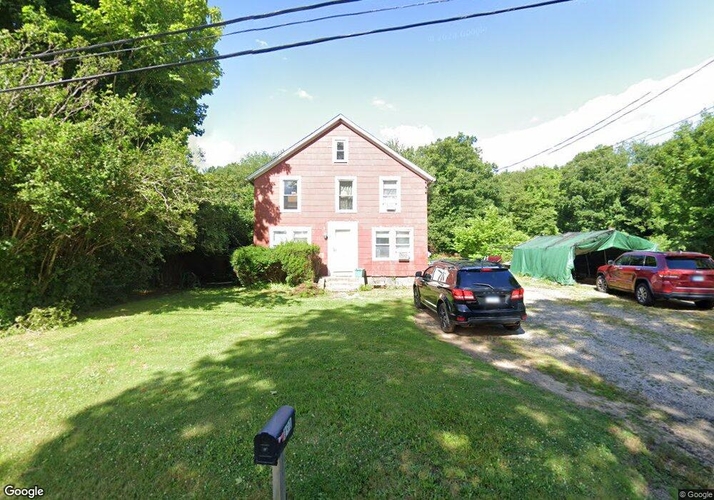
191 Mungertown Rd Madison, CT 06443
Estimated Value: $500,899 - $580,000
3
Beds
1
Bath
1,668
Sq Ft
$317/Sq Ft
Est. Value
About This Home
This home is located at 191 Mungertown Rd, Madison, CT 06443 and is currently estimated at $528,975, approximately $317 per square foot. 191 Mungertown Rd is a home located in New Haven County with nearby schools including Walter C. Polson Upper Middle School, Daniel Hand High School, and Our Lady of Mercy Preparatory Academy.
Ownership History
Date
Name
Owned For
Owner Type
Purchase Details
Closed on
Aug 7, 2023
Sold by
Brazee Alan W
Bought by
Alan William Brazee Sr Ft and Brazee
Current Estimated Value
Purchase Details
Closed on
Oct 2, 1989
Sold by
Brazee Beth S
Bought by
Brazee Alan W
Purchase Details
Closed on
Sep 16, 1988
Sold by
Gemmell Anne M
Bought by
Brazee Alan W
Home Financials for this Owner
Home Financials are based on the most recent Mortgage that was taken out on this home.
Original Mortgage
$65,000
Interest Rate
10.43%
Mortgage Type
Purchase Money Mortgage
Create a Home Valuation Report for This Property
The Home Valuation Report is an in-depth analysis detailing your home's value as well as a comparison with similar homes in the area
Home Values in the Area
Average Home Value in this Area
Purchase History
| Date | Buyer | Sale Price | Title Company |
|---|---|---|---|
| Alan William Brazee Sr Ft | -- | None Available | |
| Brazee Alan W | $30,000 | -- | |
| Brazee Alan W | $84,000 | -- |
Source: Public Records
Mortgage History
| Date | Status | Borrower | Loan Amount |
|---|---|---|---|
| Previous Owner | Brazee Alan W | $100,000 | |
| Previous Owner | Brazee Alan W | $130,000 | |
| Previous Owner | Brazee Alan W | $100,100 | |
| Previous Owner | Brazee Alan W | $65,000 |
Source: Public Records
Tax History Compared to Growth
Tax History
| Year | Tax Paid | Tax Assessment Tax Assessment Total Assessment is a certain percentage of the fair market value that is determined by local assessors to be the total taxable value of land and additions on the property. | Land | Improvement |
|---|---|---|---|---|
| 2025 | $6,307 | $281,200 | $134,500 | $146,700 |
| 2024 | $6,186 | $281,200 | $134,500 | $146,700 |
| 2023 | $5,700 | $190,200 | $103,500 | $86,700 |
| 2022 | $5,594 | $190,200 | $103,500 | $86,700 |
| 2021 | $5,487 | $190,200 | $103,500 | $86,700 |
| 2020 | $5,468 | $190,200 | $103,500 | $86,700 |
| 2019 | $5,392 | $190,200 | $103,500 | $86,700 |
| 2018 | $5,487 | $195,700 | $100,500 | $95,200 |
| 2017 | $5,343 | $195,700 | $100,500 | $95,200 |
| 2016 | $5,184 | $195,700 | $100,500 | $95,200 |
| 2015 | $5,041 | $195,700 | $100,500 | $95,200 |
| 2014 | $5,945 | $236,200 | $150,400 | $85,800 |
Source: Public Records
Map
Nearby Homes
- 7 Derenthal Dr
- 259 Mungertown Rd
- 108 Boston Post Rd
- 67 Boston Post Rd Unit 8
- 75 Fairview Dr
- 31 Stony Lane Lot 3 Rd
- 26 Opening Hill Rd
- 31 Stony Lane Lot 6 Rd
- 31 Stony Lane Lot 1 Rd
- 31 Stony Lane Lot 2 Rd
- 38 Opening Hill Rd
- 66 Beaver Pond Rd
- 62 Wellsweep Dr
- 231 Nortontown Rd
- 18 Kelsey Place
- 37 Lantern Hill Rd
- 3 Arrowhead Rd
- 110 Randi Dr
- 115 Harbor Ave
- 360 E River Rd
- 199 Mungertown Rd
- 181 Mungertown Rd
- 198 Green Hill Rd
- 175 Mungertown Rd
- 205 Mungertown Rd
- 208 Green Hill Rd
- 202 Green Hill Rd
- 169 Mungertown Rd
- 178 Mungertown Rd
- 216 Green Hill Rd
- 46 Nortontown Rd
- 50 Nortontown Rd
- 54 Nortontown Rd
- 192 Green Hill Rd
- 170 Mungertown Rd
- 163 Mungertown Rd
- 224 Green Hill Rd
- 188 Green Hill Rd
- 13 Corinth Dr
- 213 Green Hill Rd