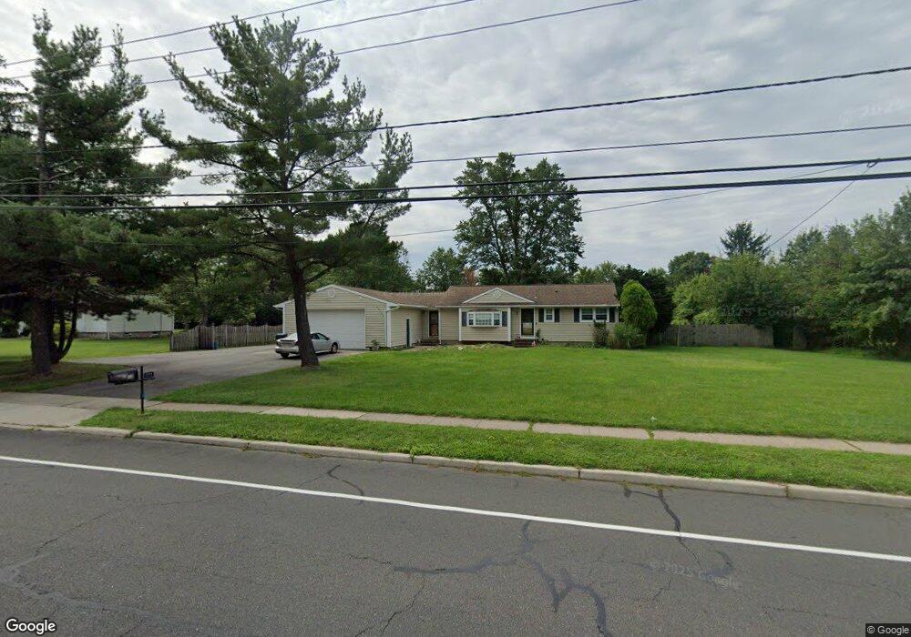
191 New Amwell Rd Hillsborough, NJ 08844
Estimated Value: $577,000 - $657,000
--
Bed
--
Bath
1,692
Sq Ft
$372/Sq Ft
Est. Value
About This Home
This home is located at 191 New Amwell Rd, Hillsborough, NJ 08844 and is currently estimated at $629,796, approximately $372 per square foot. 191 New Amwell Rd is a home located in Somerset County with nearby schools including Hillsborough High School, Cherry Blossom Montessori School, and Brighthorizons at Hillsborough.
Ownership History
Date
Name
Owned For
Owner Type
Purchase Details
Closed on
Oct 28, 2016
Sold by
Hall Michal R and Hall Christina
Bought by
Hall Michael and Hall Christina
Current Estimated Value
Home Financials for this Owner
Home Financials are based on the most recent Mortgage that was taken out on this home.
Original Mortgage
$288,000
Outstanding Balance
$185,309
Interest Rate
3.54%
Mortgage Type
New Conventional
Estimated Equity
$444,487
Purchase Details
Closed on
May 20, 2011
Sold by
Degroot Frederick F and De Groot Vivian L
Bought by
Hall Michael R and Miller Christina A
Home Financials for this Owner
Home Financials are based on the most recent Mortgage that was taken out on this home.
Original Mortgage
$315,000
Interest Rate
4.94%
Mortgage Type
New Conventional
Create a Home Valuation Report for This Property
The Home Valuation Report is an in-depth analysis detailing your home's value as well as a comparison with similar homes in the area
Home Values in the Area
Average Home Value in this Area
Purchase History
| Date | Buyer | Sale Price | Title Company |
|---|---|---|---|
| Hall Michael | -- | None Available | |
| Hall Michael R | $350,000 | Mt Arlington Title Agency Ll |
Source: Public Records
Mortgage History
| Date | Status | Borrower | Loan Amount |
|---|---|---|---|
| Open | Hall Michael | $288,000 | |
| Closed | Hall Michael R | $315,000 |
Source: Public Records
Tax History Compared to Growth
Tax History
| Year | Tax Paid | Tax Assessment Tax Assessment Total Assessment is a certain percentage of the fair market value that is determined by local assessors to be the total taxable value of land and additions on the property. | Land | Improvement |
|---|---|---|---|---|
| 2025 | $9,401 | $469,900 | $260,000 | $209,900 |
| 2024 | $9,401 | $438,700 | $250,000 | $188,700 |
| 2023 | $8,696 | $403,900 | $225,000 | $178,900 |
| 2022 | $8,488 | $380,100 | $200,000 | $180,100 |
| 2021 | $8,601 | $366,300 | $185,000 | $181,300 |
| 2020 | $8,401 | $352,400 | $170,000 | $182,400 |
| 2019 | $8,438 | $351,000 | $170,000 | $181,000 |
| 2018 | $8,154 | $337,100 | $155,000 | $182,100 |
| 2017 | $7,544 | $312,400 | $135,000 | $177,400 |
| 2016 | $7,447 | $308,500 | $130,000 | $178,500 |
| 2015 | $6,937 | $287,100 | $130,000 | $157,100 |
| 2014 | $7,242 | $310,300 | $150,000 | $160,300 |
Source: Public Records
Map
Nearby Homes
- 68 Dunedain St
- 59 Wesley Rd
- 104 Devonshire Ct
- 277 Gemini Dr Unit 1B
- 911 Merritt Dr Unit B2
- 118 Bluebird Dr Unit 3A
- 897 Merritt Dr Unit D
- 912 Merritt Dr Unit D
- 4 Marshall Rd
- 71 Buckland Dr
- 106 Perrine Pike
- 3011 Revere Ct
- 3120 Revere Ct
- 3007 Revere Ct
- 1404 Washington Common Unit 4
- 710 Whitenack Ct
- 3320 Richmond Ct
- 2109 Jamestown Common
- 903A Marlborough Common
- 906B Marlborough Common
- 185 New Amwell Rd
- 2 Lorien Place
- 179 New Amwell Rd
- 3 Lorien Place
- 4 Lorien Place
- 5 Lorien Place
- 173 New Amwell Rd
- 23 Snowbourn Place
- 6 Lorien Place
- 7 Lorien Place
- 25 Snowbourn Place
- 8 Lorien Place
- 381 Gemini Dr
- 27 Snowbourn Place
- 52 Dunedain St
- 167 New Amwell Rd
- 9 Lorien Place
- 10 Lorien Place
- 319 New Amwell Rd
- 24 Snowbourn Place