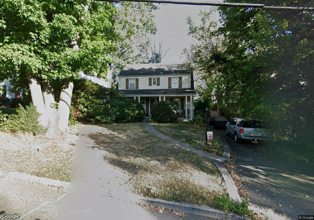
191 Riveredge Rd Tenafly, NJ 07670
Estimated Value: $893,352 - $1,082,000
--
Bed
--
Bath
1,536
Sq Ft
$638/Sq Ft
Est. Value
About This Home
This home is located at 191 Riveredge Rd, Tenafly, NJ 07670 and is currently estimated at $980,588, approximately $638 per square foot. 191 Riveredge Rd is a home located in Bergen County with nearby schools including Tenafly Middle School, Tenafly High School, and Lubavitch On The Palisades.
Ownership History
Date
Name
Owned For
Owner Type
Purchase Details
Closed on
Aug 16, 1996
Sold by
Bates Thomas and Bates Dolores
Bought by
Driver Steven and Driver Rena
Current Estimated Value
Home Financials for this Owner
Home Financials are based on the most recent Mortgage that was taken out on this home.
Original Mortgage
$108,000
Outstanding Balance
$8,514
Interest Rate
8.18%
Estimated Equity
$972,074
Create a Home Valuation Report for This Property
The Home Valuation Report is an in-depth analysis detailing your home's value as well as a comparison with similar homes in the area
Home Values in the Area
Average Home Value in this Area
Purchase History
| Date | Buyer | Sale Price | Title Company |
|---|---|---|---|
| Driver Steven | $222,500 | -- |
Source: Public Records
Mortgage History
| Date | Status | Borrower | Loan Amount |
|---|---|---|---|
| Open | Driver Steven | $108,000 |
Source: Public Records
Tax History Compared to Growth
Tax History
| Year | Tax Paid | Tax Assessment Tax Assessment Total Assessment is a certain percentage of the fair market value that is determined by local assessors to be the total taxable value of land and additions on the property. | Land | Improvement |
|---|---|---|---|---|
| 2025 | $12,154 | $427,800 | $268,200 | $159,600 |
| 2024 | $11,859 | $427,800 | $268,200 | $159,600 |
| 2023 | $11,572 | $427,800 | $268,200 | $159,600 |
| 2022 | $11,572 | $427,800 | $268,200 | $159,600 |
| 2021 | $10,560 | $427,800 | $268,200 | $159,600 |
| 2020 | $11,200 | $427,800 | $268,200 | $159,600 |
| 2019 | $11,003 | $427,800 | $268,200 | $159,600 |
| 2018 | $10,832 | $427,800 | $268,200 | $159,600 |
| 2017 | $10,793 | $427,800 | $268,200 | $159,600 |
| 2016 | $10,579 | $427,800 | $268,200 | $159,600 |
| 2015 | $10,344 | $427,800 | $268,200 | $159,600 |
| 2014 | $10,152 | $427,800 | $268,200 | $159,600 |
Source: Public Records
Map
Nearby Homes
- 17 Wight Place
- 118 Sunset Ln
- 152 W Clinton Ave
- 52 Surrey Ln
- 302 W Clinton Ave
- 12 Spruce St
- 305 E Main St
- 280 Hickory Ave
- 20 Dojean Ct
- 21 Cedar St
- 43 Grove St
- 44 Bogert Place
- 27 W Clinton Ave Unit 2-M
- 17 Jefferson Ave
- 230 Knickerbocker Rd
- 23 Cherry Ct
- 139 Stonegate Trail
- 202 Pleasant Ave
- 25 Clinton Park Dr
- 241 E Main St Unit 1D
- 1 Wight Place
- 193 Riveredge Rd
- 9 Wight Place
- 195 Riveredge Rd
- 195 Riveredge Rd Unit 2
- 195 Riveredge Rd Unit 1
- 11 Wight Place
- 185 Riveredge Rd
- 8 Wight Place
- 192 Riveredge Rd
- 196 Riveredge Rd
- 13 Wight Place
- 24 Winthrop Ct
- 188 Riveredge Rd
- 10 Wight Place
- 198 Riveredge Rd
- 1 Winthrop Ct
- 15 Wight Place
- 12 Wight Place
- 186 Riveredge Rd