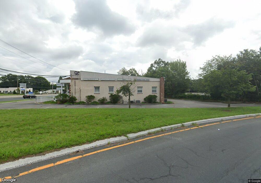
191 Route 37 W Toms River, NJ 08755
Estimated Value: $890,994
--
Bed
--
Bath
6,912
Sq Ft
$129/Sq Ft
Est. Value
About This Home
This home is located at 191 Route 37 W, Toms River, NJ 08755 and is currently estimated at $890,994, approximately $128 per square foot. 191 Route 37 W is a home located in Ocean County with nearby schools including St Joseph Grade School, Ambassador Christian Academy, and Donovan Catholic High School.
Ownership History
Date
Name
Owned For
Owner Type
Purchase Details
Closed on
Jun 3, 2021
Sold by
Ob Route 37 Llc
Bought by
Persistence Holdings Llc
Current Estimated Value
Home Financials for this Owner
Home Financials are based on the most recent Mortgage that was taken out on this home.
Original Mortgage
$431,250
Outstanding Balance
$390,443
Interest Rate
2.9%
Mortgage Type
Commercial
Estimated Equity
$500,551
Purchase Details
Closed on
Apr 27, 2005
Sold by
Connolly Brian C and Connolly Olana
Bought by
Ob Route 37 Llc
Create a Home Valuation Report for This Property
The Home Valuation Report is an in-depth analysis detailing your home's value as well as a comparison with similar homes in the area
Home Values in the Area
Average Home Value in this Area
Purchase History
| Date | Buyer | Sale Price | Title Company |
|---|---|---|---|
| Persistence Holdings Llc | $575,000 | Counsellors Title Agency Inc | |
| Ob Route 37 Llc | -- | -- |
Source: Public Records
Mortgage History
| Date | Status | Borrower | Loan Amount |
|---|---|---|---|
| Open | Persistence Holdings Llc | $431,250 |
Source: Public Records
Tax History Compared to Growth
Tax History
| Year | Tax Paid | Tax Assessment Tax Assessment Total Assessment is a certain percentage of the fair market value that is determined by local assessors to be the total taxable value of land and additions on the property. | Land | Improvement |
|---|---|---|---|---|
| 2025 | $10,070 | $553,000 | $210,000 | $343,000 |
| 2024 | $9,572 | $553,000 | $210,000 | $343,000 |
| 2023 | $9,230 | $553,000 | $210,000 | $343,000 |
| 2022 | $9,230 | $553,000 | $210,000 | $343,000 |
| 2021 | $13,527 | $540,000 | $189,000 | $351,000 |
| 2020 | $13,468 | $540,000 | $189,000 | $351,000 |
| 2019 | $12,884 | $540,000 | $189,000 | $351,000 |
| 2018 | $12,712 | $540,000 | $189,000 | $351,000 |
| 2017 | $12,604 | $540,000 | $189,000 | $351,000 |
| 2016 | $12,274 | $540,000 | $189,000 | $351,000 |
| 2015 | $11,810 | $540,000 | $189,000 | $351,000 |
| 2014 | $11,243 | $540,000 | $189,000 | $351,000 |
Source: Public Records
Map
Nearby Homes
- 533 Skylark Dr
- 17 Ridgewood Dr
- 30 Smith Rd
- 502 River Terrace
- 44 Shady Nook Dr
- 59 Sun Valley Rd
- 12 Harley Rd
- 15 Oak Leaf Ln
- 39 Blue Jay Dr
- 7 Oxford Dr
- 56 Cliffside Dr
- 30 Chutney St
- 12 Woodridge Ave
- 927 Edgebrook Dr N
- 937 Edgebrook Dr N
- 20 Woodridge Ave
- 35 Southampton Rd
- 34 Cambridge Ct
- 32 Camelot Dr
- 424 Colleen Ct
- 191 Route 37 W Unit 4
- 191 Route 37 W Unit BASEMENT
- 191 New Jersey 37
- 192 Route 37 W
- 202 New Jersey 37
- 530 Lakehurst Rd Unit 307
- 530 Lakehurst Rd Unit 302
- 530 Lakehurst Rd Unit 306
- 530 Lakehurst Rd Unit 303
- 530 Lakehurst Rd Unit 309
- 530 Lakehurst Rd Unit 308
- 530 Lakehurst Rd Unit 301
- 530 Lakehurst Rd Unit 207
- 530 Lakehurst Rd Unit 206
- 530 Lakehurst Rd Unit 205
- 530 Lakehurst Rd Unit 204
- 530 Lakehurst Rd Unit 203
- 530 Lakehurst Rd Unit 202
- 530 Lakehurst Rd Unit 201
- 530 Lakehurst Rd Unit 102