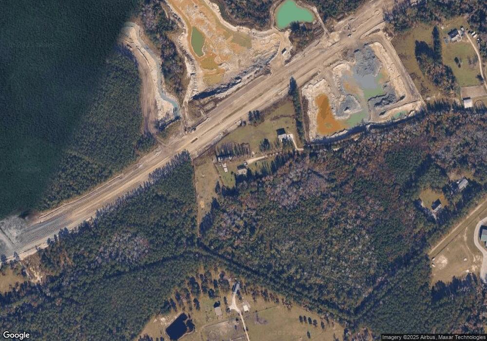
191 Tim Moore Dr Hampstead, NC 28443
Estimated Value: $333,000 - $743,661
3
Beds
2
Baths
1,618
Sq Ft
$299/Sq Ft
Est. Value
About This Home
This home is located at 191 Tim Moore Dr, Hampstead, NC 28443 and is currently estimated at $484,165, approximately $299 per square foot. 191 Tim Moore Dr is a home located in Pender County with nearby schools including South Topsail Elementary School, Topsail Middle School, and Topsail High School.
Ownership History
Date
Name
Owned For
Owner Type
Purchase Details
Closed on
Mar 18, 2021
Sold by
Adams Patrick W
Bought by
Department Of Transportation
Current Estimated Value
Purchase Details
Closed on
Apr 26, 2006
Sold by
Adams Patrick W
Bought by
Sage Harry M
Home Financials for this Owner
Home Financials are based on the most recent Mortgage that was taken out on this home.
Original Mortgage
$373,326
Interest Rate
2.05%
Mortgage Type
Construction
Purchase Details
Closed on
Aug 4, 1998
Bought by
Adams Patrick W
Create a Home Valuation Report for This Property
The Home Valuation Report is an in-depth analysis detailing your home's value as well as a comparison with similar homes in the area
Home Values in the Area
Average Home Value in this Area
Purchase History
| Date | Buyer | Sale Price | Title Company |
|---|---|---|---|
| Department Of Transportation | $500 | None Available | |
| Department Of Transportation | -- | None Listed On Document | |
| Sage Harry M | $150,000 | -- | |
| Adams Patrick W | -- | -- |
Source: Public Records
Mortgage History
| Date | Status | Borrower | Loan Amount |
|---|---|---|---|
| Previous Owner | Sage Harry M | $373,326 |
Source: Public Records
Tax History Compared to Growth
Tax History
| Year | Tax Paid | Tax Assessment Tax Assessment Total Assessment is a certain percentage of the fair market value that is determined by local assessors to be the total taxable value of land and additions on the property. | Land | Improvement |
|---|---|---|---|---|
| 2024 | $4,292 | $442,334 | $55,680 | $386,654 |
| 2023 | $2,384 | $442,334 | $55,680 | $386,654 |
| 2022 | $2,384 | $259,994 | $76,290 | $183,704 |
| 2021 | $2,571 | $282,413 | $98,709 | $183,704 |
| 2020 | $2,571 | $282,413 | $98,709 | $183,704 |
| 2019 | $2,571 | $282,413 | $98,709 | $183,704 |
| 2018 | $1,995 | $203,428 | $39,109 | $164,319 |
| 2017 | $1,995 | $203,428 | $39,109 | $164,319 |
| 2016 | $1,935 | $198,876 | $34,557 | $164,319 |
| 2015 | $1,900 | $198,876 | $34,557 | $164,319 |
| 2014 | $1,535 | $203,428 | $39,109 | $164,319 |
| 2013 | -- | $203,428 | $39,109 | $164,319 |
| 2012 | -- | $203,428 | $39,109 | $164,319 |
Source: Public Records
Map
Nearby Homes
- Rosebay Plan at Brookfield Branch
- Fern Plan at Brookfield Branch
- Honeybird Plan at Brookfield Branch
- Hazel Plan at Brookfield Branch
- Alder Plan at Brookfield Branch
- 83 Cobbler Way Unit 39
- 91 Cobbler Way Unit 40
- 99 Cobbler Way Unit 41
- 50 Cobbler Way Unit 50
- 107 Cobbler Way Unit 42
- 115 Cobbler Way Unit 43
- 68 Cobbler Way Unit 52
- 131 Cobbler Way Unit 45
- 92 Cobbler Way Unit 55
- 155 Cobbler Way Unit 48
- 28 W Farley Dr Unit 98
- 24 W Farley Dr Unit 99
- 17 E Farley Dr Unit 70
- 25 E Farley Dr Unit 69
- 383 Woodside Dr
- 135 Tim Moore Dr
- 483 Orchard Mill Rd
- 133 Tim Moore Dr
- 91 Tim Moore Dr
- 194 Tim Moore Dr
- 258 One Mile Rd
- 440 Orchard Mill Rd
- 81 One Mile Rd
- 441 Orchard Mill Rd
- 481 Nc State Highway 210
- 293 One Mile Rd
- 40 Landward Way Unit Lot 2031
- 350 Orchard Mill Rd
- 33 Stacey Greg Rd
- 35 Stacey Greg Rd
- 34 Stacey Greg Rd
- 298 Orchard Mill Rd
- 359 Orchard Mill Rd
- 53 Frey Ct
- 327 Holiday Dr
