191 Wall Ave Unit 197 Paterson, NJ 07504
Eastside NeighborhoodEstimated Value: $702,556 - $817,000
--
Bed
--
Bath
3,445
Sq Ft
$215/Sq Ft
Est. Value
About This Home
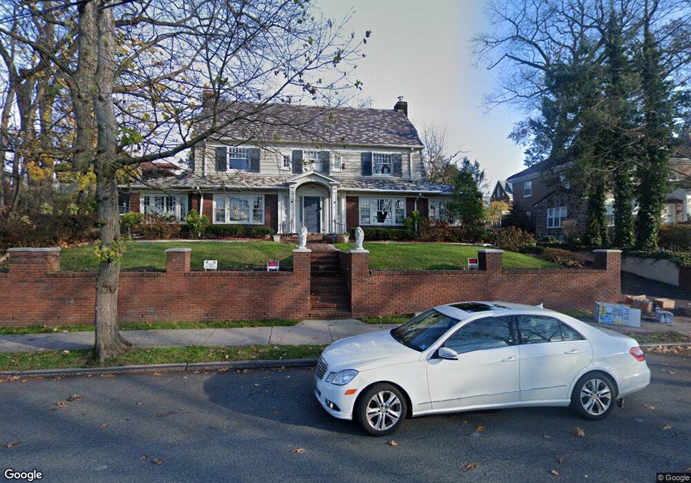
This home is located at 191 Wall Ave Unit 197, Paterson, NJ 07504 and is currently estimated at $740,139, approximately $214 per square foot. 191 Wall Ave Unit 197 is a home located in Passaic County with nearby schools including Edward W. Kilpatrick School of Discovery, Dale Avenue Elementary School, and Paterson School 6.
Ownership History
Date
Name
Owned For
Owner Type
Purchase Details
Closed on
Jul 30, 2020
Sold by
Bx Holding Llc
Bought by
Ighara Talal
Current Estimated Value
Home Financials for this Owner
Home Financials are based on the most recent Mortgage that was taken out on this home.
Original Mortgage
$328,652
Interest Rate
2.8%
Mortgage Type
New Conventional
Purchase Details
Closed on
Oct 7, 2019
Sold by
Schaublin Yanes Robert and Yanes Romulo A
Bought by
Bx Holdings Llc
Purchase Details
Closed on
Jan 24, 2005
Sold by
Page Liston
Bought by
Yanes Robert and Yanes Romulo
Home Financials for this Owner
Home Financials are based on the most recent Mortgage that was taken out on this home.
Original Mortgage
$325,000
Interest Rate
5.77%
Create a Home Valuation Report for This Property
The Home Valuation Report is an in-depth analysis detailing your home's value as well as a comparison with similar homes in the area
Home Values in the Area
Average Home Value in this Area
Purchase History
| Date | Buyer | Sale Price | Title Company |
|---|---|---|---|
| Ighara Talal | $380,000 | Providence Abstract Llc | |
| Bx Holdings Llc | $308,000 | None Available | |
| Yanes Robert | $500,000 | -- |
Source: Public Records
Mortgage History
| Date | Status | Borrower | Loan Amount |
|---|---|---|---|
| Previous Owner | Ighara Talal | $328,652 | |
| Previous Owner | Yanes Robert | $325,000 |
Source: Public Records
Tax History Compared to Growth
Tax History
| Year | Tax Paid | Tax Assessment Tax Assessment Total Assessment is a certain percentage of the fair market value that is determined by local assessors to be the total taxable value of land and additions on the property. | Land | Improvement |
|---|---|---|---|---|
| 2025 | $19,641 | $385,500 | $121,300 | $264,200 |
| 2024 | $18,901 | $385,500 | $121,300 | $264,200 |
| 2022 | $17,895 | $385,500 | $121,300 | $264,200 |
| 2021 | $17,255 | $385,500 | $121,300 | $264,200 |
| 2020 | $16,095 | $385,500 | $121,300 | $264,200 |
| 2019 | $15,565 | $376,500 | $118,300 | $258,200 |
| 2018 | $16,062 | $371,300 | $117,300 | $254,000 |
| 2017 | $15,342 | $368,800 | $116,800 | $252,000 |
| 2016 | $16,857 | $388,500 | $122,200 | $266,300 |
| 2015 | $15,960 | $388,500 | $122,200 | $266,300 |
| 2014 | $15,950 | $550,000 | $220,300 | $329,700 |
Source: Public Records
Map
Nearby Homes
- 277 E 32nd St Unit 279
- 723-725 Broadway
- 5 Park Rd
- 523 Park Ave
- 554 Park Ave Unit 560
- 324 E 30th St Unit 326
- 98-108 E 38th St
- 444 15th Ave Unit 446
- 444-446 15th Ave
- 475 Park Ave
- 313-321 E 39th St
- 440 Park Ave
- 282-284 17th Ave
- 645 E 26th St
- 693 E 28th St Unit 695
- 336 E 41st St Unit 338
- 361 15th Ave
- 39 E 39th St Unit 8G
- 39 E 39th St Unit 412
- 39 E 39th St
- 197 Wall Ave Unit 203
- 195 Wall Ave
- 181 Wall Ave Unit 189
- 184 Derrom Ave Unit 192
- 785 14th Ave Unit 791
- 793-795 14th Ave
- 793 14th Ave Unit 795
- 170 Wall
- 196 Derrom Ave Unit 204
- 709-711 14th Ave
- 173 Derrom Ave Unit 183
- 195 Derrom Ave Unit 203
- 790 14th Ave Unit 792
- 786 14th Ave Unit 788
- 794 14th Ave Unit 796
- 798 14th Ave Unit 804
- 164 Wall Ave Unit 166
- 776 14th Ave Unit 780
- 165 Derrom Ave
- 770 14th Ave Unit 772