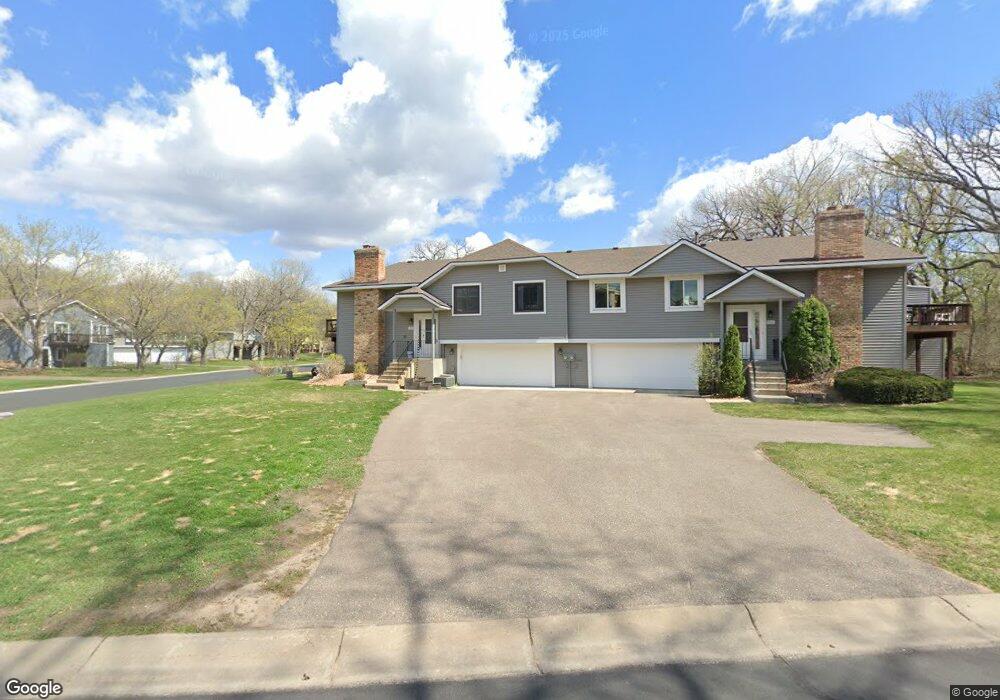
1910 113th Ln NW Coon Rapids, MN 55433
Estimated Value: $243,000 - $268,000
2
Beds
3
Baths
1,078
Sq Ft
$235/Sq Ft
Est. Value
About This Home
This home is located at 1910 113th Ln NW, Coon Rapids, MN 55433 and is currently estimated at $253,667, approximately $235 per square foot. 1910 113th Ln NW is a home located in Anoka County with nearby schools including Lucile Bruner Elementary School, Hamilton Elementary School, and Laughlin Junior/Senior High School.
Ownership History
Date
Name
Owned For
Owner Type
Purchase Details
Closed on
Mar 23, 2021
Sold by
Ganter Mark A and Ganter Cynthia
Bought by
Ganter Mark A and Ganter Cynthia
Current Estimated Value
Create a Home Valuation Report for This Property
The Home Valuation Report is an in-depth analysis detailing your home's value as well as a comparison with similar homes in the area
Home Values in the Area
Average Home Value in this Area
Purchase History
| Date | Buyer | Sale Price | Title Company |
|---|---|---|---|
| Ganter Mark A | -- | Ancona Title & Escrow |
Source: Public Records
Tax History Compared to Growth
Tax History
| Year | Tax Paid | Tax Assessment Tax Assessment Total Assessment is a certain percentage of the fair market value that is determined by local assessors to be the total taxable value of land and additions on the property. | Land | Improvement |
|---|---|---|---|---|
| 2025 | $2,237 | $238,400 | $60,000 | $178,400 |
| 2024 | $2,237 | $226,500 | $47,000 | $179,500 |
| 2023 | $2,261 | $231,300 | $55,000 | $176,300 |
| 2022 | $2,106 | $228,900 | $51,500 | $177,400 |
| 2021 | $2,107 | $192,200 | $30,000 | $162,200 |
| 2020 | $1,955 | $188,100 | $30,000 | $158,100 |
| 2019 | $1,797 | $169,400 | $27,000 | $142,400 |
| 2018 | $1,717 | $152,900 | $0 | $0 |
| 2017 | $1,457 | $143,000 | $0 | $0 |
| 2016 | $1,481 | $122,200 | $0 | $0 |
| 2015 | -- | $122,200 | $17,500 | $104,700 |
| 2014 | -- | $99,900 | $5,200 | $94,700 |
Source: Public Records
Map
Nearby Homes
- 11350 Jay St NW
- 11361 Jay St NW
- 11424 Hanson Blvd NW
- 11444 Hanson Blvd NW
- 11409 Quinn St NW
- 11036 Hanson Blvd NW Unit 20
- 1660 Northdale Blvd NW
- 11267 Robinson Dr NW
- 11000 Swallow St NW
- 2201 108th Ave NW
- 2400 108th Ave NW
- 1449 119th Ln NW
- 12034 Ibis St NW
- 10658 Hummingbird St NW
- 12010 Eagle St NW
- 1830 121st Ln NW Unit 611
- 10634 Hummingbird St NW
- 11852 Yellow Pine St NW
- 1727 121st Ln NW
- 11835 Crocus St NW
- 1902 113th Ln NW
- 1914 113th Ln NW
- 1882 113th Ln NW
- 11341 Martin St NW
- 1906 113th Ln NW
- 1874 113th Ln NW
- 1886 113th Ln NW
- 1903 113th Ln NW
- 1911 113th Ln NW
- 11365 Martin St NW
- 1878 113th Ln NW
- 1883 113th Ln NW
- 1909 113th Ave NW
- 1870 113th Ln NW
- 1889 113th Ave NW
- 1875 113th Ln NW
- 1907 113th Ln NW
- 11309 Martin St NW
- 1915 113th Ln NW
- 1858 113th Ln NW