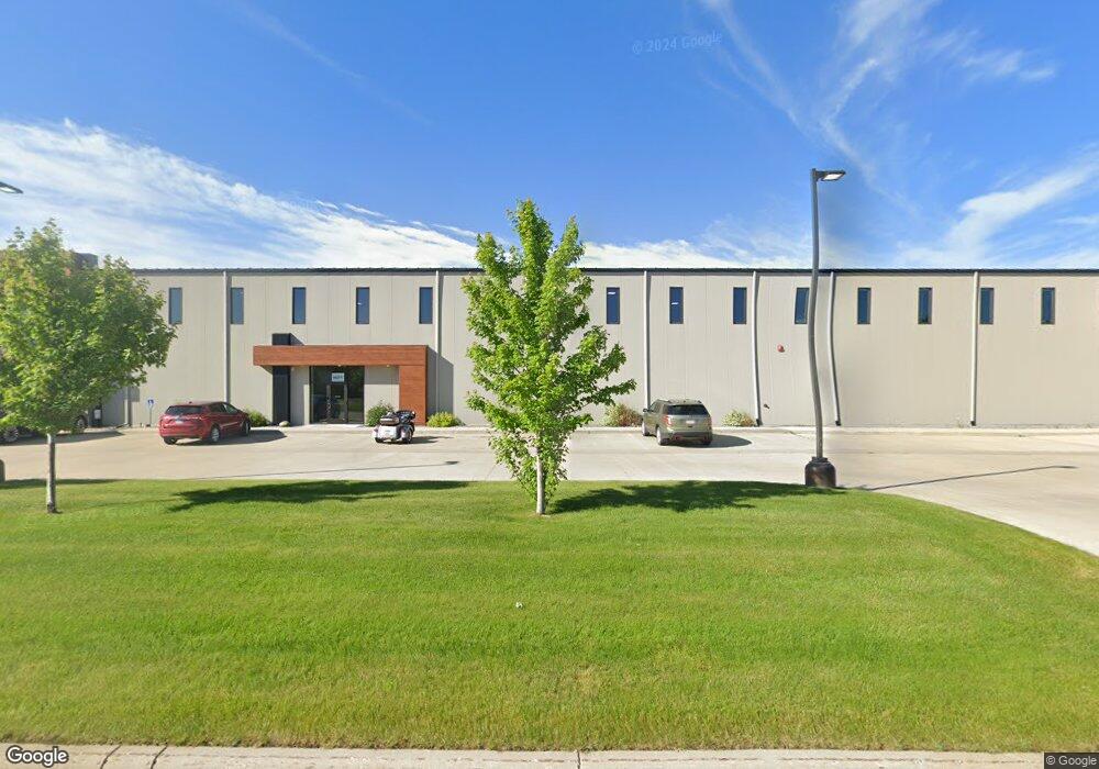
1910 42nd Ave W Unit 200 Alexandria, MN 56308
--
Bed
--
Bath
48,143
Sq Ft
5.33
Acres
About This Home
This home is located at 1910 42nd Ave W Unit 200, Alexandria, MN 56308. 1910 42nd Ave W Unit 200 is a home located in Douglas County with nearby schools including Lincoln Elementary School, Discovery Middle School, and Alexandria Area High School.
Ownership History
Date
Name
Owned For
Owner Type
Purchase Details
Closed on
Oct 16, 2018
Sold by
Goodneighbor Properties Llc
Bought by
Goodneighbors 1910 Building Llc
Home Financials for this Owner
Home Financials are based on the most recent Mortgage that was taken out on this home.
Original Mortgage
$2,245,000
Interest Rate
4.8%
Mortgage Type
Construction
Purchase Details
Closed on
Aug 26, 2014
Sold by
Seykora Trustee Of The Merodie R Seykora Trus
Create a Home Valuation Report for This Property
The Home Valuation Report is an in-depth analysis detailing your home's value as well as a comparison with similar homes in the area
Home Values in the Area
Average Home Value in this Area
Purchase History
| Date | Buyer | Sale Price | Title Company |
|---|---|---|---|
| Goodneighbors 1910 Building Llc | $320,000 | None Available | |
| Goodneighbor Properties Llc | $160,000 | Alexandria Title Co | |
| -- | $50,000 | -- |
Source: Public Records
Mortgage History
| Date | Status | Borrower | Loan Amount |
|---|---|---|---|
| Previous Owner | Goodneighbors 1910 Building Llc | $2,245,000 |
Source: Public Records
Tax History Compared to Growth
Tax History
| Year | Tax Paid | Tax Assessment Tax Assessment Total Assessment is a certain percentage of the fair market value that is determined by local assessors to be the total taxable value of land and additions on the property. | Land | Improvement |
|---|---|---|---|---|
| 2025 | $82,424 | $3,598,600 | $264,000 | $3,334,600 |
| 2024 | $82,424 | $3,427,800 | $252,500 | $3,175,300 |
| 2023 | $80,124 | $3,191,200 | $241,000 | $2,950,200 |
| 2022 | $84,828 | $3,039,000 | $230,600 | $2,808,400 |
| 2021 | $41,986 | $2,850,500 | $221,500 | $2,629,000 |
| 2020 | $5,264 | $1,445,900 | $221,500 | $1,224,400 |
| 2019 | $24 | $221,500 | $221,500 | $0 |
| 2018 | $0 | $47,100 | $47,100 | $0 |
| 2017 | $0 | $50,200 | $50,200 | $0 |
| 2016 | $1,300 | $48,694 | $48,694 | $0 |
| 2015 | $2,294 | $0 | $0 | $0 |
| 2014 | -- | $50,200 | $50,200 | $0 |
Source: Public Records
Map
Nearby Homes
- 2025 42nd Ave W
- XXXX Dakota St
- 4XXX Dakota St
- xxx 34th Ave W
- xx 34th Ave W
- TBD 34th Ave W
- TBD 48th Ave
- TBD Nevada St SW
- TBD 44th Ave W
- TBD 50th Ave W
- 00 30th Ave
- 2402 Reeds Villa Rd SW
- 2212 Jefferson St
- 1626 Melvina Ln SW
- 10xx 22nd Ave E
- 9xx 22nd Ave E
- TBD 34th Ave E
- xxxx 34th Ave E
- 1205 Melvina Rd SW
- 1405 Bryant St
- 1910 42nd Ave W Unit 400
- 1910 42nd Ave W Unit 300
- 1920 42nd Ave W
- 1930 42nd Ave W
- 2030 42nd Ave W
- 2040 42nd Ave W
- 2045 42nd Ave W
- 2010 42nd Ave W
- 4125 Minnesota St
- 4129 Minnesota St
- 1524 42nd Ave
- 0 42nd Ave
- State Highway 27
- 0000 Highway 27
- 2615 Highway 27
- 1610 Highway 27
- 111XX Highway 27
- 4133 Iowa St
- 4021 Nevada St SW
- 4011 Nevada St SW