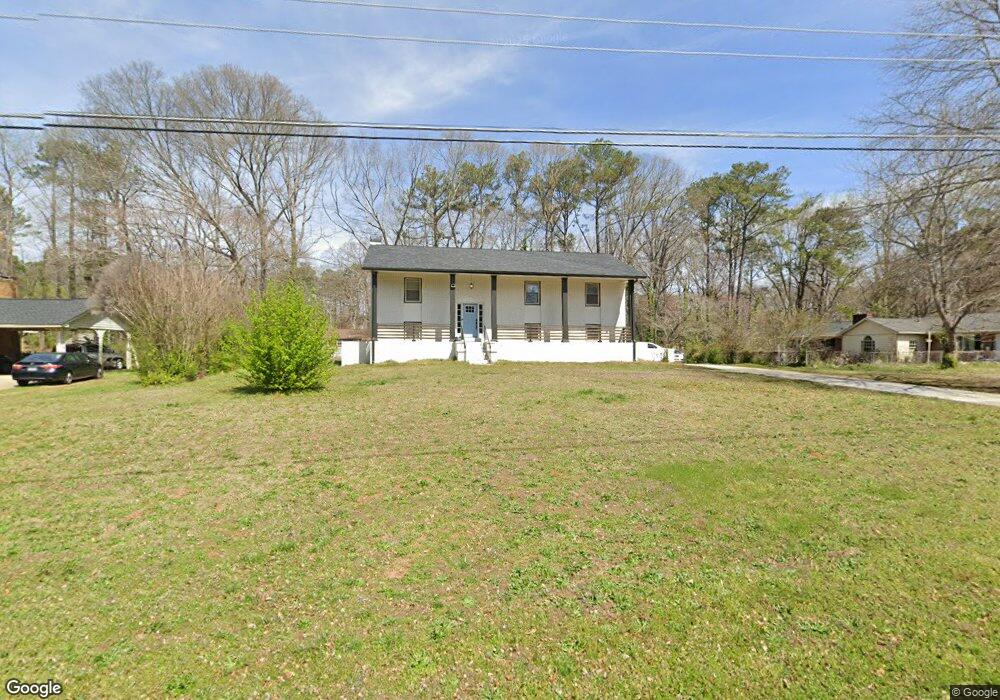
1910 Annette Ln SW Austell, GA 30106
Estimated Value: $276,000 - $388,000
3
Beds
3
Baths
1,450
Sq Ft
$231/Sq Ft
Est. Value
About This Home
This home is located at 1910 Annette Ln SW, Austell, GA 30106 and is currently estimated at $335,570, approximately $231 per square foot. 1910 Annette Ln SW is a home located in Cobb County with nearby schools including Deerwood Elementary School, Austell Elementary School, and Garrett Middle School.
Ownership History
Date
Name
Owned For
Owner Type
Purchase Details
Closed on
Nov 4, 2024
Sold by
Richards Raymond Alphanso
Bought by
Richards Raymond and Richards Raycine
Current Estimated Value
Purchase Details
Closed on
May 5, 2023
Sold by
Grb Home Improvement Llc
Bought by
Richards Raymond Alphanso
Home Financials for this Owner
Home Financials are based on the most recent Mortgage that was taken out on this home.
Original Mortgage
$281,250
Interest Rate
6.42%
Mortgage Type
New Conventional
Purchase Details
Closed on
Oct 3, 2022
Sold by
Lindsay Florilla Maria
Bought by
Grb Home Improvement Llc
Purchase Details
Closed on
Sep 10, 2008
Sold by
Lindsay Douglas J
Bought by
Lindsay Ashley M
Create a Home Valuation Report for This Property
The Home Valuation Report is an in-depth analysis detailing your home's value as well as a comparison with similar homes in the area
Home Values in the Area
Average Home Value in this Area
Purchase History
| Date | Buyer | Sale Price | Title Company |
|---|---|---|---|
| Richards Raymond | $387,500 | None Listed On Document | |
| Richards Raymond | $387,500 | None Listed On Document | |
| Richards Raymond Alphanso | $387,500 | None Listed On Document | |
| Grb Home Improvement Llc | $217,000 | -- | |
| Lindsay Ashley M | $64,500 | -- |
Source: Public Records
Mortgage History
| Date | Status | Borrower | Loan Amount |
|---|---|---|---|
| Previous Owner | Richards Raymond Alphanso | $281,250 |
Source: Public Records
Tax History Compared to Growth
Tax History
| Year | Tax Paid | Tax Assessment Tax Assessment Total Assessment is a certain percentage of the fair market value that is determined by local assessors to be the total taxable value of land and additions on the property. | Land | Improvement |
|---|---|---|---|---|
| 2025 | $4,801 | $159,356 | $26,000 | $133,356 |
| 2024 | $4,024 | $133,480 | $24,000 | $109,480 |
| 2023 | $2,617 | $86,800 | $12,320 | $74,480 |
| 2022 | $2,078 | $68,472 | $10,000 | $58,472 |
| 2021 | $2,078 | $68,472 | $10,000 | $58,472 |
| 2020 | $1,851 | $61,000 | $10,000 | $51,000 |
| 2019 | $2,132 | $70,260 | $10,000 | $60,260 |
| 2018 | $1,318 | $43,440 | $7,200 | $36,240 |
| 2017 | $1,106 | $38,464 | $6,000 | $32,464 |
| 2016 | $980 | $34,104 | $5,600 | $28,504 |
| 2015 | $853 | $28,940 | $8,000 | $20,940 |
| 2014 | $860 | $28,940 | $0 | $0 |
Source: Public Records
Map
Nearby Homes
- 1943 Arnold Dr
- 1971 Annette Ln
- 1803 Gherry Dr
- Laurel Plan at Avenbrook
- Rosedale Plan at Avenbrook
- Fulmont at Avenbrook Plan at Avenbrook
- Addison Plan at Avenbrook
- Conley Plan at Avenbrook
- Bayberry Plan at Sawmill Creek - Bungalow Series
- Wisteria Plan at Sawmill Creek - Bungalow Series
- Redbud Plan at Sawmill Creek - Bungalow Series
- 1 Perkerson Mill Rd SW
- 0 Harris St Unit 7661273
- 1645 Fulmont Cir
- 1841 Mobley St
- 5410 Beth Dr
- 5466 Davis Dr
- 5320 Beth Dr
- 5164 Medford Ln
- 5154 Medford Ln
- 1910 Annette Ln
- 1928 Annette Ln Unit 2
- 1898 Annette Ln Unit 2
- 1917 Annette Ln SW
- 1911 Arnold Dr
- 1923 Annette Ln Unit 2
- 1917 Annette Ln
- 1921 Arnold Dr
- 1897 Annette Ln
- 1932 Annette Ln
- 1947 Annette Ln SW
- 1947 Annette Ln Unit 8
- 1901 Arnold Dr
- 5267 Bullard Ln
- 5279 Bullard Ln
- 0 Bullard Ln
- 1881 Arnold Dr
- 1884 Gherry Dr
- 1884 Gherry Dr Unit 51
- 1900 Arnold Dr